

Perspectives on the prediction of catastrophic slope failures from satellite InSAR
- PMID: 31575983
- PMCID: PMC6773949
- DOI: 10.1038/s41598-019-50792-y
Perspectives on the prediction of catastrophic slope failures from satellite InSAR
Erratum in
-
Author Correction: Perspectives on the prediction of catastrophic slope failures from satellite InSAR.Sci Rep. 2019 Dec 5;9(1):18773. doi: 10.1038/s41598-019-55024-x. Sci Rep. 2019. PMID: 31801955 Free PMC article.
Abstract
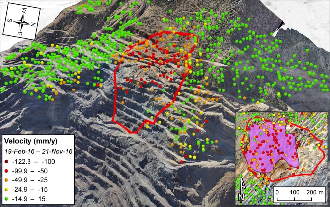
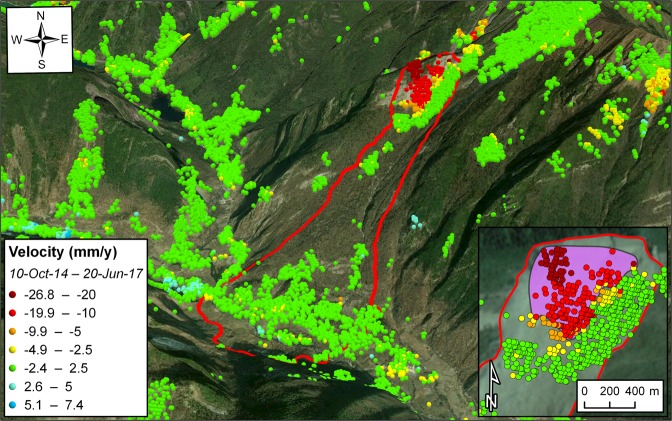
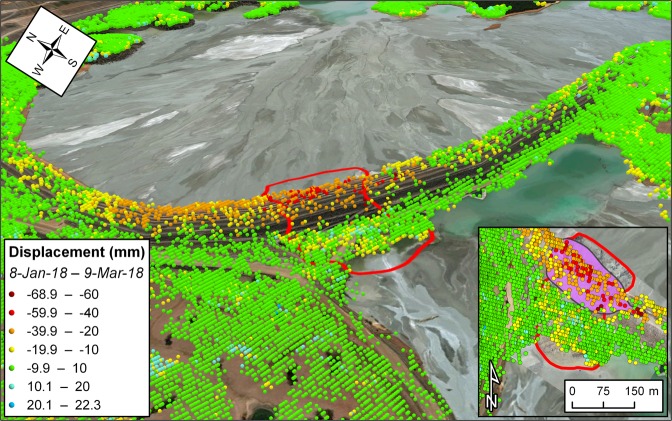
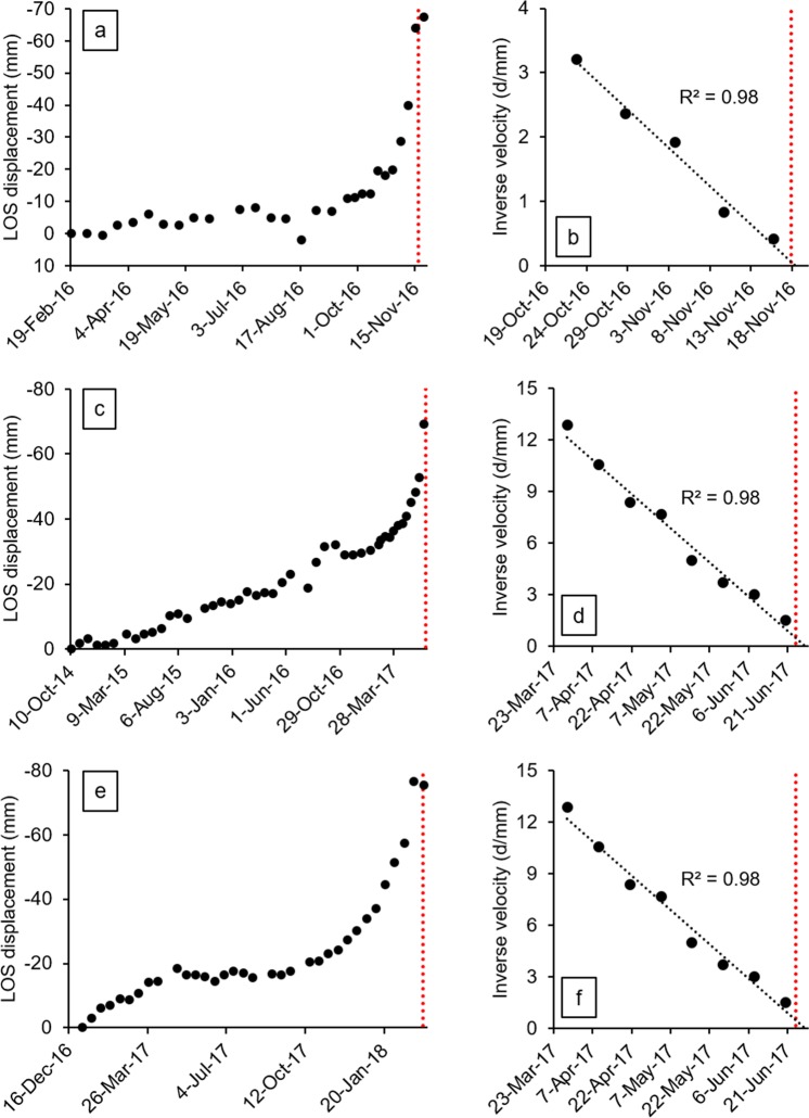
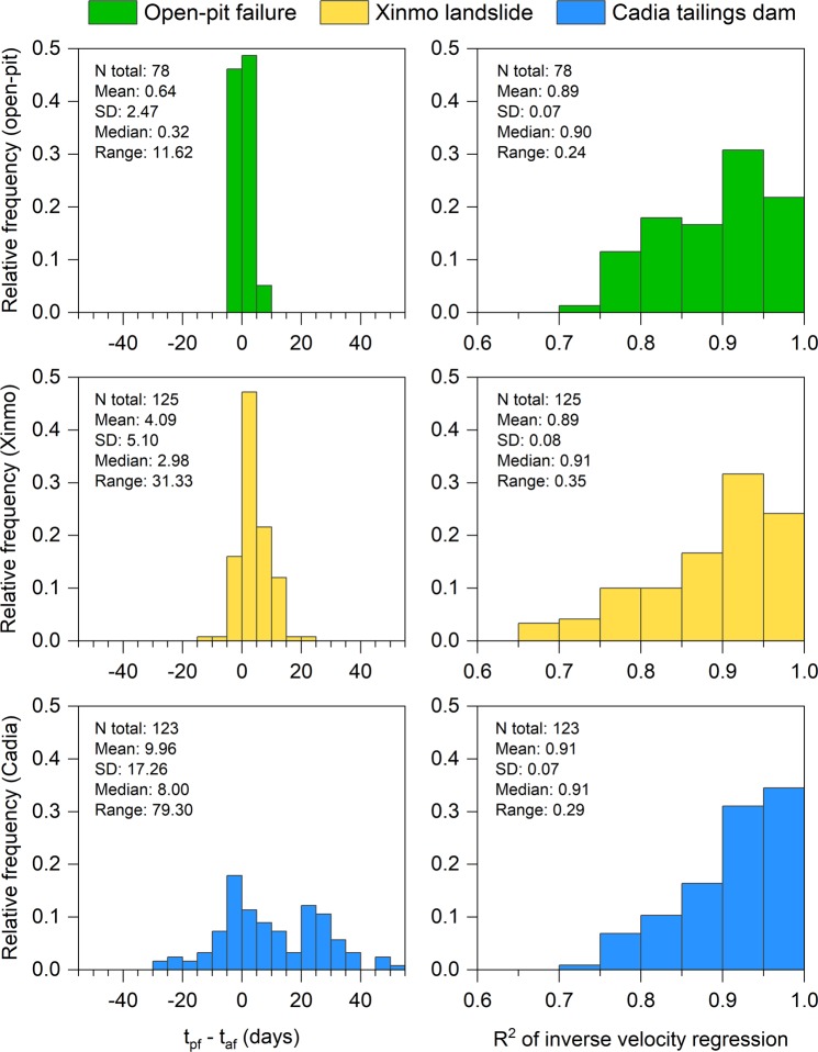
We demonstrate the potential of satellite Interferometric Synthetic Aperture Radar (InSAR) to identify precursors to catastrophic slope failures. To date, early-warning has mostly relied on the availability of detailed, high-frequency data from sensors installed in situ. The same purpose could not be chased through spaceborne monitoring applications, as these could not yield information acquired in sufficiently systematic fashion. Here we present three sets of Sentinel-1 constellation images processed by means of multi-interferometric analysis. We detect clear trends of accelerating displacement prior to the catastrophic failure of three large slopes of very different nature: an open-pit mine slope, a natural rock slope in alpine terrain, and a tailings dam embankment. We determine that these events could have been located several days or weeks in advance. The results highlight that satellite InSAR may now be used to support decision making and enhance predictive ability for this type of hazard.
Conflict of interest statement
The authors declare no competing interests.
Figures
References
-
- Kilburn CRJ, Petley DN. Forecasting giant, catastrophic slope collapse: lessons from Vajont, Northern Italy. Geomorphology. 2003;54:21–32. doi: 10.1016/S0169-555X(03)00052-7. - DOI
-
- Voight B. A method for prediction of volcanic eruptions. Nature. 1988;332(6160):125–130. doi: 10.1038/332125a0. - DOI
-
- Cornelius RR, Scott PA. A materials failure relation of accelerating creep as empirical description of damage accumulation. Rock Mechanics and Rock Engineering. 1993;26:233–252. doi: 10.1007/BF01040117. - DOI
-
- Kemeny J, Post R. Estimating three-dimensional rock discontinuity orientation from digital images of fracture traces. Computers & Geosciences. 2003;29(1):65–77. doi: 10.1016/S0098-3004(02)00106-1. - DOI
LinkOut - more resources
Full Text Sources
