

Magnetic-Map-Matching-Aided Pedestrian Navigation Using Outlier Mitigation Based on Multiple Sensors and Roughness Weighting
- PMID: 31684139
- PMCID: PMC6864634
- DOI: 10.3390/s19214782
Magnetic-Map-Matching-Aided Pedestrian Navigation Using Outlier Mitigation Based on Multiple Sensors and Roughness Weighting
Abstract
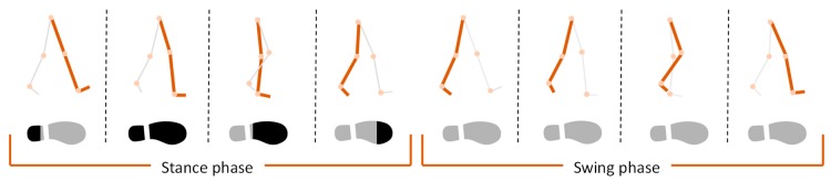
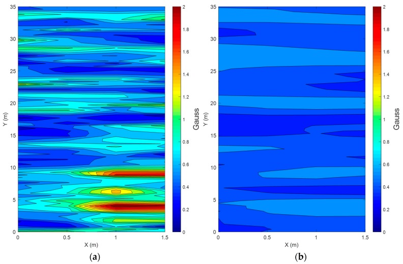
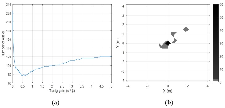
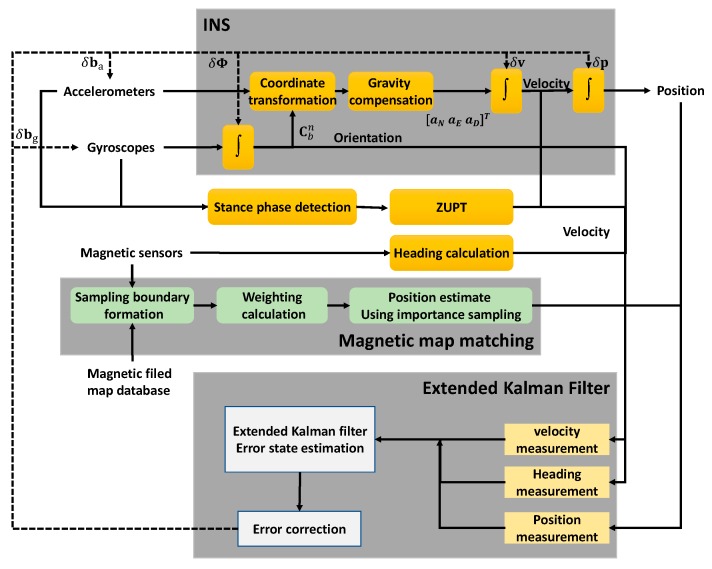
This research proposes an algorithm that improves the position accuracy of indoor pedestrian dead reckoning, by compensating the position error with a magnetic field map-matching technique, using multiple magnetic sensors and an outlier mitigation technique based on roughness weighting factors. Since pedestrian dead reckoning using a zero velocity update (ZUPT) does not use position measurements but zero velocity measurements in a stance phase, the position error cannot be compensated, which results in the divergence of the position error. Therefore, more accurate pedestrian dead reckoning is achievable when the position measurements are used for position error compensation. Unfortunately, the position information cannot be easily obtained for indoor navigation, unlike in outdoor navigation cases. In this paper, we propose a method to determine the position based on the magnetic field map matching by using the importance sampling method and multiple magnetic sensors. The proposed method does not simply integrate multiple sensors but uses the normalization and roughness weighting method for outlier mitigation. To implement the indoor pedestrian navigation algorithm more accurately than in existing indoor pedestrian navigation, a 15th-order error model and an importance-sampling extended Kalman filter was utilized to correct the error of the map-matching-aided pedestrian dead reckoning (MAPDR). To verify the performance of the proposed indoor MAPDR algorithm, many experiments were conducted and compared with conventional pedestrian dead reckoning. The experimental results show that the proposed magnetic field MAPDR algorithm provides clear performance improvement in all indoor environments.
Keywords: importance sampling; indoor navigation; magnetic field map matching; roughness weighting.
Conflict of interest statement
The authors declare no conflicts of interest.
Figures


References
-
- Jeong N., Hwang H., Matson E.T. Evaluation of low-cost lidar sensor for application in indoor UAV navigation; Proceedings of the 2018 IEEE Sensors Applications Symposium (SAS); Seoul, Korea. 12–14 March 2018; pp. 1–5.
-
- Liu S., Atia M.M., Karamat T.B., Noureldin A. A LiDAR-aided indoor navigation system for UGVs. J. Navig. 2015;68:253–273. doi: 10.1017/S037346331400054X. - DOI
-
- Tian Y., Shigaki D., Wang W., Ahn C.-J. A weighted least-squares method using received signal strength measurements for WLAN indoor positioning system; Proceedings of the 2017 20th International Symposium on Wireless Personal Multimedia Communications (WPMC); Bali, Indonesia. 17–20 December 2017; pp. 310–314.
-
- Sohrabi R., Fallah M.A., Lahouti F. Indoor pedestrian navigation fusing WLAN, INS, and map data using pattern matching; Proceedings of the 7’th International Symposium on Telecommunications (IST’2014); Tehran, Iran. 9–11 September 2014; pp. 349–354.
Grants and funding
LinkOut - more resources
Full Text Sources
Other Literature Sources
