

Aeromedical retrieval of trauma patients: Impact of flight path model on estimates of population coverage
- PMID: 32037046
- PMCID: PMC8008479
- DOI: 10.1016/j.amjsurg.2020.01.056
Aeromedical retrieval of trauma patients: Impact of flight path model on estimates of population coverage
Abstract
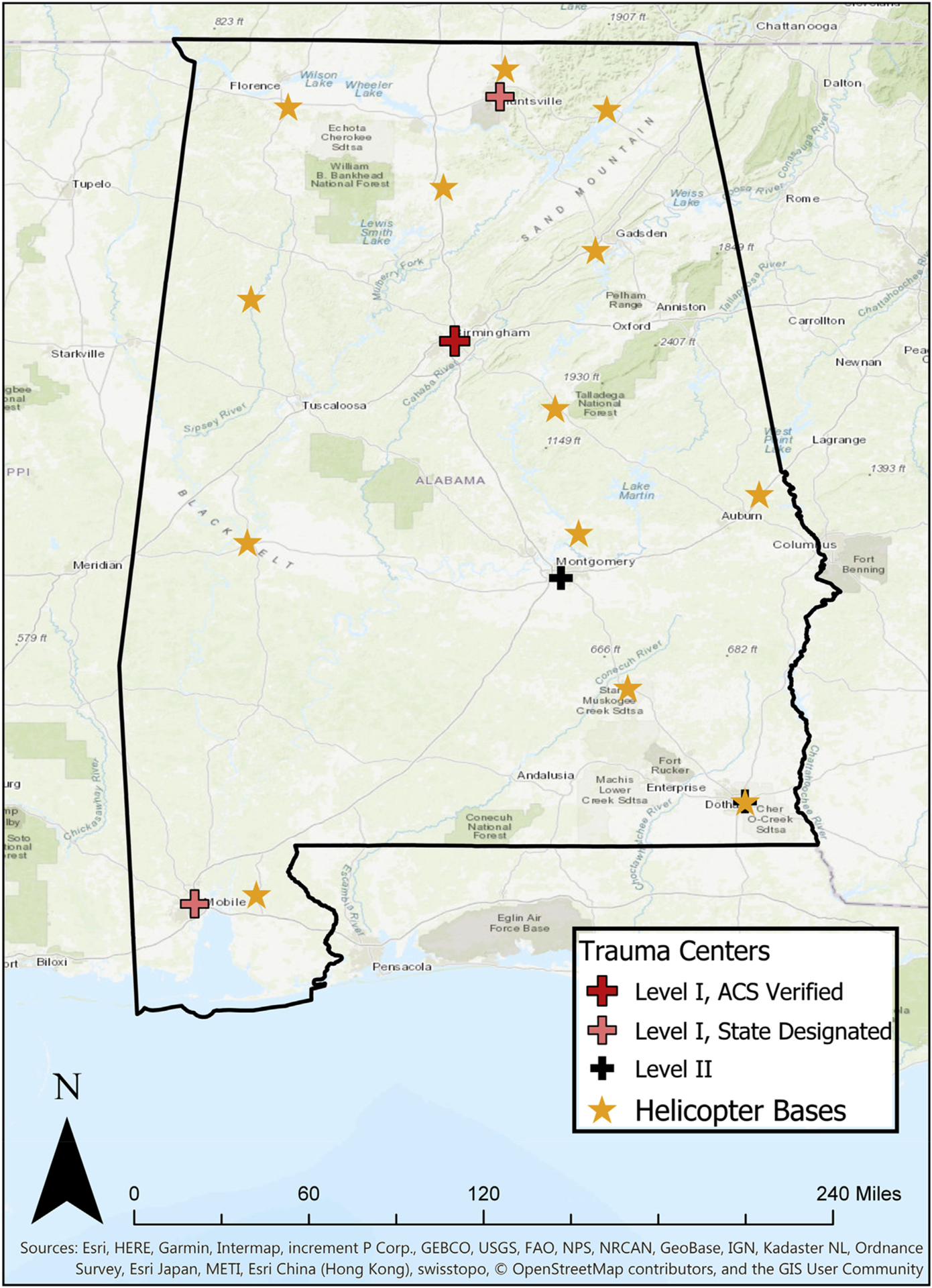
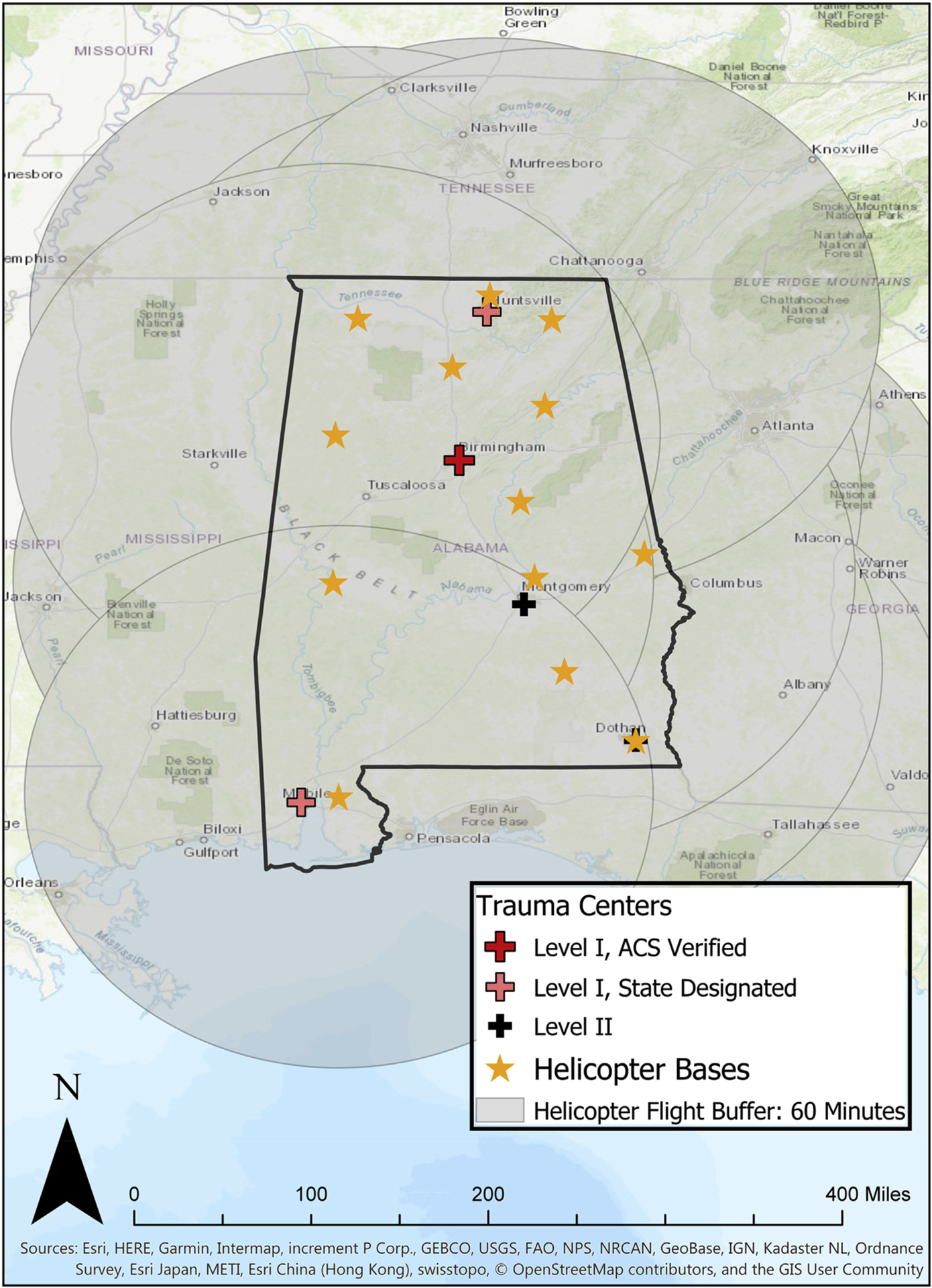
Background: The aim of this study was to compare the impact of different flight path models on the calculated population coverage of aeromedical retrieval systems, using the state of Alabama as a case study.
Methods: Geospatial analysis of U.S. Census Bureau population data using helicopter bases and trauma centers as foci of either circular or elliptical coverage areas.
Results: Circular isochrone models around helicopter bases or trauma centers suggest that the entire population of Alabama could reach a level I or II trauma center within 60 min. Elliptical isochrones, incorporating outbound and inbound flights, suggest that only 78.8% of the population have ready access to level I or II trauma centers.
Conclusion: While all three flight path models described have some validity and utility, simplistic circular flight time isochrones around trauma centers and helicopter bases provide overly optimistic estimates of population coverage. The elliptical model provides a more realistic evaluation.
Keywords: Aeromedical; Helicopter; Isochrone; Population coverage; Trauma.
Copyright © 2020 Elsevier Inc. All rights reserved.
Conflict of interest statement
Declaration of competing interest Dr. Kerby is the medical director of an EMS agency in Alabama.
Figures


References
-
- MacKenzie EJ, Rivara FP, Jurkovich GJ, et al. A national evaluation of the effect of trauma-center care on mortality. N Engl J Med. 2006;354(4):366–378. - PubMed
-
- Trauma. ACoSCo. Resources for Optimal Care of the Injured Patient. Chicago: ACS; 2014.
-
- Sasser SM, Hunt RC, Faul M, et al. Guidelines for field triage of injured patients: recommendations of the national expert panel on field triage. MMWR Recomm Rep. 2012. 2011;61(RR-1):1–20. - PubMed
-
- Nocera A Helicopter emergency medical services. Lancet. 2000;356(Suppl):s2. - PubMed
-
- Jones CW, Rodriguez RD, Griffin RL, et al. Complications associated with placement of chest tubes: a trauma system perspective. J Surg Res. 2019;239: 98–102. - PubMed
MeSH terms
Grants and funding
LinkOut - more resources
Full Text Sources
Medical
