

Water Quality Assessment: A Quali-Quantitative Method for Evaluation of Environmental Pressures Potentially Impacting on Groundwater, Developed under the M.I.N.O.Re. Project
- PMID: 32178314
- PMCID: PMC7143906
- DOI: 10.3390/ijerph17061835
Water Quality Assessment: A Quali-Quantitative Method for Evaluation of Environmental Pressures Potentially Impacting on Groundwater, Developed under the M.I.N.O.Re. Project
Abstract
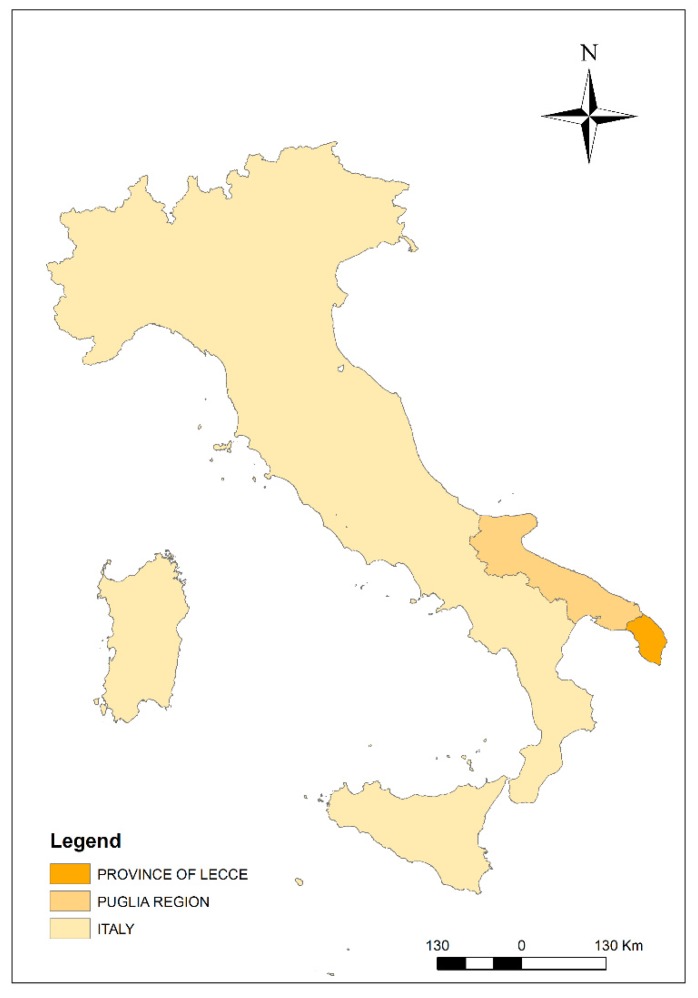
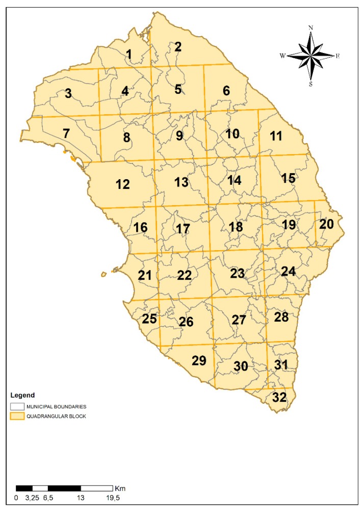
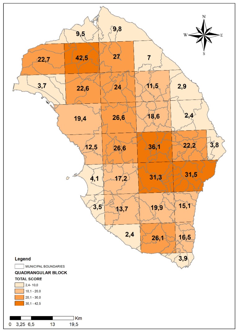
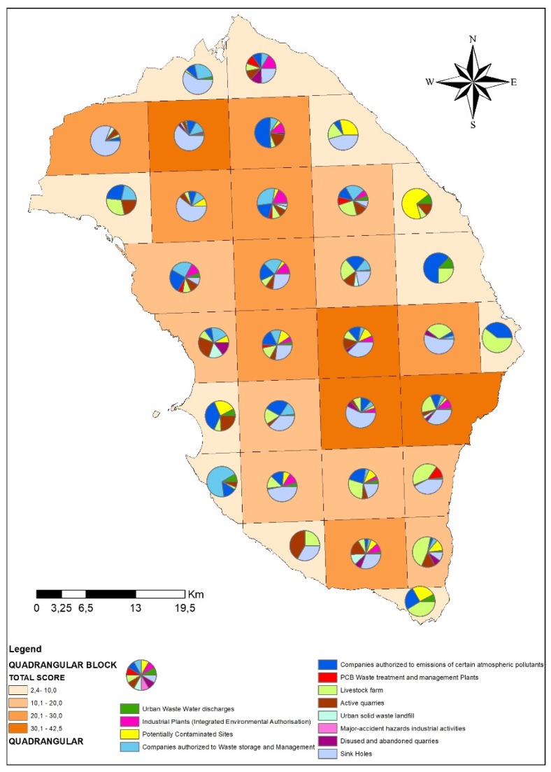
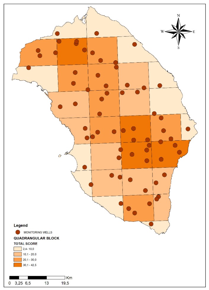
Background: At global level, the vulnerability of aquifers is deteriorating at an alarming rate due to environmental pollution and intensive human activities. In this context, Local Health Authority ASL Lecce has launched the M.I.N.O.Re. (Not Compulsory Water Monitoring Activities at Regional level) project, in order to assess the vulnerability of the aquifer in Salento area (Puglia Region) by performing several non-compulsory analyses on groundwater samples. This first paper describes the quali-quantitative approach adopted under the M.I.N.O.Re. project for the assessment of environmental pressures suffered by groundwater and determines the number of wells to be monitored in specific sampling areas on the basis of the local potential contamination and vulnerability of the aquifer. Methods: We created a map of the entire Lecce province, interpolating it with a grid that led to the subdivision of the study area in 32 quadrangular blocks measuring 10 km × 10 km. Based on current hydrogeological knowledge and institutional data, we used GIS techniques to represent on these 32 blocks the 12 different layers corresponding to the main anthropic or environmental type of pressures potentially impacting on the aquifer. To each kind of pressure, a score from 0 to 1 was attributed on the basis of the potential impact on groundwater. A total score was assigned to each of the 32 blocks. A higher number of wells was selected to be monitored in those blocks presenting higher risk scores for possible groundwater contamination due to anthropic/environmental pressures. Results: The range of total scores varied from 2.4 to 42.5. On the basis of total scores, the 10 km × 10 km blocks were divided into four classes of environmental pressure (1st class: from 0,1 to 10,00; 2nd class: from 10,01 to 20,00; 3rd class: from 20,1 to 30,00; 4th class: from 30,01 to 42,50). There were 11 areas in the 1st class, 9 areas in the 2nd class, 8 areas in the 3rd class and 4 areas in the 4th class. We assigned 1 monitoring well in 1st class areas, 2 monitoring wells in 2nd class areas, 3 monitoring wells in 3rd class areas and 4 monitoring wells in 4th class areas. Conclusion: The methodology developed under the M.I.N.O.Re. project could represent a useful model to be used in other areas to assess the environmental pressures suffered by aquifers and the quality of the groundwater.
Keywords: georeferentiation; groundwater; water monitoring; water quality assessment.
Conflict of interest statement
The authors declare no conflict of interest. The funders had no role in the design of the study; in the collection, analyses, or interpretation of data; in the writing of the manuscript, or in the decision to publish the results.
Figures
References
-
- Wu J., Li P., Qian H. Study on the hydrogeochemistry and noncarcinogenic health risk induced by fluoride in Pengyang County, China. Int. J. Environ. Sci. 2012;2:1127–1134.
-
- European Commission (EC) Groundwater Protection in Europe. European Commission; Brussels, Belgium: 2008. p. 35.
-
- Ielpo P., Cassano D., Lopez A., Pappagallo G., Uricchio V.F., De Napoli P.A. Source apportionment of groundwater pollutants in Apulian agricultural sites using multivariate statistical analyses: Case study of Foggia province. Chem. Cent. J. 2012;6:S5. doi: 10.1186/1752-153X-6-S2-S5. - DOI - PMC - PubMed
-
- Fidelibus M.D., Tulipano L. Regional flow of intruding sea water in the carbonate aquifers of Apulia (Southern Italy); Proceedings of the 14th Salt Water Intrusion Meeting; Malmo, Sweden. 16–31 June 1996.
