

UAV-based imaging platform for monitoring maize growth throughout development
- PMID: 32524060
- PMCID: PMC7278367
- DOI: 10.1002/pld3.230
UAV-based imaging platform for monitoring maize growth throughout development
Abstract
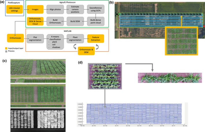
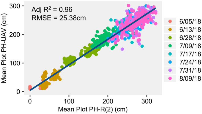
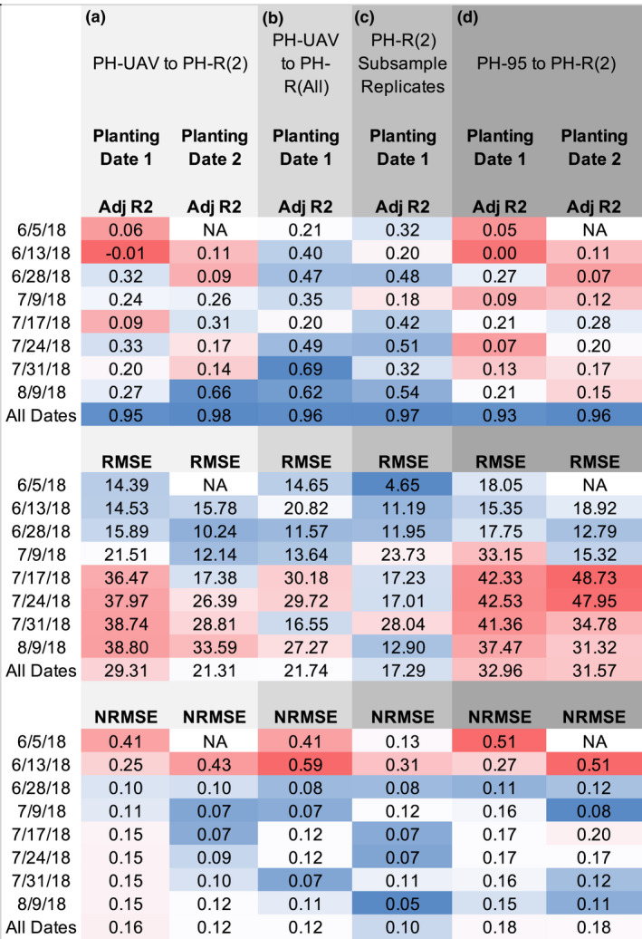
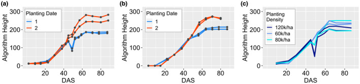
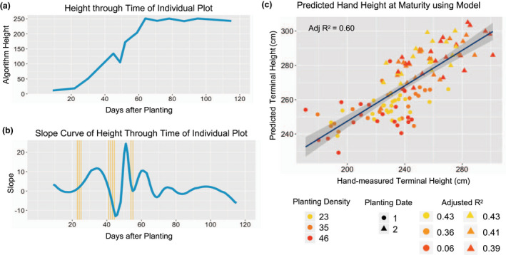
Plant height (PH) data collected at high temporal resolutions can give insight into how genotype and environmental variation influence plant growth. However, in order to increase the temporal resolution of PH data collection, more robust, rapid, and low-cost methods are needed to evaluate field plots than those currently available. Due to their low cost and high functionality, unmanned aerial vehicles (UAVs) provide an efficient means for collecting height at various stages throughout development. We have developed a procedure for utilizing structure from motion algorithms to collect PH from RGB drone imagery and have used this platform to characterize a yield trial consisting of 24 maize hybrids planted in replicate under two dates and three planting densities. PH data was collected using both weekly UAV flights and manual measurements. The comparisons of UAV-based and manually acquired PH measurements revealed sources of error in measuring PH and were used to develop a robust pipeline for generating UAV-based PH estimates. This pipeline was utilized to document differences in the rate of growth between genotypes and planting dates. Our results also demonstrate that growth rates generated by PH measurements collected at multiple timepoints early in development can be useful in improving predictions of PH at the end of the season. This method provides a low cost, high throughput method for evaluating plant growth in response to environmental stimuli on a plot basis that can be implemented at the scale of a breeding program.
Keywords: UAV phenotyping; maize; plant height.
© 2020 The Authors. Plant Direct published by American Society of Plant Biologists, Society for Experimental Biology and John Wiley & Sons Ltd.
Conflict of interest statement
The authors do not have any conflict of interest to declare.
Figures
References
-
- AgiSoft PhotoScan Professional Edition (Version 1.4.4) (Software). (2018). Retrieved from http://www.agisoft.com/downloads/installer/
-
- Agisoft LLC . (2018). Agisoft photoscan user manual: Professional Edition v.1.2.6. St. Petersburg, Russia: Agisoft LLC.
-
- Anderson, S. L. II , Murray, S. C. , Malambo, L. , Ratcliff, C. , Popescu, S. C. , Cope, D. A. , … Thomasson, J. (2019). Prediction of maize grain yield before maturity using improved temporal height estimates of unmanned aerial systems. The Plant Phenome Journal, 2, 190004 10.2135/tppj2019.02.0004 - DOI
-
- Anthony, D. J. , Elbaum, S. G. , Lorenz, A. , & Detweiler, C. (2014). On crop height estimation with UAVs. IEEE/RSJ International Conference on Intelligent Robots and Systems, 2014, 4805–4812.
LinkOut - more resources
Full Text Sources
