Incorporating Geographic Information Science and Technology in Response to the COVID-19 Pandemic
- PMID: 32644920
- PMCID: PMC7367069
- DOI: 10.5888/pcd17.200246
Incorporating Geographic Information Science and Technology in Response to the COVID-19 Pandemic
Abstract
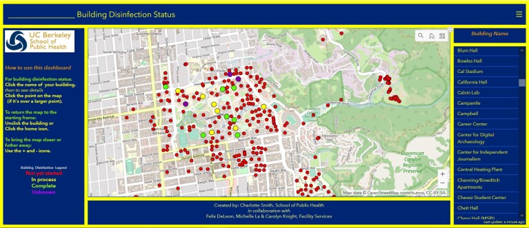
Incorporating geographic information science and technology (GIS&T) into COVID-19 pandemic surveillance, modeling, and response enhances understanding and control of the disease. Applications of GIS&T include 1) developing spatial data infrastructures for surveillance and data sharing, 2) incorporating mobility data in infectious disease forecasting, 3) using geospatial technologies for digital contact tracing, 4) integrating geographic data in COVID-19 modeling, 5) investigating geographic social vulnerabilities and health disparities, and 6) communicating the status of the disease or status of facilities for return-to-normal operations. Locations and availability of personal protective equipment, ventilators, hospital beds, and other items can be optimized with the use of GIS&T. Challenges include protection of individual privacy and civil liberties and closer collaboration among the fields of geography, medicine, public health, and public policy.
Figures
References
-
- National Center for Health Statistics. Healthy People 2010. snapshots. Healthy People 2010 final review: overview and selected findings. https://www.cdc.gov/nchs/healthy_people/hp2010/hp2010_snapshots.htm. Accessed June 15, 2020.
MeSH terms
LinkOut - more resources
Full Text Sources