

A grid-based map for the Biogeographical Regions of Europe
- PMID: 32684779
- PMCID: PMC7340631
- DOI: 10.3897/BDJ.8.e53720
A grid-based map for the Biogeographical Regions of Europe
Abstract
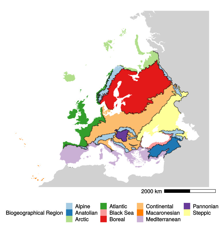
Background: Biogeographical units are widely adopted in ecological research and nature conservation management, even though biogeographical regionalisation is still under scientific debate. The European Environment Agency provided an official map of the European Biogeographical Regions (EBRs), which contains the official boundaries used in the Habitats and Birds Directives. However, these boundaries bisect cells in the official EU 10 km × 10 km grid used for many purposes, including reporting species and habitat data, meaning that 6881 cells overlap two or more regions. Therefore, superimposing the EBRs vector map over the grid creates ambiguities in associating some cells with European Biogeographical Regions.
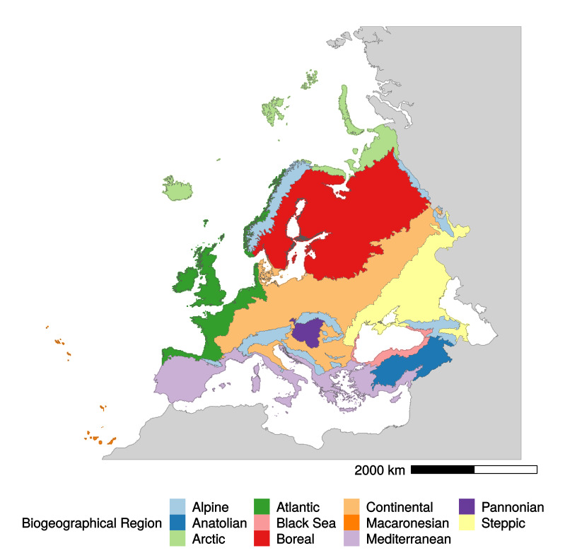
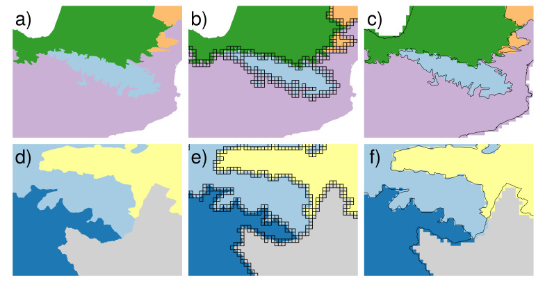
New information: To provide an operational tool to unambiguously define the boundaries of the eleven European Biogeographical Regions, we provide a specifically developed raster map of Grid-Based European Biogeographical Regions (GB-EBRs). In this new map, the borders of the EBRs are reshaped to coherently match the standard European 10 km × 10 km grid imposed for reporting tasks by Article 17 of the Habitats Directive and used for many other datasets. We assign each cell to the EBR with the largest area within the cell.
Keywords: biodiversity monitoring; biogeographical boundaries; biogeography; habitat; redefining; regionalisation..
Figures
References
-
- 79/409/EEC The Birds Directive. https://ec.europa.eu/environment/nature/legislation/birdsdirective/index.... [2020-04-24T00:00:00+03:00];
-
- 92/43/EEC The Habitats Directive. https://ec.europa.eu/environment/nature/legislation/habitatsdirective/in.... [2020-04-24T00:00:00+03:00];
-
- Bache SM., Wickham H. magrittr: A forward-pipe operator for R. R package version 1.5. https://CRAN.R-project.org/package=magrittr 2014
-
- Baston D. exactextractr: Fast extraction from raster datasets using polygons. R package version 0.1.1. https://CRAN.R-project.org/package=exactextractr 2019
LinkOut - more resources
Full Text Sources