

Spatial epidemiology: An empirical framework for syndemics research
- PMID: 32950331
- PMCID: PMC7962030
- DOI: 10.1016/j.socscimed.2020.113352
Spatial epidemiology: An empirical framework for syndemics research
Abstract
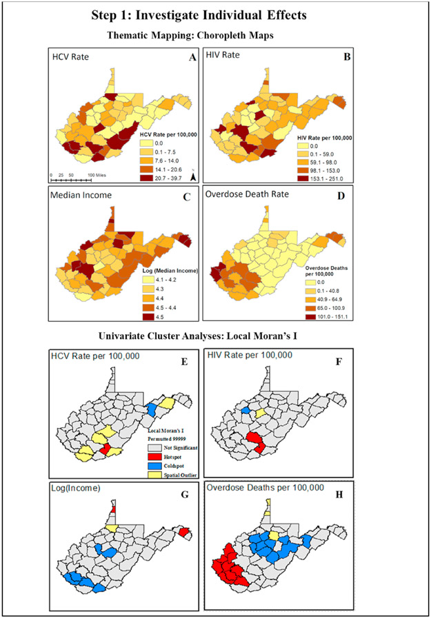
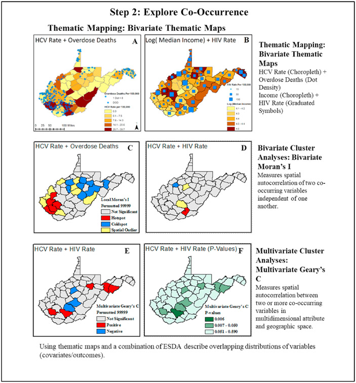
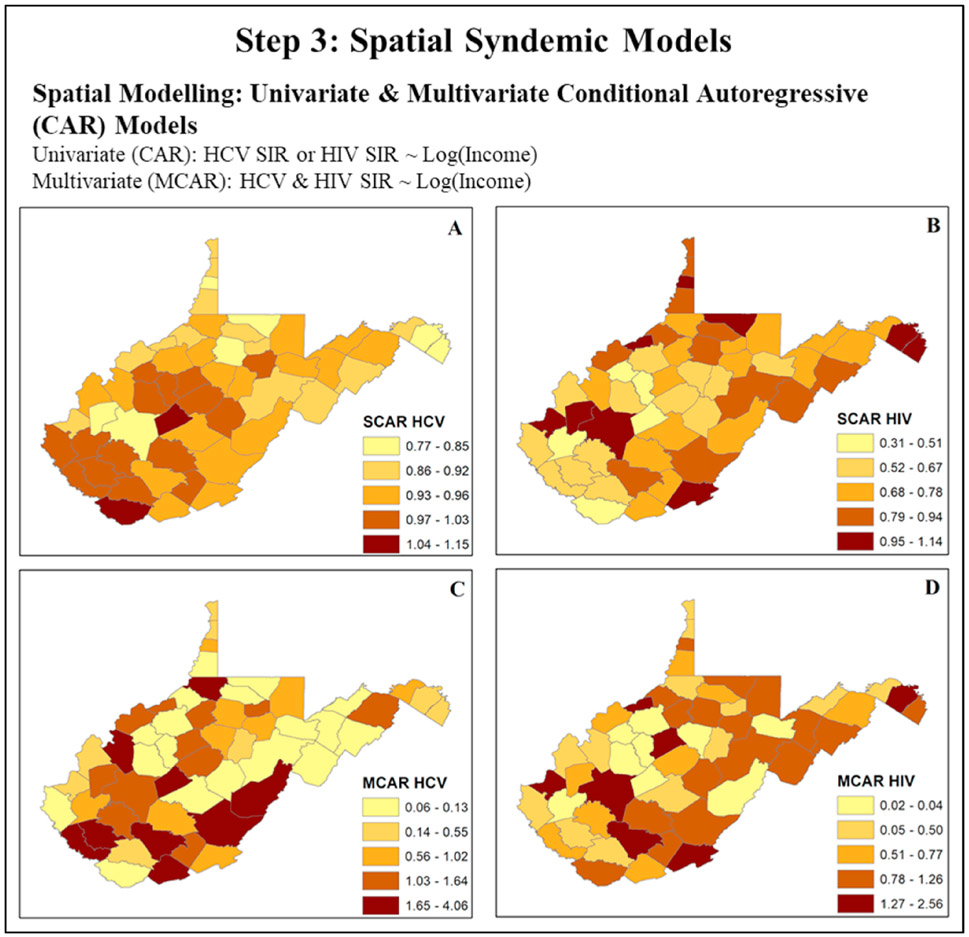
Syndemics framework describes two or more co-occurring epidemics that synergistically interact with each other and the complex structural social forces that sustain them leading to excess disease burden. The term syndemic was first used to describe the interaction between substance abuse, violence, and AIDS by Merrill Singer. A broader range of syndemic studies has since emerged describing the framework's applicability to other public health scenarios. With syndemic theory garnering significant attention, the focus is shifting towards developing robust empirical analytical approaches. Unfortunately, the complex nature of the disease-disease interactions nested within several social contexts complicates empirical analyses. In answering the call to analyze syndemics at the population level, we propose the use of spatial epidemiology as an empirical framework for syndemics research. Spatial epidemiology, which typically relies on geographic information systems (GIS) and statistics, is a discipline that studies spatial variations to understand the geographic landscape and the risk environment within which disease epidemics occur. GIS maps provide visualization aids to investigate the spatial distribution of disease outcomes, the associated social factors, and environmental exposures. Analytical inference, such as estimation of disease risks and identification of spatial disease clusters, can provide a detailed statistical view of spatial distributions of diseases. Spatial and spatiotemporal models can help us to understand, measure, and analyze disease syndemics as well as the social, biological, and structural factors associated with them in space and time. In this paper, we present a background on syndemics and spatial epidemiological theory and practice. We then present a case study focused on the HIV and HCV syndemic in West Virginia to provide an example of the use of GIS and spatial analytical methods. The concepts described in this paper can be considered to enhance understanding and analysis of other syndemics for which space-time data are available.
Keywords: Geographic information system (GIS); Spatial epidemiology; Syndemics.
Copyright © 2020 Elsevier Ltd. All rights reserved.
Figures
References
-
- Adeboye A, Ross M, Wilkerson M, Springer A, Ahaneku H, Yusuf R, 2017. Syndemic production of HIV infection among Tanzanian MSM. J Health Educ Res Dev 5 (3), 1000231.
-
- Ali M, Emch M, Donnay JP, Yunus M, Sack RB, 2002. Identifying environmental risk factors for endemic cholera: a raster GIS approach. Health Place 8 (3), 201–210. - PubMed
-
- Anselin L, 1995a. Local indicators of spatial association - LISA. Geogr. Anal 27 (2), 93–115.
-
- Anselin L, 1995b. Local indicators of spatial association—LISA. Geogr. Anal 27 (2), 93–115.
-
- Anselin L, 2019. A local indicator of multivariate spatial association: extending Geary’s C. Geogr. Anal 51 (2), 133–150.
Publication types
MeSH terms
Grants and funding
LinkOut - more resources
Full Text Sources
Medical
Miscellaneous
