. 2021 Jan;589(7842):408-414.
doi: 10.1038/s41586-020-2887-3. Epub 2020 Oct 26.

High sensitivity of tropical precipitation to local sea surface temperature

Affiliations

High sensitivity of tropical precipitation to local sea surface temperature

Peter Good et al. Nature. 2021 Jan.

Abstract

Precipitation and atmospheric circulation are the coupled processes through which tropical ocean surface temperatures drive global weather and climate1-5. Local sea surface warming tends to increase precipitation, but this local control is difficult to disentangle from remote effects of conditions elsewhere. As an example of such a remote effect, El Niño Southern Oscillation (ENSO) events in the equatorial Pacific Ocean alter precipitation across the tropics. Atmospheric circulations associated with tropical precipitation are predominantly deep, extending up to the tropopause. Shallow atmospheric circulations6-8 affecting the lower troposphere also occur, but the importance of their interaction with precipitation is unclear. Uncertainty in precipitation observations9,10 and limited observations of shallow circulations11 further obstruct our understanding of the ocean's influence on weather and climate. Despite decades of research, persistent biases remain in many numerical model simulations12-18, including excessively wide tropical rainbands14,18, the 'double-intertropical convergence zone problem'12,16,17 and too-weak responses to ENSO15. These biases demonstrate gaps in our understanding, reducing confidence in forecasts and projections. Here we use observations to show that seasonal tropical precipitation has a high sensitivity to local sea surface temperature. Our best observational estimate is an 80 per cent change in precipitation for every gram per kilogram change in the saturation specific humidity (itself a function of the sea surface temperature). This observed sensitivity is higher than in 43 of the 47 climate models studied, and is associated with strong shallow circulations. Models with more realistic (closer to 80%) sensitivity have smaller biases across a wide range of metrics. Our results apply to both temporal and spatial variation, over regions where climatological precipitation is about one millimetre per day or more. Our analyses of multiple independent observations, physical constraints and model data underpin these findings. The spread in model behaviour is further linked to differences in shallow convection, thus providing a focus for accelerated research to improve seasonal forecasts through multidecadal climate projections.


Figures

Extended data Figure 1.
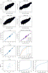
Effect of low spatial resolution in GPCP satellite observations of log(seasonal precipitation). y-axis: regression gradient in validation against GTMBA raingauge data (i.e. gradients in Figure 1 for light blue and red symbols). x-axis: horizontal grid dimension relative to TRMM (e.g. the TRMM resolution is 0.25°, ten times smaller than the GPCP resolution of 2.5°, so the red symbol is placed at x=10). Dark blue symbols: results when TRMM data is regridded (by area averaging) to coarser grids. The coarser grids are chosen so the grid box edges overlap edges of the native TRMM grid. To give the errors context, the dash-dot line marks the ratio between the largest and smallest model values of kqsat (2.5). Solid black line is a quadratic least-squares best fit line through the TRMM-based data. The intercept of the TRMM best-fit curve at x=0 (i.e. infinitely fine grid) is very close to the value estimated on the TRMM native grid (light blue symbol), indicating that the TRMM grid is sufficiently fine for comparison with the rangauge data on seasonal timescales.
Extended data Figure 2.
Testing the method of estimating kqsat. a-d: example results of the sortav method for TRMM precipitation and HadISST SST, for different seasons: mean vectors of anomalies in (y-axis) log(precipitation) and (x-axis) qsat; kqsat is given by the gradient of the blue best-fit regression line. e, y-axis: kqsat calculated after excluding the 9 years with the largest absolute value of the nino3.4 index; x-axis: default kqsat (one symbol per model); kqsat is on average 6% lower when ENSO years excluded, due to a small sensitivity to the ENSO characteristic spatial pattern; but the model ranking is largely unchanged (r = 0.99). f, kqsat calculated for individual seasons versus the annual mean value; g kqsat using only years 1995–1999 versus the full 25-year estimate; h, estimating variability (due to internal variability in SST patterns) in kqsat estimated from 25 years of data: for each coupled ocean-atmosphere model, kqsat is estimated both for the full historical run, and for all 25-year chunks. Panel shows the cumulative distribution function of absolute percentage differences between the 25-year estimates and the full estimates (95% of samples are within 8% of the long-term value from the full historical run). This panel shows results for two methods of estimating kqsat: our ‘sortav’ method (as used throughout the manuscript), and standard OLS regression between seasonal anomalies in log(precipitation) and qsat. i comparing kqsatspattemp with kqsat; each cross represents one CMIP5 model. j,k Cumulative distribution functions of j climatological mean precipitation and k log(precipitation). From HadGEM2-A, May-July season (same picture seen in other seasons).
Extended data Figure 3.
Model biases for the high, mid-range and low-kqsat models separately. As Figure 2, for a-f high-kqsat models; g-l mid-kqsat models; m-r low-kqsat models.
Extended data Figure 4.
Testing potential errors in the satellite validation against GTMBA. a,b testing for regression dilution bias from error in TRMM observations: as Figure 1, but for a TRMM versus GPCP (both interpolated to GTMBA sites and masked as in Figure 1) and b GPCP versus TRMM. c-f testing for effects of SST uncertainty on the binning: as Figure 1, but using c,d ERSST and e,f COBE SST datasets to bin the data.
Extended data Figure 5.
Regions where models are most sensitive to kqsat. For each latitude of each region: y-axis shows Pearson correlation coefficients (r) between the 28 different CMIP5 model values kqsat, and the 28 CMIP5 model values of the logarithm of the precipitation ratio for that latitude and region (i.e. the logarithm of the grey lines in Figure 2a–f). Green bands mark the latitude intervals chosen to estimate the observational constraints on kqsat (a-e: intervals chosen where |r|> 0.6; f, a band of most negative r is chosen). Coefficients close to zero near 8N in the Atlantic and East Pacific spatial patterns correspond to the latitude of the precipitation peak in most models (the model spread in the precipitation peak is scaled out; coefficients are not exactly zero as there is a small model spread in the latitude of the precipitation peak).
Extended data Figure 6.
Scatter plots underpinning the central observational estimate of kqsat. a-g Precipitation error index versus kqsat for each of the 7 latitude intervals highlighted in Figure 2. Y-axes: logarithm of precipitation ratio, averaged over each latitude band, minus the equivalent value for TRMM observations, for (black) CMIP5 and (red) CMIP6 models. Dotted lines: linear least-squares fits (using CMIP5 data only). Vertical black line: kqsat estimate for each latitude interval, from the intercept of the green line with zero error index (dotted line). h Mean precipitation error index versus kqsat: mean error index is averaged over the 7 indices in the other panels (after the signs of the 5 indices with negative best-fit slopes were changed, to ensure a positive correlation with kqsat).
Extended data Figure 7.
Supporting results for observational estimate of the kqsat lower bound. Estimating error, from internal variability, due to the fact that the TRMM operational period only partly overlaps the time period simulated by the AMIP SST-forced models. Error magnitudes are estimated from the coupled ocean-atmosphere simulations, using differences between kqsat estimated from all possible overlapping 17-year (TRMM-like) and 25-year (AMIP-like) periods (with the same overlap as TRMM and the 25-year SST-forced model simulations). Results are given for two methods of estimating kqsat: our ‘sortav’ method (as used throughout the manuscript), and standard OLS regression between seasonal anomalies in log(precipitation) and qsat.
Extended Data Figure 8.
Atmospheric circulation measures in CMIP5 and CMIP6 models. a-c thick lines are CMIP5 composite means, for (magenta) high kqsat subset; (blue) low kqsat subset and (gold) intermediate kqsat. Thin grey lines are individual models (CMIP5 and CMIP6). Descent (5S-1N), mid (1–7N) and ascent (7–13N) regions are marked by vertical dotted lines in Figure 5c–e. d-h: each symbol represents one CMIP5 (black) or CMIP6 (red) model. Title gives Pearson correlation coefficient. d shallow descent versus kqsat; vertical line marks our best estimate of kqsat. e shallow ascent versus shallow descent. f shallow meridional return flow versus shallow descent. g shallow versus very-shallow meridional wind, over Galapgos: the negligible correlation indicates different physical processes at these two levels. h deep versus shallow ascent. i standard deviation, across models, of the pressure velocity (wap) at each pressure level.
Figure 1.
Figure 1.
Validating observations of log precipitation from satellites. GTMBA in-situ raingauge observations versus satellite observations from a TRMM and b GPCP. Each symbol represents the mean of all seasonal mean data within a given SST bin (Methods). Green line: best fit line (gradient and its 95% confidence interval quoted in each figure); dotted line: 1:1 line.
Figure 2.
Figure 2.
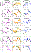
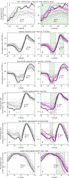
Model precipitation biases. (black) TRMM observations. Horizontal dashed line marks precipitation ratio=1. a-f all CMIP5 models are shown in grey lines; g-i magenta: ‘high-kqsat’ subset; grey: other models. Spatial patterns (bottom 3 rows) given by scaling zonal mean precipitation by its latitudinal maximum. Green shading marks the intervals used for the 7 estimates of kqsat. These examples were chosen as they feature large differences/gradients in SST. Precipitation ratios are plotted because of the form of Equation 1.
Figure 3.
Figure 3.
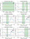
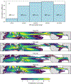
The region of applicability of kqsat. (a) each bar represents a climatological zone covering 20% of the tropical oceans, defined by the seasonal climatological SSTs (e.g. the left bar is the zone with the coolest 20% of SSTs – white masked ocean in the maps below). Climatological zones are defined separately for each season. Bar height: the correlation coefficient, across CMIP5 models, between the standard calculation of kqsat, and that calculated only over the selected climatological zone. Mean SST (°C) for each zone is also shown. (b-e) Colours: mean TRMM precipitation; orange line highlights 1 mm/day contour. Data is masked over the 20% of the oceans where kqsat is inapplicable (left-hand bar in panel a shows low correlation). White contour shows the 30th percentile of SST: the standard calculation of kqsat uses data inside this contour.
Figure 4.
Figure 4.
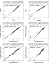
High sensitivity of precipitation to SST, and strong shallow circulations, in the real world. a horizontal lines mark (white dashes) the 7 estimates of kqsat (Extended data Figure 6), and the central estimate (black solid); shading marks kqsat values above our lower-bound estimate; symbols mark sorted model kqsat values for (crosses) CMIP5 (blue and magenta denote low-kqsat and high-kqsat model subsets) and (circles) CMIP6. b kqsat(spatial) versus kqsat, for each (black) CMIP5 and (red) CMIP6 model; horizontal line: kqsat(spatial) from TRMM observations; vertical line: best estimate of kqsat. c,d each symbol represents one CMIP5 (black) or CMIP6 (red) model; title gives Pearson correlation coefficient. c surface meridional wind averaged over the mid-region (180W-10E, 1–7N) versus shallow descent index (defined in Figure 5); horizontal line marks QuikSCAT observation. d meridional wind averaged over Galapagos & Christmas island, 600–700hPa (few observations above 600hPa) versus meridional wind averaged over the mid region (180W-10E, 1–7N), 500–700hPa; horizontal line marks wind profiler observation.
Figure 5.
Figure 5.
Linking kqsat to shallow circulations. a,b quantifies internal variability, and c-e climate means. a CMIP5 ensemble mean of kqsatwap (Pa kg/g), at each pressure level. b inter-model correlations (Pearson r) between kqsat, and kqsatwap, at each pressure level. Correlations are negative because of the definition of wap. c-e Aug-Oct, 180W-10E zonal means. c CMIP5 ensemble mean of (colours) vertical velocity (Pa/s) and (white contours) meridional wind. d inter-model correlations between kqsat and mean vertical velocity (colours) and between kqsat and mean meridional wind (white contours). e as d, but for correlations with the shallow descent index instead of kqsat (shallow descent index = vertical velocity averaged over left-hand orange-dashed box: 5S-1N, 850–600 hPa).

References

    1. Philander SGH El-Nino Southern Oscillation Phenomena. Nature 302, 295–301 (1983).
    1. Pierrehumbert RT Thermostats, Radiator Fins, and the Local Runaway Greenhouse. J. Atmos. Sci. 52, 1784–1806 (1995).
    1. Tian BJ Spread of model climate sensitivity linked to double-Intertropical Convergence Zone bias. Geophys. Res. Lett. 42, 4133–4141 (2015).
    1. Back LE & Bretherton CS Geographic variability in the export of moist static energy and vertical motion profiles in the tropical Pacific. Geophys. Res. Lett. 33, (2006).
    1. Sherwood SC, Bony S & Dufresne JL Spread in model climate sensitivity traced to atmospheric convective mixing. Nature 505, 37-+ (2014). - PubMed

Methods References

    1. Hutcheon JA, Chiolero A & Hanley JA Random measurement error and regression dilution bias. Br. Med. J. 340, (2010). - PubMed

Publication types