Heavy metal pollution and ecological risk assessment in brownfield soil from Xi'an, China: An integrated analysis of man-land interrelations
- PMID: 33137143
- PMCID: PMC7605699
- DOI: 10.1371/journal.pone.0241398
Heavy metal pollution and ecological risk assessment in brownfield soil from Xi'an, China: An integrated analysis of man-land interrelations
Abstract
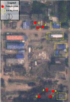
The core of urbanization is land use change, resulting in the urban sprawl and urban population explosion. The problem of land resources shortage and ecological environment destruction has become increasingly prominent. Land use change and human activities can directly lead to urban soil pollution. This study analyzed the concentration of Cd, Cr, Cu, Ni, Pb, Zn, Hg and As in the original site of Xi'an chlor-alkali chemical plant, which was know as a brownfield. The results showed the concentrations of Hg, Pb and Zn in research areas were obviously higher than soil background value. Through pollution index (PI) method and Geo-accumulation Index (Igeo) method, totally 26 sample points in different areas (A, B, C, D) were classified into different pollution degrees. The CPI results indicated 9 sample points were heavily polluted, accounting for 34.6% of the total. Among them, 6 out of 9 were located in area A. 12 samples points were not polluted. The average Igeo values of single heavy metal were arranged in the order of Hg (1.83) > Zn (1.26) > Pb (0.33). The pollution of Hg was relatively serious and extensive, especially in area A. It was mainly because of the historical pollution produced by chemical plant. The pollution of Pb in each point was quite different. Mainly influenced by automobile related activities, Igeo(Pb) in sample point 15 and 16 were all beyond 4.00. The average potential ecological risk (PER) of each area was in the order of A (1428) > B (297) > D (249) > C (163). The ecological risk was mainly determined by previous industrial production and present human activity at the same time. People and land are interdependent and interactive. The understanding on the mechanism of man-land interralations, regarding to urban land use and ecological environment, will promote urban sustainability.
Conflict of interest statement
Shaanxi Provincial Land Engineering Construction Group Co., Ltd and Institute of Land Engineering and Technology, Shaanxi Provincial Land Engineering Construction Group Co., Ltd provided support in the form of salaries for authors [Liu SQ, Wang LY, Guo C], but did not have any additional role in the study design, data collection and analysis, decision to publish, or preparation of the manuscript. Commercial affiliation of Liu SQ, Wang LY and Guo C does not alter our adherence to PLOS ONE policies on sharing data and materials.
Figures


References
-
- Messerli B, Grosjean M, Hofer T, Núñez L, Pfister C. From nature-dominated to human-dominated environmental changes. Quaternary Science Reviews. 2000; 19(1–5): 459–479. 10.1016/S0277-3791(99)00075-X - DOI
-
- Huang GX, Zhang M, Liu CY, Li LP, Chen ZY. Heavy metal(loid)s and organic contaminants in groundwater in the Pearl River Delta that has undergone three decades of urbanization and industrialization: Distributions, sources, and driving forces. Science of the Total Environment. 2018; 635: 913–925. 10.1016/j.scitotenv.2018.04.210 - DOI - PubMed
-
- Li K, Lin BQ. Impacts of urbanization and industrialization on energy consumption/CO2 emissions: Does thelevel of development matter? Renewable and Sustainable Energy Reviews. 2015; 52: 1107–1122. 10.1016/j.rser.2015.07.185 - DOI
-
- Megremi I, Vasilatos C, Vassilakis E. Economou-Eliopoulos M. Spatial diversity of Cr distribution in soil and groundwater sites in relation with land use management in a Mediterranean region: The case of C. Evia and Assopos-Thiva Basins, Greece. Science of the Total Environment. 2019; 651: 656–667. 10.1016/j.scitotenv.2018.09.186 - DOI - PubMed
-
- Long HL, Qu Y. Land use transitions and land management: A mutual feedback perspective. Land Use Policy. 2018; 74: 111–120. 10.1016/j.landusepol.2017.03.021 - DOI
MeSH terms
Substances
LinkOut - more resources
Full Text Sources
Research Materials
Miscellaneous

