

A Review on Early Forest Fire Detection Systems Using Optical Remote Sensing
- PMID: 33187292
- PMCID: PMC7697165
- DOI: 10.3390/s20226442
A Review on Early Forest Fire Detection Systems Using Optical Remote Sensing
Abstract
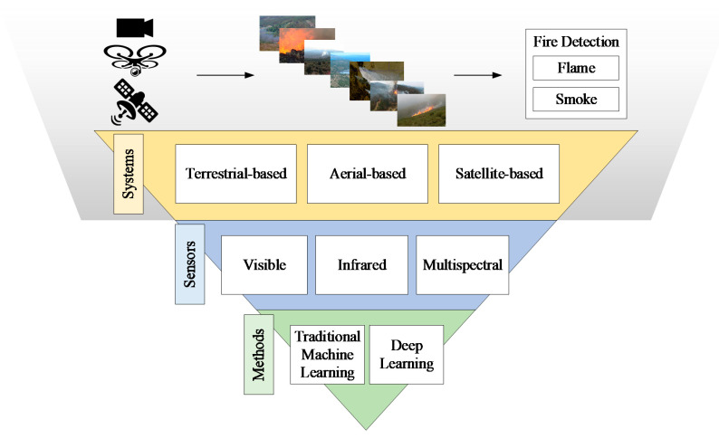
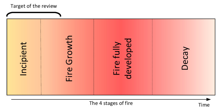
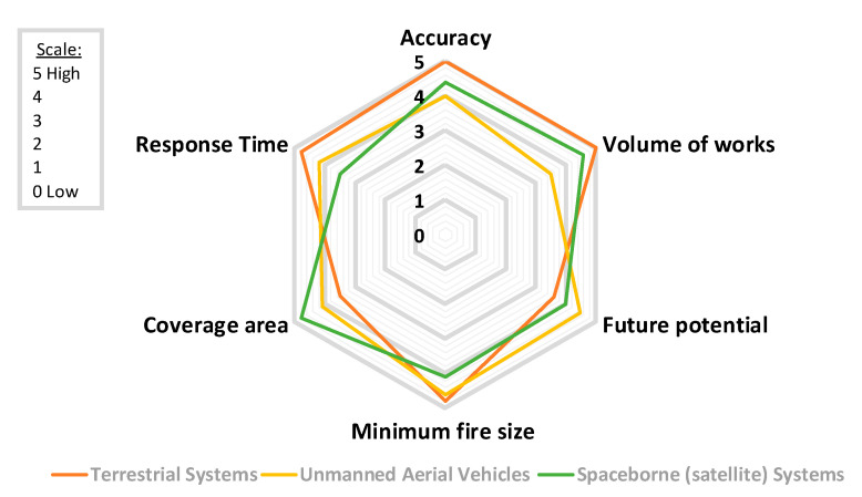
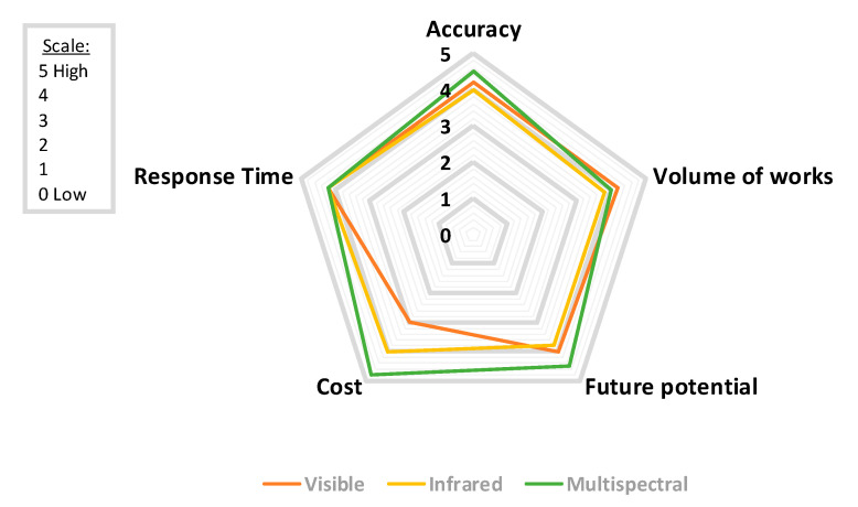
The environmental challenges the world faces nowadays have never been greater or more complex. Global areas covered by forests and urban woodlands are threatened by natural disasters that have increased dramatically during the last decades, in terms of both frequency and magnitude. Large-scale forest fires are one of the most harmful natural hazards affecting climate change and life around the world. Thus, to minimize their impacts on people and nature, the adoption of well-planned and closely coordinated effective prevention, early warning, and response approaches are necessary. This paper presents an overview of the optical remote sensing technologies used in early fire warning systems and provides an extensive survey on both flame and smoke detection algorithms employed by each technology. Three types of systems are identified, namely terrestrial, airborne, and spaceborne-based systems, while various models aiming to detect fire occurrences with high accuracy in challenging environments are studied. Finally, the strengths and weaknesses of fire detection systems based on optical remote sensing are discussed aiming to contribute to future research projects for the development of early warning fire systems.
Keywords: aerial; artificial intelligence; early fire detection; multispectral imaging systems; satellite; terrestrial.
Conflict of interest statement
The authors declare no conflict of interest.
Figures
References
-
- Tanase M.A., Aponte C., Mermoz S., Bouvet A., Le Toan T., Heurich M. Detection of windthrows and insect outbreaks by L-band SAR: A case study in the Bavarian Forest National Park. Remote Sens. Environ. 2018;209:700–711. doi: 10.1016/j.rse.2018.03.009. - DOI
-
- Pradhan B., Suliman M.D.H.B., Awang M.A.B. Forest fire susceptibility and risk mapping using remote sensing and geographical information systems (GIS) Disaster Prev. Manag. Int. J. 2007;16 doi: 10.1108/09653560710758297. - DOI
-
- Kresek R. History of the Osborne Firefinder. [(accessed on 7 September 2020)];2007 Available online: http://nysforestrangers.com/archives/osborne%20firefinder%20by%20kresek.pdf.
-
- Bouabdellah K., Noureddine H., Larbi S. Using wireless sensor networks for reliable forest fires detection. Procedia Comput. Sci. 2013;19:794–801. doi: 10.1016/j.procs.2013.06.104. - DOI
-
- Gaur A., Singh A., Kumar A., Kulkarni K.S., Lala S., Kapoor K., Srivastava V., Kumar A., Mukhopadhyay S.C. Fire sensing technologies: A review. IEEE Sens. J. 2019;19:3191–3202. doi: 10.1109/JSEN.2019.2894665. - DOI
Publication types
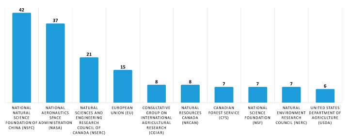
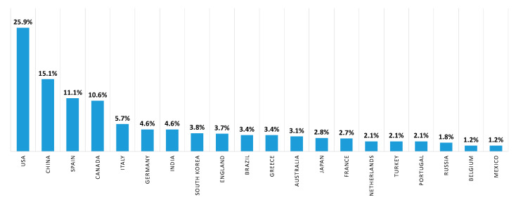
Grants and funding
LinkOut - more resources
Full Text Sources
Other Literature Sources
