

HTrack: A new tool to facilitate public health field visits and electronic data capture
- PMID: 33320896
- PMCID: PMC7737954
- DOI: 10.1371/journal.pone.0244028
HTrack: A new tool to facilitate public health field visits and electronic data capture
Abstract
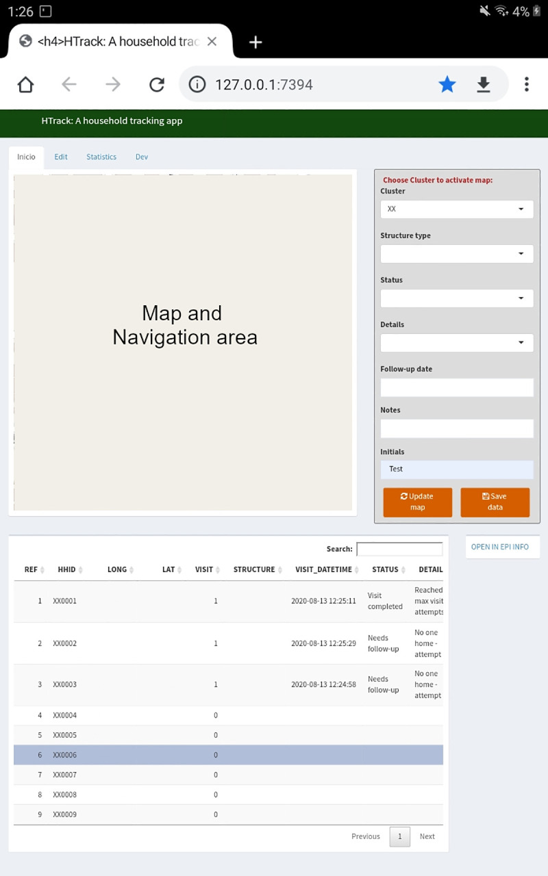
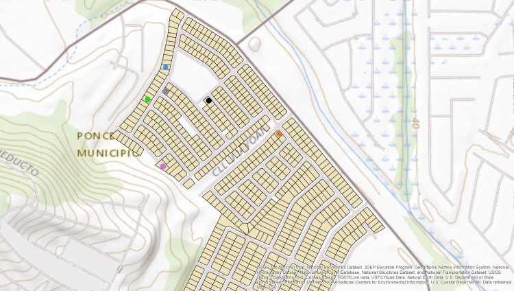
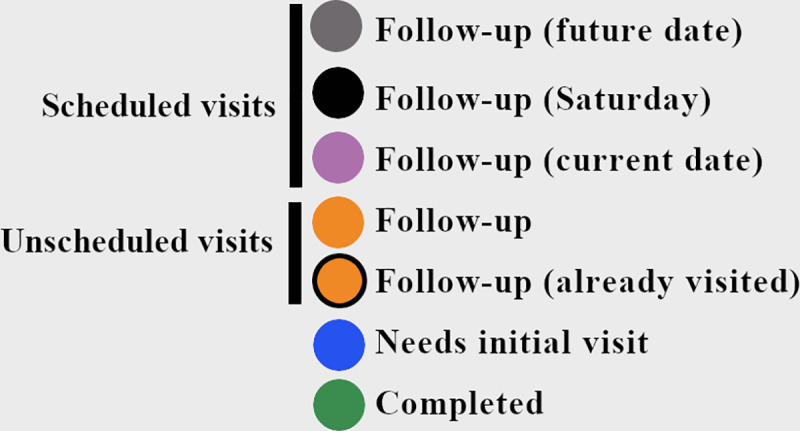
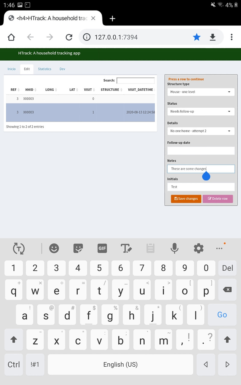
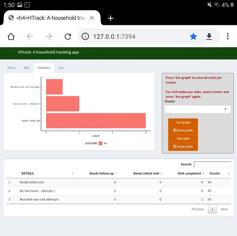
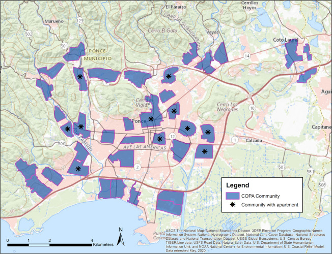
Many applications have been developed for electronic data collection. However, offline field navigation tools incorporating secure electronic data capture and field visit tracking are currently scarce. We created an R-Shiny application, HTrack (Household Tracking), for use on encrypted Android devices in the field. The application was implemented in the Communities Organized to Prevent Arboviruses (COPA) project, a study beginning in 2018 to better understand arboviral disease incidence in 38 communities in Puerto Rico. The application was used to navigate to randomly selected structures and capture visit outcomes after conducting multiple visits for participant recruitment. It also served as a bridge to an alternate software, Epi Info, to collect participant-level questionnaire data. This application successfully captured each visit outcome and improved the logistics of field level activities for the COPA project, eliminating the use of paper maps for navigation. We show the development of HTrack and comment on the limitations and strengths of this application and further improvements.
Conflict of interest statement
The authors have declared that no competing interests exist.
Figures
References
-
- Esri, Navigator for ArcGIS https://www.esri.com/en-us/arcgis/products/arcgis-navigator/overview
-
- Esri, Collector for ArcGIS Overview https://www.esri.com/en-us/arcgis/products/arcgis-collector/overview
-
- Esri, Survey123 for ArcGIS https://www.esri.com/en-us/arcgis/products/arcgis-survey123/overview
-
- Esri, QuickCapture for ArcGIS https://www.esri.com/en-us/arcgis/products/arcgis-quickcapture/overview
-
- Nowak MM, Dziób K, Ludwisiak T, Chmiel J. Mobile GIS applications for environmental field surveys: A state of the art, Global Ecology and Conservation. Volume 23, 2020, e01089, ISSN 2351-9894, 10.1016/j.gecco.2020.e01089. - DOI
Publication types
MeSH terms
Grants and funding
LinkOut - more resources
Full Text Sources
