. 2021 Jan;27(1):170-181.
doi: 10.3201/eid2701.191787.

Delineating and Analyzing Locality-Level Determinants of Cholera, Haiti

Delineating and Analyzing Locality-Level Determinants of Cholera, Haiti

Karolina Griffiths et al. Emerg Infect Dis. 2021 Jan.

Abstract

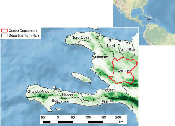
Centre Department, Haiti, was the origin of a major cholera epidemic during 2010-2019. Although no fine-scale spatial delineation is officially available, we aimed to analyze determinants of cholera at the local level and identify priority localities in need of interventions. After estimating the likely boundaries of 1,730 localities by using Voronoi polygons, we mapped 5,322 suspected cholera cases reported during January 2015-September 2016 by locality alongside environmental and socioeconomic variables. A hierarchical clustering on principal components highlighted 2 classes with high cholera risk: localities close to rivers and unimproved water sources (standardized incidence ratio 1.71, 95% CI 1.02-2.87; p = 0.04) and urban localities with markets (standardized incidence ratio 1.69, 95% CI 1.25-2.29; p = 0.0006). Our analyses helped identify and characterize areas where efforts should be focused to reduce vulnerability to cholera and other waterborne diseases; these methods could be used in other contexts.

Keywords: Haiti; Vibrio cholerae O1; bacteria; cholera; communicable disease prevention and control; enteric infections; epidemiology; foodborne infections; risk factors; spatial analysis; waterborne infections.


Figures

Figure 1
Figure 1
Topographical map of Haiti and its departments, highlighting Centre Department (red outline). Altitude increases from light green to dark green. Inset shows Haiti in relation to neighboring continents.
Figure 2
Figure 2
Geographic and demographic details of Centre Department, Haiti. A) Outline of the department’s 12 communes, principal urban areas, altitude raster, rivers, roads, and position of markets. B) Polygon outline and estimated population for each locality, positions of unimproved and improved water sources, and vaccinated areas.
Figure 3
Figure 3
Estimated incidence of suspected cholera cases per 10,000 persons for each locality in Centre Department, Haiti, January 2015–September 2016.
Figure 4
Figure 4
Classification analysis of localities regarding environmental variables based on hierarchical clustering on principal components of multiple correspondence analysis, Centre Department, Haiti. A) Cluster dendrogram demonstrating the division of localities into 4 classes: green, class 1; blue, class 2; purple, class 3; red, class 4. Height indicates the order at which the clusters were joined. B) Factor map demonstrating the 4 classes on the first 2 dimensions of the multiple correspondence analysis with the following variables: altitude, distance to an unimproved water source, distance to an improved water source, distance to road, distance to a river, presence of market, rural or urban, and cholera vaccination. The x and y axes represent the first 2 dimensions of the multiple correspondence analysis; the percentage of the total dataset inertia is represented by each dimension. Each point is a locality, with the shaded areas representing the 4 classes, as in panel A.
Figure 5
Figure 5
Localities of Centre Department, Haiti, mapped according to hierarchical clustering on principal components classification analysis. Classification analysis determined 2 large lower-risk classes: class 1 localities were remote and higher altitude, and class 2 localities were rural intermediary areas. Two at high-risk classes were identified: class 3 localities are closer to rivers and unimproved water sources, and class 4 localities have markets and are in urban areas.
Figure 6
Figure 6
Comparison of the most strongly associated risk factors for cholera between 2 high-risk classes, Centre Department, Haiti. The most strongly associated risk factors for suspected cholera cases were distance <200 m to a river, distance <150 m to an unimproved water source, low altitude, distance to a road <150 m, presence of a market, and urban areas. Class 3 and class 4, both at higher risk for cholera, were close to a road but differed for the other identified risk factors.

References

    1. Piarroux R, Barrais R, Faucher B, Haus R, Piarroux M, Gaudart J, et al. Understanding the cholera epidemic, Haiti. Emerg Infect Dis. 2011;17:1161–8. 10.3201/eid1707.110059 - DOI - PMC - PubMed
    1. Gaudart J, Rebaudet S, Barrais R, Boncy J, Faucher B, Piarroux M, et al. Spatio-temporal dynamics of cholera during the first year of the epidemic in Haiti. PLoS Negl Trop Dis. 2013;7:e2145. 10.1371/journal.pntd.0002145 - DOI - PMC - PubMed
    1. Ministère Santé Publique et de la Population (MSPP). Department of Epidemiology, Laboratories and Research (DELR). Report of the National Cholera Surveillance Network, 40th epidemiological week 2019. [in French] [cited 2019 Dec 1]. http://mspp.gouv.ht/site/downloads/Profil%20statistique%20Cholera%2040SE...
    1. Republic of Haiti, Ministry of Public Health and Population, National Directorate for Water Supply and Sanitation. National plan for the elimination of cholera in Haiti 2013–2022 [in French] [cited 2019 Dec 1]. https://www.paho.org/hq/index.php?option=com_docman&task=doc_view&gid=20...
    1. Republic of Haiti, Ministry of Public Health and Population, National Directorate for Water Supply and Sanitation. National plan for the elimination of cholera: development of the long term plan 2018–2022 [in French] [cited 2019 Dec 1]. http://mspp.gouv.ht/site/downloads/Plan%20a%20long%20terme%202018%202022...

LinkOut - more resources