

Validating and Comparing Highly Resolved Commercial "Off the Shelf" PM Monitoring Sensors with Satellite Based Hybrid Models, for Improved Environmental Exposure Assessment
- PMID: 33374352
- PMCID: PMC7796136
- DOI: 10.3390/s21010063
Validating and Comparing Highly Resolved Commercial "Off the Shelf" PM Monitoring Sensors with Satellite Based Hybrid Models, for Improved Environmental Exposure Assessment
Abstract
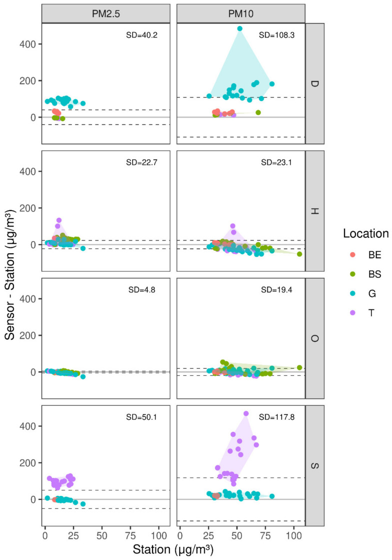
Particulate matter is a common health hazard, and under certain conditions, an ecological threat. While many studies were conducted in regard to air pollution and potential effects, this paper serves as a pilot scale investigation into the spatial and temporal variability of particulate matter (PM) pollution in arid urban environments in general, and Beer-Sheva, Israel as a case study. We explore the use of commercially off the shelf (COTS) sensors, which provide an economical solution for spatio-temporal measurements. We started with a comparison process against an A-grade meteorological station, where it was shown that under specific climatic conditions, a number of COTS sensors were able to produce robust agreement (mean R2=0.93, average SD=17.5). The second stage examined the COTS sensors that were proven accurate in a mobile measurement campaign. Finally, data collected was compared to a validated satellite prediction model. We present how these tests and COTS sensor-kits could then be used to further explain the continuity and dispersion of particulate matter in similar areas.
Keywords: Brompton bicycle; bike; dust sensors; micro-controllers; mobile measurements; particulate matter.
Conflict of interest statement
The authors declare no conflict of interest.
Figures


References
-
- Luisa M. Contribution of Natural Sources to Air Pollution Levels in the EU—A Technical Basis for the Development of Guidance for the Member States. EUR—Scientific and Technical Research Reports; Ispra, Italy: 2007.
-
- Francisco P., Ioana I. Anthropogenic Air Pollution Sources. Air Qual. 2010 doi: 10.5772/9751. - DOI
-
- Helena K., Itzhak K., Petros K., Michael D. Friger. Contribution of dust storms to PM10 levels in urban arid environments. J. Air Waste Manag. Assos. 2014;64:89–94. - PubMed
-
- Eliezer G., Isabella O., Amnon S., Pinhas A. Increasing trend of African dust, over 49 year, in the eastern Mediterranean. JGR Atmos. 2010;115:D7. doi: 10.1029/2009JD012500. - DOI
MeSH terms
Substances
LinkOut - more resources
Full Text Sources
Medical
