

Spatial analysis of the impact of urban geometry and socio-demographic characteristics on COVID-19, a study in Hong Kong
- PMID: 33418356
- PMCID: PMC7738937
- DOI: 10.1016/j.scitotenv.2020.144455
Spatial analysis of the impact of urban geometry and socio-demographic characteristics on COVID-19, a study in Hong Kong
Abstract
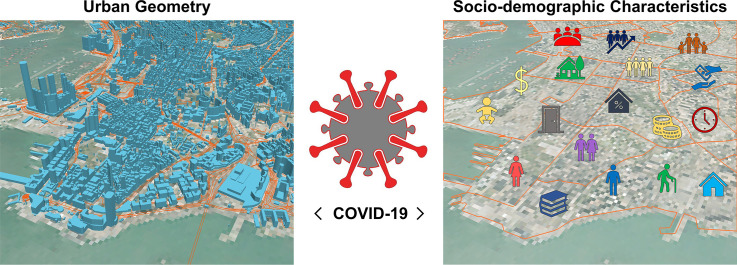
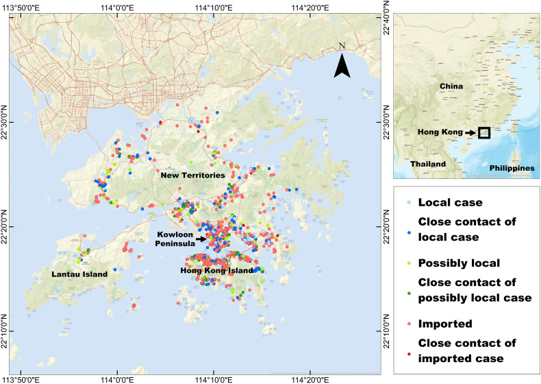
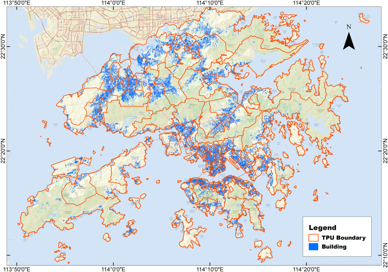
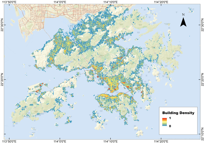
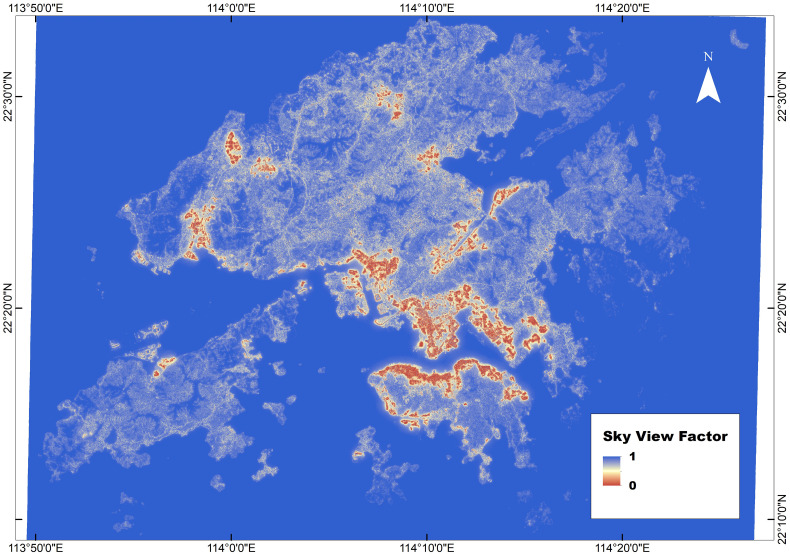
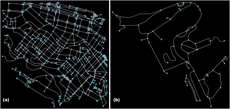
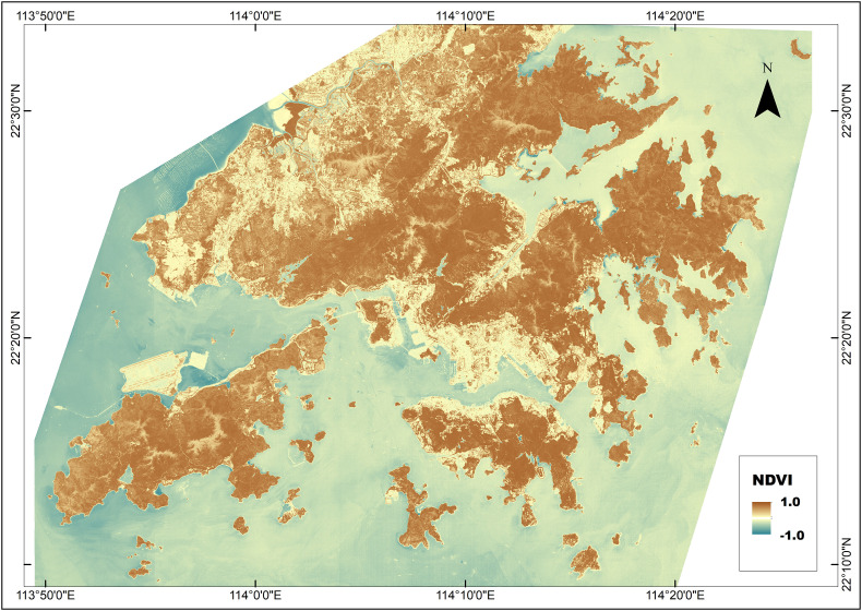
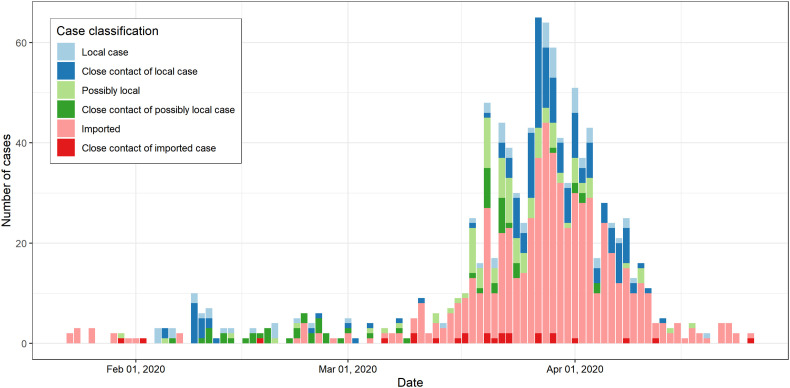
The World Health Organization considered the wide spread of COVID-19 over the world as a pandemic. There is still a lack of understanding of its origin, transmission, and treatment methods. Understanding the influencing factors of COVID-19 can help mitigate its spread, but little research on the spatial factors has been conducted. Therefore, this study explores the effects of urban geometry and socio-demographic factors on the COVID-19 cases in Hong Kong. For each patient, the places they visited during the incubation period before going to hospital were identified, and matched with corresponding attributes of urban geometry (i.e., building geometry, road network and greenspace) and socio-demographic factors (i.e., demographic, educational, economic, household and housing characteristics) based on the coordinates. The local cases were then compared with the imported cases using stepwise logistic regression, logistic regression with case-control of time, and least absolute shrinkage and selection operator regression to identify factors influencing local disease transmission. Results show that the building geometry, road network and certain socio-economic characteristics are significantly associated with COVID-19 cases. In addition, the results indicate that urban geometry is playing a more important role than socio-demographic characteristics in affecting COVID-19 incidence. These findings provide a useful reference to the government and the general public as to the spatial vulnerability of COVID-19 transmission and to take appropriate preventive measures in high-risk areas.
Keywords: COVID-19 pandemic; Socio-demographic characteristics; Spatial analysis; Urban geometry.
Copyright © 2020 Elsevier B.V. All rights reserved.
Conflict of interest statement
Declaration of competing interest The authors declare that they have no known competing financial interests or personal relationships that could have appeared to influence the work reported in this paper.
Figures
References
-
- Ali-Toudert F., Mayer H. Numerical study on the effects of aspect ratio and orientation of an urban street canyon on outdoor thermal comfort in hot and dry climate. Build. Environ. 2006;41:94–108.
-
- Boeing G. OSMnx: new methods for acquiring, constructing, analyzing, and visualizing complex street networks. Comput. Environ. Urban. Syst. 2017;65:126–139. doi: 10.1016/j.compenvurbsys.2017.05.004. - DOI
-
- Census and Statistics Department (HKSAR) 2016 Population by-Census. 2018. https://www.bycensus2016.gov.hk/en/index.html [WWW Document]. URL.
MeSH terms
LinkOut - more resources
Full Text Sources
Other Literature Sources
Medical
