

Walking Secure: Safe Routing Planning Algorithm and Pedestrian's Crossing Intention Detector Based on Fuzzy Logic App
- PMID: 33451012
- PMCID: PMC7828533
- DOI: 10.3390/s21020529
Walking Secure: Safe Routing Planning Algorithm and Pedestrian's Crossing Intention Detector Based on Fuzzy Logic App
Abstract
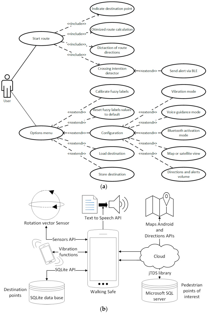
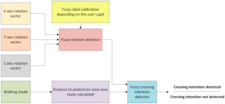
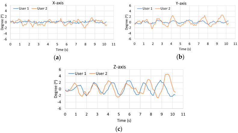
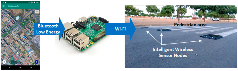
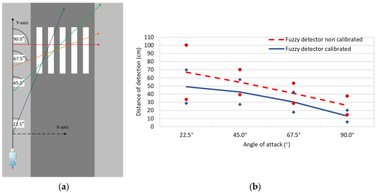
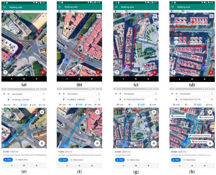
Improving road safety through artificial intelligence is now crucial to achieving more secure smart cities. With this objective, a mobile app based on the integration of the smartphone sensors and a fuzzy logic strategy to determine the pedestrian's crossing intention around crosswalks is presented. The app developed also allows the calculation, tracing and guidance of safe routes thanks to an optimization algorithm that includes pedestrian areas on the paths generated over the whole city through a cloud database (i.e., zebra crossings, pedestrian streets and walkways). The experimentation carried out consisted in testing the fuzzy logic strategy with a total of 31 volunteers crossing and walking around a crosswalk. For that, the fuzzy logic approach was subjected to a total of 3120 samples generated by the volunteers. It has been proven that a smartphone can be successfully used as a crossing intention detector system with an accuracy of 98.63%, obtaining a true positive rate of 98.27% and a specificity of 99.39% according to a receiver operating characteristic analysis. Finally, a total of 30 routes were calculated by the proposed algorithm and compared with Google Maps considering the values of time, distance and safety along the routes. As a result, the routes generated by the proposed algorithm were safer than the routes obtained with Google Maps, achieving an increase in the use of safe pedestrian areas of at least 183%.
Keywords: Android application; crossing intention detector; pedestrians; road safety; safe routes; smart cities.
Conflict of interest statement
The authors declare no conflict of interest.
Figures

References
-
- Cohen B. What Exactly Is a Smart City? Technical Report. [(accessed on 26 November 2020)];2012 Available online: https://www.fastcompany.com/
-
- Soomro K., Bhutta M.N.M., Khan Z., Tahir M.A. Smart City big data analytics: An advanced review. Wiley Interdiscip. Rev. Data Min. Knowl. Discov. 2019;9:1–25. doi: 10.1002/widm.1319. - DOI
-
- Navarathna P.J., Malagi V.P. Artificial intelligence in smart city analysis; Proceedings of the 2018 International Conference on Smart Systems and Inventive Technology; Tirunelveli, India. 13–14 December 2018; pp. 44–47.
-
- Lewicki W., Stankiewicz B., Olejarz-Wahba A.A. The role of intelligent transport system in the development of the idea of smart city; Proceedings of the 16th Scientific and Technical Conference on Transport Systems Theory and Practice; Katowice, Poland. 16–18 September 2019; pp. 26–36.
Grants and funding
- "Industrialization of a Road Signaling Autonomous System for Smart Pedestrian Crosswalks" (ref. 5947)/Ministry of Economy and Knowledge of the Andalusian Government, Spain
- "Improvement of Road Safety Through an Intelligent Service Platform for Pedestrians, Sensors and Environment" (ref. UHU-1260596)/Ministry of Economy and Knowledge of the Andalusian Government, Spain
LinkOut - more resources
Full Text Sources
Other Literature Sources
Research Materials
