

High-resolution, large-scale laboratory measurements of a sandy beach and dynamic cobble berm revetment
- PMID: 33473128
- PMCID: PMC7817828
- DOI: 10.1038/s41597-021-00805-1
High-resolution, large-scale laboratory measurements of a sandy beach and dynamic cobble berm revetment
Erratum in
-
Author Correction: High-resolution, large-scale laboratory measurements of a sandy beach and dynamic cobble berm revetment.Sci Data. 2021 Mar 15;8(1):86. doi: 10.1038/s41597-021-00874-2. Sci Data. 2021. PMID: 33723256 Free PMC article. No abstract available.
Abstract
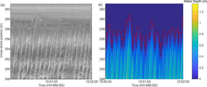
High quality laboratory measurements of nearshore waves and morphology change at, or near prototype-scale are essential to support new understanding of coastal processes and enable the development and validation of predictive models. The DynaRev experiment was completed at the GWK large wave flume over 8 weeks during 2017 to investigate the response of a sandy beach to water level rise and varying wave conditions with and without a dynamic cobble berm revetment, as well as the resilience of the revetment itself. A large array of instrumentation was used throughout the experiment to capture: (1) wave transformation from intermediate water depths to the runup limit at high spatio-temporal resolution, (2) beach profile change including wave-by-wave changes in the swash zone, (3) detailed hydro and morphodynamic measurements around a developing and a translating sandbar.
Conflict of interest statement
The authors declare no competing interests.
Figures


References
-
- Almeida LP, Masselink G, McCall R, Russell PE. Storm overwash of a gravel barrier: Field measurements and XBeach-G modelling. Coast. Eng. 2017;120:22–35. doi: 10.1016/j.coastaleng.2016.11.009. - DOI
-
- Briganti R, Dodd N, Incelli G, Kikkert G. Numerical modelling of the flow and bed evolution of a single bore-driven swash event on a coarse sand beach. Coast. Eng. 2018;142:62–76. doi: 10.1016/j.coastaleng.2018.09.006. - DOI
-
- Masselink G, et al. Large-scale Barrier Dynamics Experiment II (BARDEX II): Experimental design, instrumentation, test program, and data set. Coast. Eng. 2016;113:3–18. doi: 10.1016/j.coastaleng.2015.07.009. - DOI
-
- Eichentopf S, van der Zanden J, Cáceres I, Baldock TE, Alsina JM. Influence of storm sequencing on breaker bar and shoreline evolution in large-scale experiments. Coast. Eng. 2020;157:103659. doi: 10.1016/j.coastaleng.2020.103659. - DOI
-
- Allan JC, Komar P. Environmentally compatible berm and artificial dune for shore protection. Shore and Beach. 2004;721:9–16.
Publication types
Grants and funding
- 654110, HYDRALAB+/EC | Horizon 2020 Framework Programme (EU Framework Programme for Research and Innovation H2020)/International
- 654110, HYDRALAB+/EC | Horizon 2020 Framework Programme (EU Framework Programme for Research and Innovation H2020)/International
- 654110, HYDRALAB+/EC | Horizon 2020 Framework Programme (EU Framework Programme for Research and Innovation H2020)/International
- 654110, HYDRALAB+/EC | Horizon 2020 Framework Programme (EU Framework Programme for Research and Innovation H2020)/International
- 654110, HYDRALAB+/EC | Horizon 2020 Framework Programme (EU Framework Programme for Research and Innovation H2020)/International
- 654110, HYDRALAB+/EC | Horizon 2020 Framework Programme (EU Framework Programme for Research and Innovation H2020)/International
- 654110, HYDRALAB+/EC | Horizon 2020 Framework Programme (EU Framework Programme for Research and Innovation H2020)/International
- 654110, HYDRALAB+/EC | Horizon 2020 Framework Programme (EU Framework Programme for Research and Innovation H2020)/International
- 654110, HYDRALAB+/EC | Horizon 2020 Framework Programme (EU Framework Programme for Research and Innovation H2020)/International
- WISE CDT/RCUK | Engineering and Physical Sciences Research Council (EPSRC)/International
LinkOut - more resources
Full Text Sources
Other Literature Sources
