

Credal decision tree based novel ensemble models for spatial assessment of gully erosion and sustainable management
- PMID: 33542340
- PMCID: PMC7862281
- DOI: 10.1038/s41598-021-82527-3
Credal decision tree based novel ensemble models for spatial assessment of gully erosion and sustainable management
Abstract
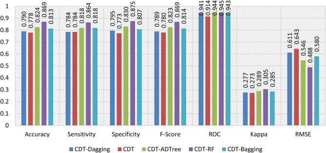
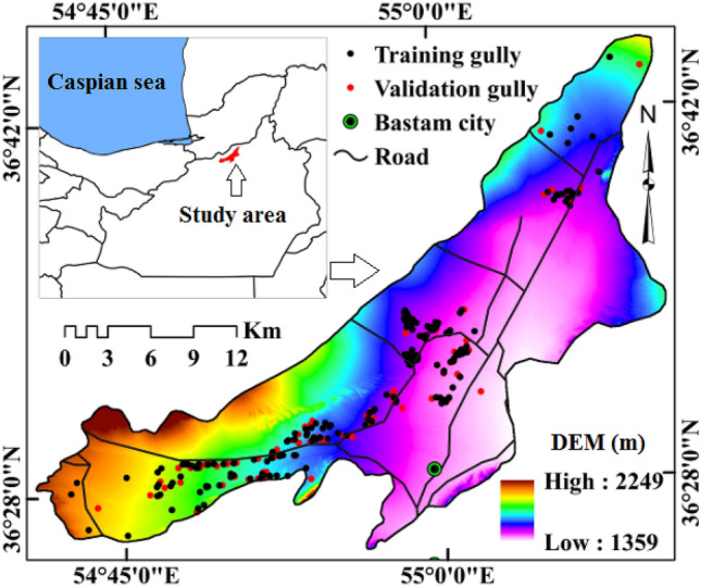
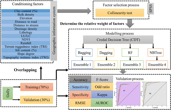
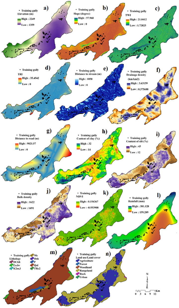
We introduce novel hybrid ensemble models in gully erosion susceptibility mapping (GESM) through a case study in the Bastam sedimentary plain of Northern Iran. Four new ensemble models including credal decision tree-bagging (CDT-BA), credal decision tree-dagging (CDT-DA), credal decision tree-rotation forest (CDT-RF), and credal decision tree-alternative decision tree (CDT-ADTree) are employed for mapping the gully erosion susceptibility (GES) with the help of 14 predictor factors and 293 gully locations. The relative significance of GECFs in modelling GES is assessed by random forest algorithm. Two cut-off-independent (area under success rate curve and area under predictor rate curve) and six cut-off-dependent metrics (accuracy, sensitivity, specificity, F-score, odd ratio and Cohen Kappa) were utilized based on both calibration as well as testing dataset. Drainage density, distance to road, rainfall and NDVI were found to be the most influencing predictor variables for GESM. The CDT-RF (AUSRC = 0.942, AUPRC = 0.945, accuracy = 0.869, specificity = 0.875, sensitivity = 0.864, RMSE = 0.488, F-score = 0.869 and Cohen's Kappa = 0.305) was found to be the most robust model which showcased outstanding predictive accuracy in mapping GES. Our study shows that the GESM can be utilized for conserving soil resources and for controlling future gully erosion.
Conflict of interest statement
The authors declare no competing interests.
Figures


References
-
- Sartori M, et al. A linkage between the biophysical and the economic: Assessing the global market impacts of soil erosion. Land Use Policy. 2019;86:299–312. doi: 10.1016/j.landusepol.2019.05.014. - DOI
-
- Poesen J. Soil erosion in the Anthropocene: Research needs. Earth Surf. Process. Landforms. 2018;43:64–84. doi: 10.1002/esp.4250. - DOI
-
- Arabameri A, et al. A methodological comparison of head-cut based gully erosion susceptibility models: Combined use of statistical and artificial intelligence. Geomorphology. 2020;359:107136. doi: 10.1016/j.geomorph.2020.107136. - DOI
-
- Douglas-Mankin KR, et al. A comprehensive review of ephemeral gully erosion models. CATENA. 2020;195:104901. doi: 10.1016/j.catena.2020.104901. - DOI
-
- Muhs DR. The geochemistry of loess: Asian and North American deposits compared. J. Asian Earth Sci. 2018;155:81–115. doi: 10.1016/j.jseaes.2017.10.032. - DOI
Publication types
LinkOut - more resources
Full Text Sources
Other Literature Sources
