

Super Resolution Infrared Thermal Imaging Using Pansharpening Algorithms: Quantitative Assessment and Application to UAV Thermal Imaging
- PMID: 33578847
- PMCID: PMC7916566
- DOI: 10.3390/s21041265
Super Resolution Infrared Thermal Imaging Using Pansharpening Algorithms: Quantitative Assessment and Application to UAV Thermal Imaging
Abstract
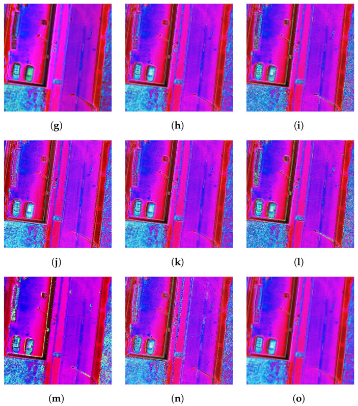
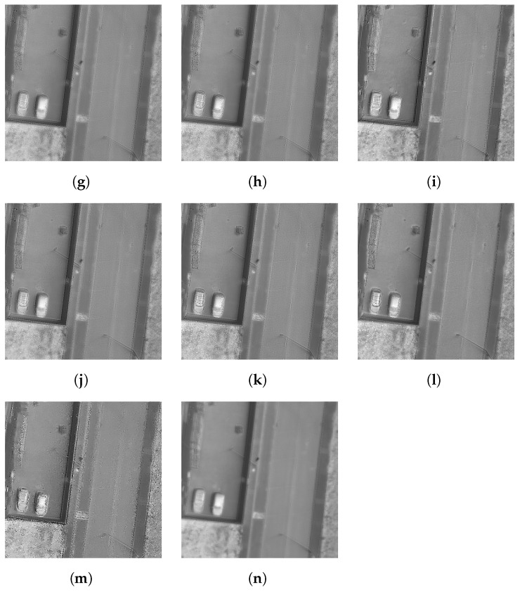
The lack of high-resolution thermal images is a limiting factor in the fusion with other sensors with a higher resolution. Different families of algorithms have been designed in the field of remote sensors to fuse panchromatic images with multispectral images from satellite platforms, in a process known as pansharpening. Attempts have been made to transfer these pansharpening algorithms to thermal images in the case of satellite sensors. Our work analyses the potential of these algorithms when applied to thermal images from unmanned aerial vehicles (UAVs). We present a comparison, by means of a quantitative procedure, of these pansharpening methods in satellite images when they are applied to fuse high-resolution images with thermal images obtained from UAVs, in order to be able to choose the method that offers the best quantitative results. This analysis, which allows the objective selection of which method to use with this type of images, has not been done until now. This algorithm selection is used here to fuse images from thermal sensors on UAVs with other images from different sensors for the documentation of heritage, but it has applications in many other fields.
Keywords: infrared; multispectral; pansharpening; remote sensing; resolution enhancement; super-resolution; thermal imaging.
Conflict of interest statement
The authors declare no conflict of interest.
Figures


References
-
- Kohin M., Butler N.R. Performance limits of uncooled VO x microbolometer focal plane arrays; Proceedings of the Infrared Technology and Applications XXX; Orlando, FL, USA. 12–16 April 2004; p. 447. - DOI
-
- Yue L., Shen H., Li J., Yuan Q., Zhang H., Zhang L. Image super-resolution: The techniques, applications, and future. Signal Process. 2016;128:389–408. doi: 10.1016/j.sigpro.2016.05.002. - DOI
-
- Chavez P.S., Sides S.C., Anderson J.A. Comparison of three different methods to merge multiresolution and multispectral data: Landsat TM and SPOT panchromatic. Photogramm. Eng. Remote Sens. 1991 doi: 10.1306/44b4c288-170a-11d7-8645000102c1865d. - DOI
-
- Lagüela S., Armesto J., Arias P., Herráez J. Automation of thermographic 3D modelling through image fusion and image matching techniques. Autom. Constr. 2012;27:24–31. doi: 10.1016/j.autcon.2012.05.011. - DOI
-
- Kuenzer C., Dech S. Thermal remote sensing Sensors, Methods, Applications. In: Kuenzer C., Dech S., editors. Remote Sensing and Digital Image Processing. Volume 17. Springer; Dordrecht, The Netherlands: 2013. pp. 287–313. - DOI
LinkOut - more resources
Full Text Sources
Other Literature Sources
