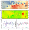
Response of altitudinal vegetation belts of the Tianshan Mountains in northwestern China to climate change during 1989-2015
- PMID: 33649482
- PMCID: PMC7921417
- DOI: 10.1038/s41598-021-84399-z
Response of altitudinal vegetation belts of the Tianshan Mountains in northwestern China to climate change during 1989-2015
Abstract
Within the mountain altitudinal vegetation belts, the shift of forest tree lines and subalpine steppe belts to high altitudes constitutes an obvious response to global climate change. However, whether or not similar changes occur in steppe belts (low altitude) and nival belts in different areas within mountain systems remain undetermined. It is also unknown if these, responses to climate change are consistent. Here, using Landsat remote sensing images from 1989 to 2015, we obtained the spatial distribution of altitudinal vegetation belts in different periods of the Tianshan Mountains in Northwestern China. We suggest that the responses from different altitudinal vegetation belts to global climate change are different. The changes in the vegetation belts at low altitudes are spatially different. In high-altitude regions (higher than the forest belts), however, the trend of different altitudinal belts is consistent. Specifically, we focused on analyses of the impact of changes in temperature and precipitation on the nival belts, desert steppe belts, and montane steppe belts. The results demonstrated that the temperature in the study area exhibited an increasing trend, and is the main factor of altitudinal vegetation belts change in the Tianshan Mountains. In the context of a significant increase in temperature, the upper limit of the montane steppe in the eastern and central parts will shift to lower altitudes, which may limit the development of local animal husbandry. The montane steppe in the west, however, exhibits the opposite trend, which may augment the carrying capacity of pastures and promote the development of local animal husbandry. The lower limit of the nival belt will further increase in all studied areas, which may lead to an increase in surface runoff in the central and western regions.
Conflict of interest statement
The authors declare no competing interests.
Figures


References
-
- Sanchez-Gonzalez A, Lopez-Mata L. Plant species richness and diversity along an altitudinal gradient in the Sierra Nevada, Mexico. Divers. Distrib. 2005;11:567–575. doi: 10.1111/j.1366-9516.2005.00186.x. - DOI
-
- Dai L, Feng Y, Luo G, Li Y, Xu W. The relationship between soil, climate and forest development in the mid-mountain zone of the Sangong River watershed in the northern Tianshan Mountains, China. J. Arid Land. 2014;7:63–72. doi: 10.1007/s40333-014-0073-x. - DOI
-
- Baiping Z, Ya T, Senguo MO. Digital spectrum and analysis of altitudinal belts in the Tianshan Mountains. J. Mt. Res. 2004;1:18–28.
-
- Li WJ, et al. Effects of climate change on potential habitats of the cold temperate coniferous forest in Yunnan province, southwestern China. J. Mt. Sci. Engl. 2016;13:1411–1422. doi: 10.1007/s11629-016-3846-1. - DOI
Publication types
LinkOut - more resources
Full Text Sources
Other Literature Sources

