

Facilitating fine-grained intra-urban dengue forecasting by integrating urban environments measured from street-view images
- PMID: 33766145
- PMCID: PMC7992840
- DOI: 10.1186/s40249-021-00824-5
Facilitating fine-grained intra-urban dengue forecasting by integrating urban environments measured from street-view images
Abstract
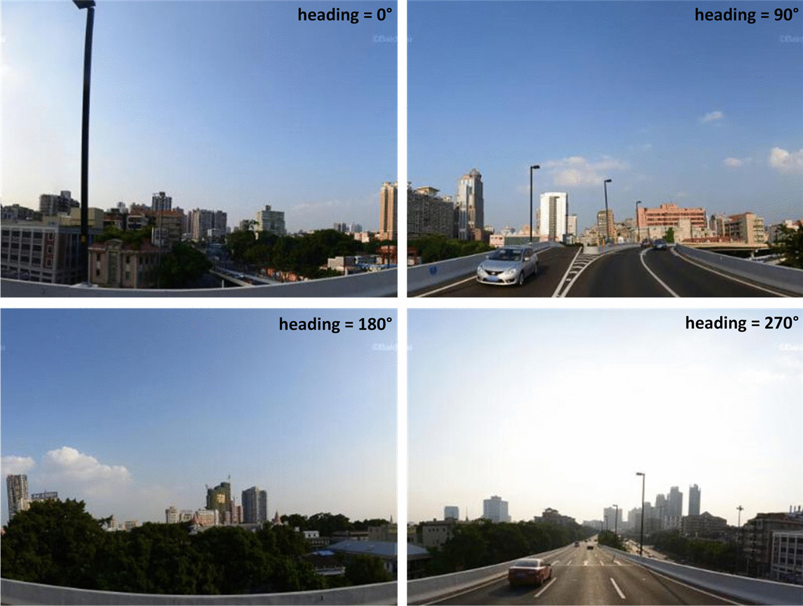
Background: Dengue fever (DF) is a mosquito-borne infectious disease that has threatened tropical and subtropical regions in recent decades. An early and targeted warning of a dengue epidemic is important for vector control. Current studies have primarily determined weather conditions to be the main factor for dengue forecasting, thereby neglecting that environmental suitability for mosquito breeding is also an important factor, especially in fine-grained intra-urban settings. Considering that street-view images are promising for depicting physical environments, this study proposes a framework for facilitating fine-grained intra-urban dengue forecasting by integrating the urban environments measured from street-view images.
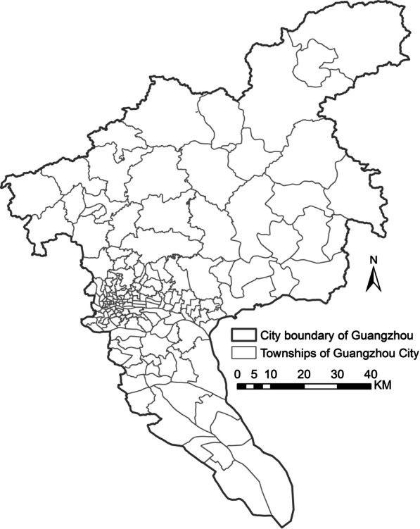
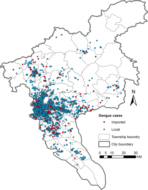
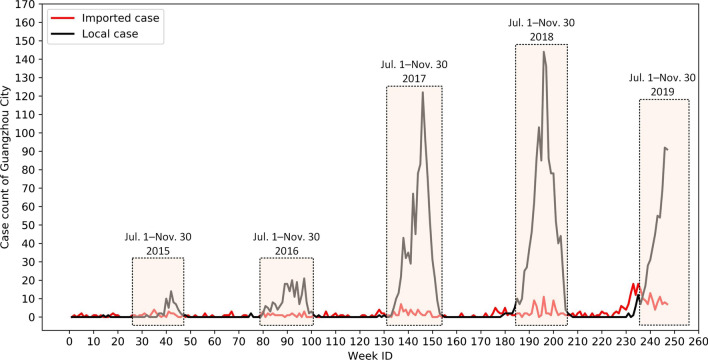
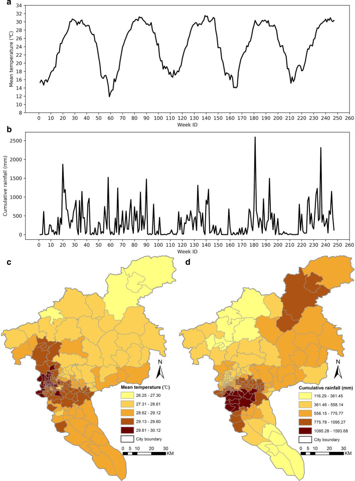
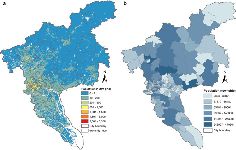
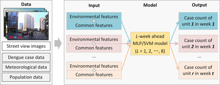
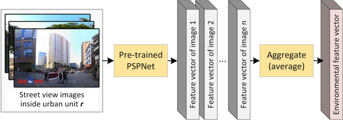
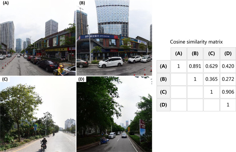
Methods: The dengue epidemic that occurred in 167 townships of Guangzhou City, China, between 2015 and 2019 was taken as a study case. First, feature vectors of street-view images acquired inside each township were extracted by a pre-trained convolutional neural network, and then aggregated as an environmental feature vector of the township. Thus, townships with similar physical settings would exhibit similar environmental features. Second, the environmental feature vector is combined with commonly used features (e.g., temperature, rainfall, and past case count) as inputs to machine-learning models for weekly dengue forecasting.
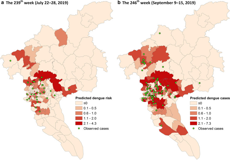
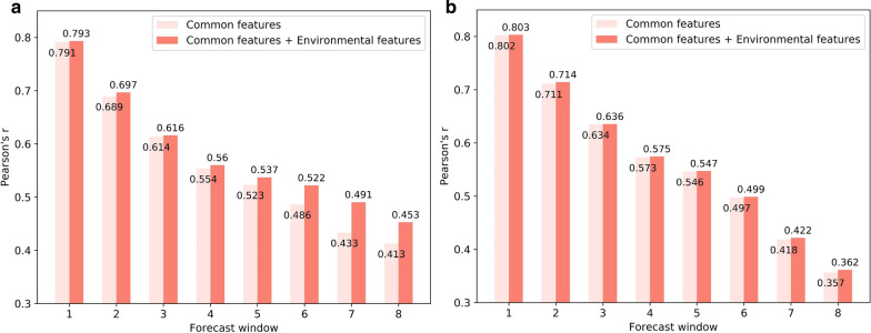
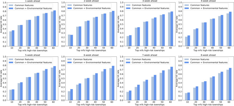
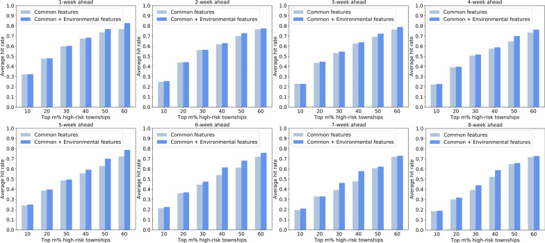
Results: The performance of machine-learning forecasting models (i.e., MLP and SVM) integrated with and without environmental features were compared. This indicates that models integrating environmental features can identify high-risk urban units across the city more precisely than those using common features alone. In addition, the top 30% of high-risk townships predicted by our proposed methods can capture approximately 50-60% of dengue cases across the city.
Conclusions: Incorporating local environments measured from street view images is effective in facilitating fine-grained intra-urban dengue forecasting, which is beneficial for conducting spatially precise dengue prevention and control.
Keywords: Dengue forecasting; Fine-grained; Intra-urban; Street-view image; Urban environment.
Conflict of interest statement
The authors declare no competing interests.
Figures
References
MeSH terms
Grants and funding
LinkOut - more resources
Full Text Sources
Other Literature Sources
Medical
Miscellaneous
