Satellite Observations and Malaria: New Opportunities for Research and Applications
- PMID: 33775559
- PMCID: PMC8122067
- DOI: 10.1016/j.pt.2021.03.003
Satellite Observations and Malaria: New Opportunities for Research and Applications
Abstract
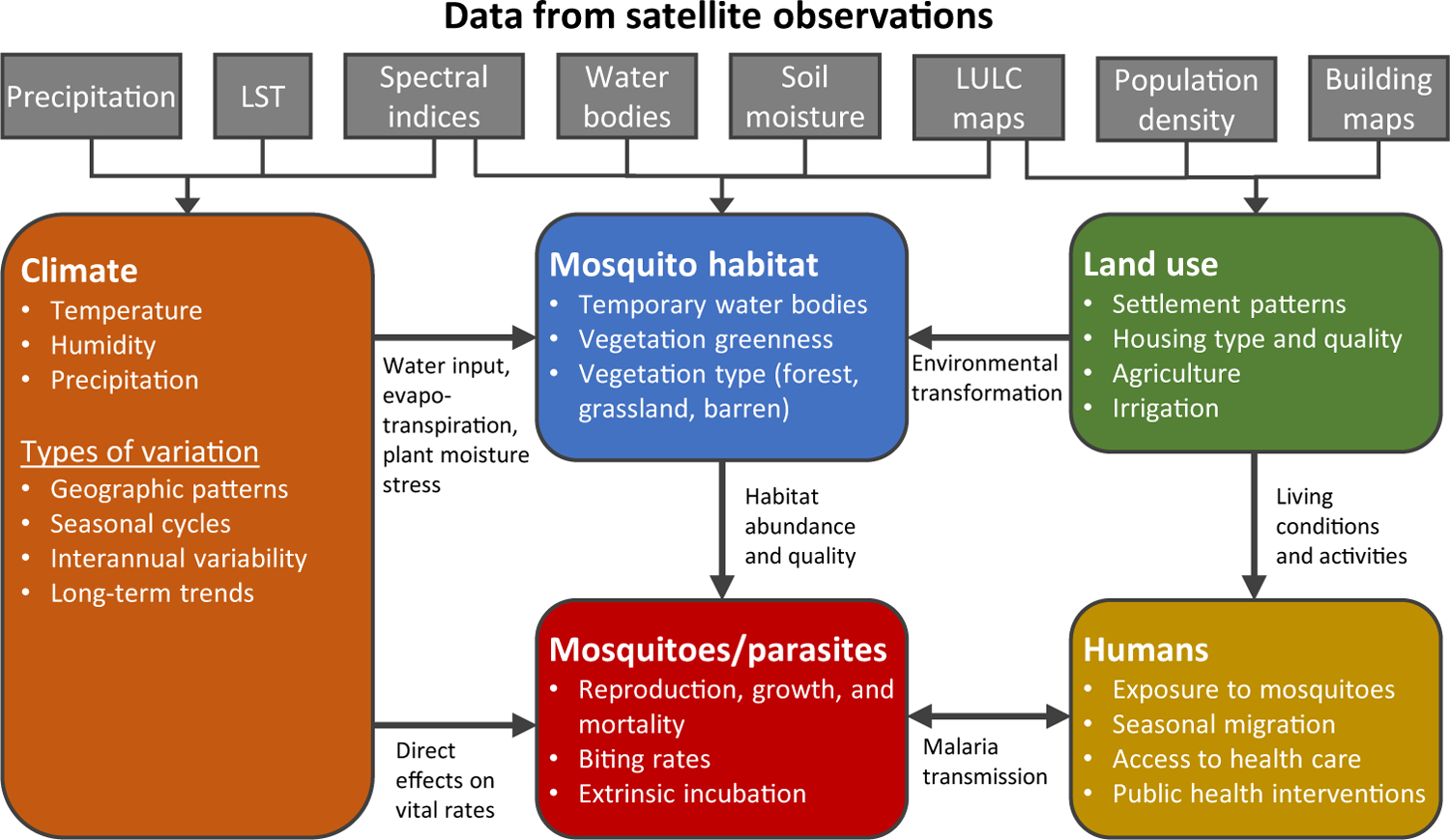
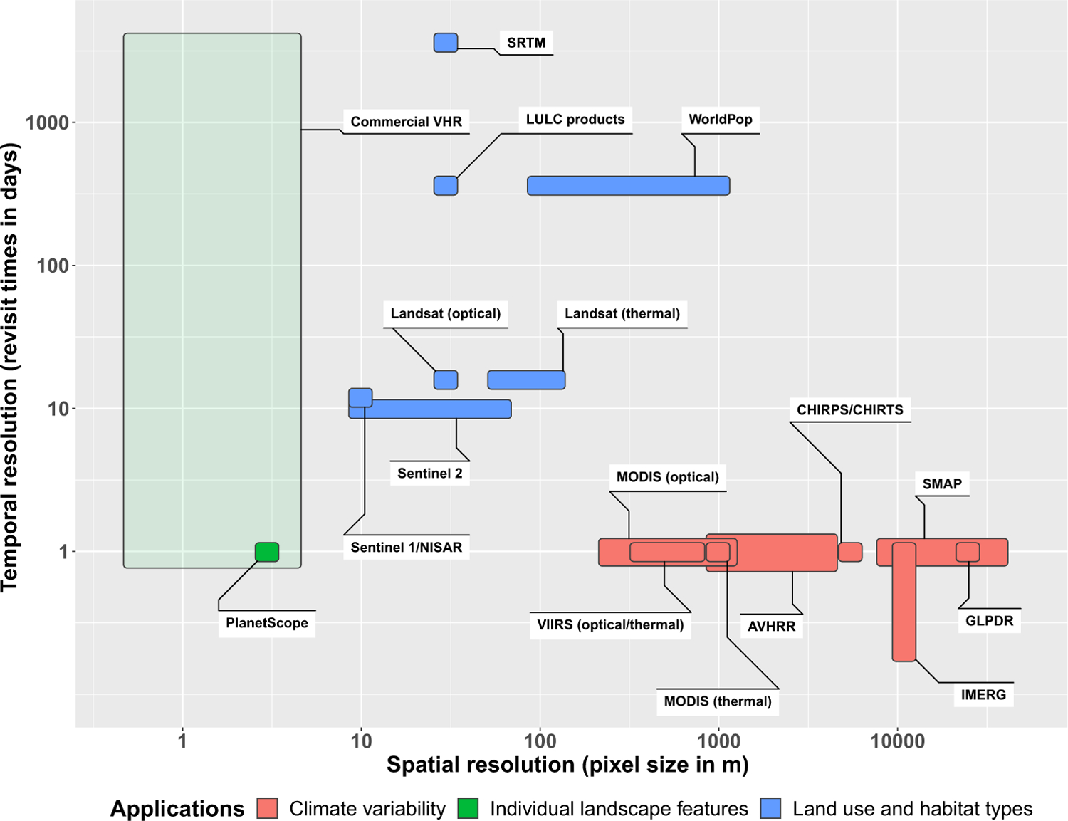
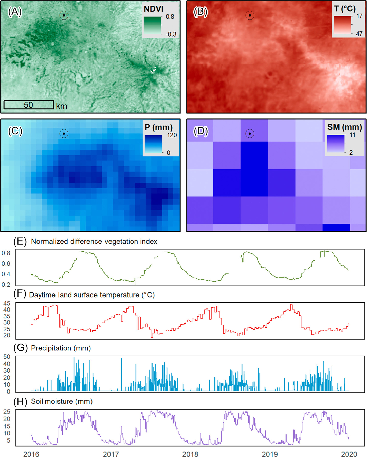
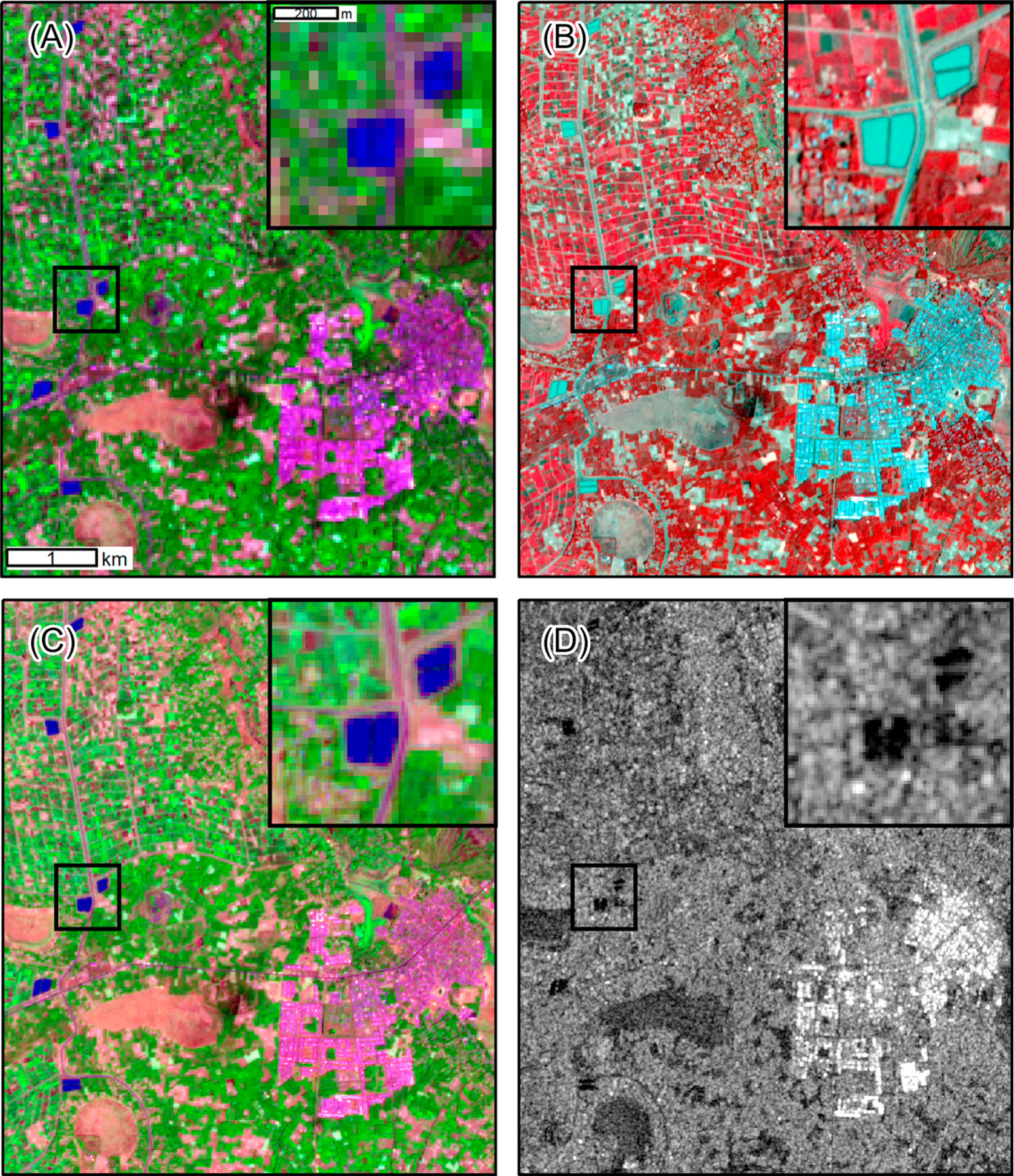
Satellite remote sensing provides a wealth of information about environmental factors that influence malaria transmission cycles and human populations at risk. Long-term observations facilitate analysis of climate-malaria relationships, and high-resolution data can be used to assess the effects of agriculture, urbanization, deforestation, and water management on malaria. New sources of very-high-resolution satellite imagery and synthetic aperture radar data will increase the precision and frequency of observations. Cloud computing platforms for remote sensing data combined with analysis-ready datasets and high-level data products have made satellite remote sensing more accessible to nonspecialists. Further collaboration between the malaria and remote sensing communities is needed to develop and implement useful geospatial data products that will support global efforts toward malaria control, elimination, and eradication.
Keywords: climate; land use and land cover; malaria; mosquito habitat; remote sensing; spatial decision support systems.
Copyright © 2021 The Author(s). Published by Elsevier Ltd.. All rights reserved.
Conflict of interest statement
Declaration of Interests The authors declare no competing interests.
Figures
References
-
- O’Meara WP et al. (2010) Changes in the burden of malaria in sub-Saharan Africa. Lancet Infect. Dis 10, 545–555 - PubMed
-
- World Health Organization (2019) World Malaria Report 2019, WHO
-
- Feachem RG et al. (2019) Malaria eradication within a generation: ambitious, achievable, and necessary. Lancet 394, 1056–1112 - PubMed
Publication types
MeSH terms
Grants and funding
LinkOut - more resources
Full Text Sources
Other Literature Sources
Medical