

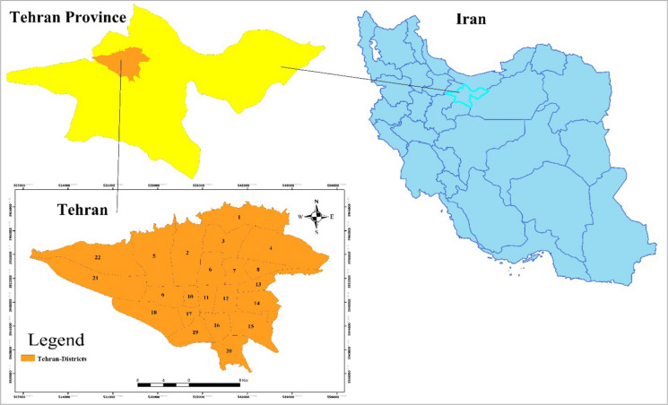
Spatio-temporal analysis of COVID-19 incidence rate using GIS: a case study-Tehran metropolitan, Iran
- PMID: 33994652
- PMCID: PMC8114020
- DOI: 10.1007/s10708-021-10438-x
Spatio-temporal analysis of COVID-19 incidence rate using GIS: a case study-Tehran metropolitan, Iran
Abstract
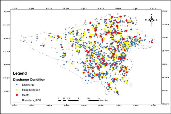
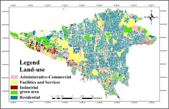
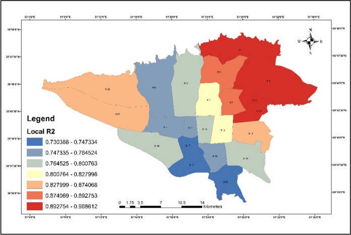
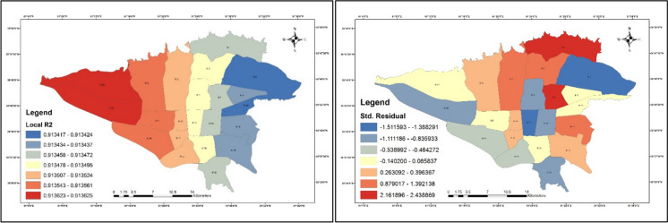
COVID-19 has been distinguished as a zoonotic coronavirus, like SARS coronavirus and MERS coronavirus. Tehran metropolis, as the capital of Iran, has a high density of residents that experienced a high incidence and mortality rates which daily increase the number of death and cases. In this study, the IDW (Inverse Distance Weight), Hotspots, and GWR (Geography Weighted Regression) Model are used as methods for analyzing big data COVID-19 in Tehran. The results showed that the majority of patients and deaths were men, but the death rate was higher in women than in men; also was observed a direct relationship between the area of the houses, and the infected rate, to COVID-19. Also, the results showed a disproportionate distribution of patients in Tehran, although in the eastern regions the number of infected people is higher than in other districts; the eastern areas have a high population density as well as residential land use, and there is a high relationship between population density in residential districts and administrative-commercial and the number of COVID-19 cases in all regions. The outputs of local R2 were interesting among patients and underlying disorders; the local R2 between hypertension and neurological diseases was 0.91 and 0.79, respectively, which was higher than other disorders. The highest rates of local R2 for diabetes and heart disease were 0.67 and 0.55, respectively. From this study, it can be concluded the restrictions must be considered especially, in areas densely populated for all people.
Keywords: COVID-19; Chronic diseases; GWR model; Land-use; Tehran.
© The Author(s), under exclusive licence to Springer Nature B.V. 2021.
Figures


References
-
- Ahmadi M, Baaghide M, Roudbari AD, Asadi M. Modeling the role of topography on the potential of tourism climate in Iran. Modeling Earth Systems and Environment. 2018;4(1):13–25. doi: 10.1007/s40808-018-0423-3. - DOI
-
- Ahmadi M, Kashki A, Roudbari AD. Spatial modeling of seasonal precipitation elevation in Iran based on aphrodite database. Modeling Earth Systems and Environment. 2018;4(2):619–633. doi: 10.1007/s40808-018-0444-y. - DOI
-
- Alibakhshi Z, Ahmadi M, Asl MF. Modeling biophysical variables and land surface temperature using the GWR model: case study—Tehran and its satellite cities. Journal of the Indian Society of Remote Sensing. 2020;48(1):59–70. doi: 10.1007/s12524-019-01062-x. - DOI
LinkOut - more resources
Full Text Sources
Other Literature Sources
Miscellaneous