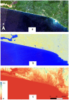
Testing the Contribution of Multi-Source Remote Sensing Features for Random Forest Classification of the Greater Amanzule Tropical Peatland
- PMID: 34068200
- PMCID: PMC8153014
- DOI: 10.3390/s21103399
Testing the Contribution of Multi-Source Remote Sensing Features for Random Forest Classification of the Greater Amanzule Tropical Peatland
Abstract
Tropical peatlands such as Ghana's Greater Amanzule peatland are highly valuable ecosystems and under great pressure from anthropogenic land use activities. Accurate measurement of their occurrence and extent is required to facilitate sustainable management. A key challenge, however, is the high cloud cover in the tropics that limits optical remote sensing data acquisition. In this work we combine optical imagery with radar and elevation data to optimise land cover classification for the Greater Amanzule tropical peatland. Sentinel-2, Sentinel-1 and Shuttle Radar Topography Mission (SRTM) imagery were acquired and integrated to drive a machine learning land cover classification using a random forest classifier. Recursive feature elimination was used to optimize high-dimensional and correlated feature space and determine the optimal features for the classification. Six datasets were compared, comprising different combinations of optical, radar and elevation features. Results showed that the best overall accuracy (OA) was found for the integrated Sentinel-2, Sentinel-1 and SRTM dataset (S2+S1+DEM), significantly outperforming all the other classifications with an OA of 94%. Assessment of the sensitivity of land cover classes to image features indicated that elevation and the original Sentinel-1 bands contributed the most to separating tropical peatlands from other land cover types. The integration of more features and the removal of redundant features systematically increased classification accuracy. We estimate Ghana's Greater Amanzule peatland covers 60,187 ha. Our proposed methodological framework contributes a robust workflow for accurate and detailed landscape-scale monitoring of tropical peatlands, while our findings provide timely information critical for the sustainable management of the Greater Amanzule peatland.
Keywords: Google Earth Engine; Sentinel; classification; feature selection; random forest; tropical peatland.
Conflict of interest statement
The authors declare no conflict of interest.
Figures


References
-
- Posa M.R.C., Wijedasa L.S., Corlett R.T. Biodiversity and conservation of tropical peat swamp forests. Bioscience. 2011;61:49–57. doi: 10.1525/bio.2011.61.1.10. - DOI
-
- FAO . Peatland Mapping and Monitoring—Recommendations and Technical Overview. FAO; Rome, Italy: 2020.
-
- Paulson Institute . Report on Coastal Wetland Conservation Blueprint Project in China, Main Findings and Recommendations. Paulson Institute; Beijing, China: 2015.
-
- Carless D., Luscombe D.J., Gatis N., Anderson K., Brazier R.E. Mapping landscape-scale peatland degradation using airborne lidar and multispectral data. Landsc. Ecol. 2019;34:1329–1345. doi: 10.1007/s10980-019-00844-5. - DOI
-
- Murdiyarso D., Lilleskov E., Kolka R. Tropical peatlands under siege: The need for evidence-based policies and strategies. Mitig. Adapt. Strateg. Glob. Chang. 2019;24:493–505. doi: 10.1007/s11027-019-9844-1. - DOI
Grants and funding
LinkOut - more resources
Full Text Sources

