

Measures of Spatial Accessibility to Healthcare in a GIS Environment: Synthesis and a Case Study in Chicago Region
- PMID: 34188345
- PMCID: PMC8238135
- DOI: 10.1068/b29120
Measures of Spatial Accessibility to Healthcare in a GIS Environment: Synthesis and a Case Study in Chicago Region
Abstract
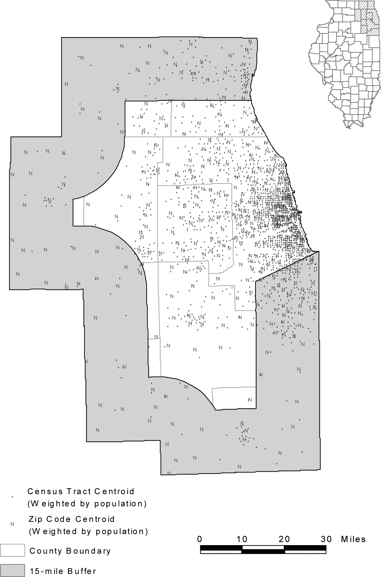
This article synthesizes two GIS-based accessibility measures into one framework, and applies the methods to examining spatial accessibility to primary healthcare in the Chicago 10-county region. The floating catchment area method defines the service area of physicians by a threshold travel time while accounting for the availability of physicians by their surrounded demands. The gravity-based method considers a nearby physician more accessible than a remote one and discounts a physician's availability by a gravity-based potential. The former is a special case of the latter. Based on the 2000 Census and primary care physician data, this research assesses the variation of spatial accessibility to primary care in the Chicago region, and analyzes the sensitivity of results by experimenting with ranges of threshold travel times in the floating catchment area method and travel friction coefficients in the gravity model. The methods may be used to help the U.S. Department of Health and Human Services and state Health Departments improve health professional shortage areas designation.
Keywords: GIS; accessibility measures; gravity model; healthcare access; physician shortage areas; two-step floating catchment area method.
Figures


References
-
- Bailey TC and Gatrell AC, 1995, Interactive Spatial Data Analysis, Harlow, England: Longman Scientific & Technical.
-
- Bureau of Transportation Statistics (BTS), U.S. Department of Transportation. 1997. Transportation Statistics Annual Report 1997. BTS97-S-01. Washington, DC.
-
- Cooper RA, 1994, Seeking a balanced physician work-force for the 21st century, Journal of the American Medical Association 272, 680–687. - PubMed
-
- Cromley EK and McLafferty S, 2002, GIS and Public Health, New York: Guilford Press.
-
- Council on Graduate Medical Education (COGME) Resource Paper Compendium, 2000, Update on the Physician Workforce, Washington, D.C.: U.S. Department of Health and Human Services, Health Resources and Services Administration.
Grants and funding
LinkOut - more resources
Full Text Sources