

doi: 10.1136/bmjgh-2021-006381.
Defining service catchment areas in low-resource settings
Affiliations
- PMID: 34301676
- PMCID: PMC8728360
- DOI: 10.1136/bmjgh-2021-006381
Item in Clipboard
Defining service catchment areas in low-resource settings
BMJ Glob Health.
2021 Jul.
No abstract available
Keywords: epidemiology; health policy; health services research; health systems; indices of health and disease and standardisation of rates.
Conflict of interest statement
Competing interests: None declared.
Figures
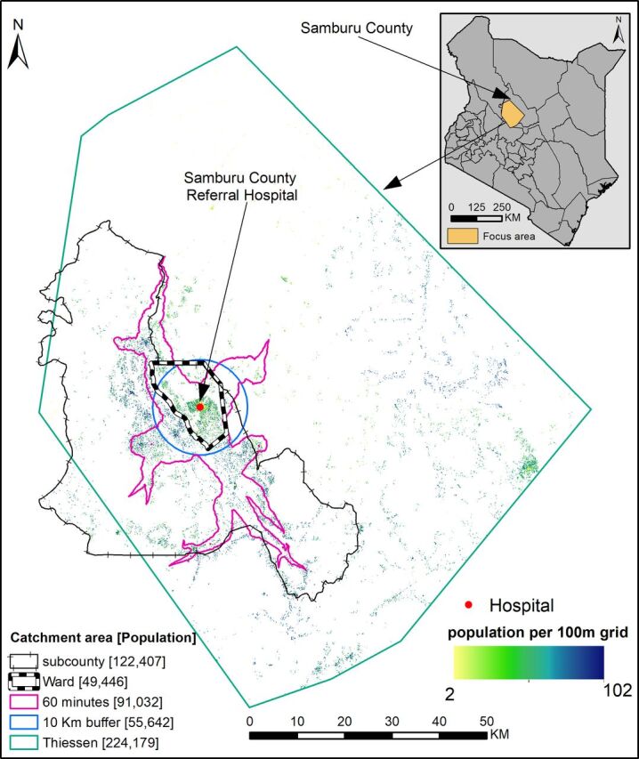
An illustration of several approaches used to define service catchment area, administrative unit (ward or subcounty), straight-line distance (10 km buffer and Thiessen polygon) and travel time (area within 60 min of a hospital). Illustration is based on 622 COVID-19 vaccination posts (https://medical.unon.org/node/169 ) approved in Kenya. If vaccine allocation was based on one of these catchment areas, there would be mismatches between those who attend a facility and the estimated population denominator in 2021 across methods due to lack of geolocated residential data of care seekers at a particular post. The top right corner shows the illustrated region within Samburu County, Kenya.
References
Publication types
MeSH terms
Grants and funding
LinkOut - more resources
Full Text Sources