

Evaluation of the Apple iPhone 12 Pro LiDAR for an Application in Geosciences
- PMID: 34782692
- PMCID: PMC8593014
- DOI: 10.1038/s41598-021-01763-9
Evaluation of the Apple iPhone 12 Pro LiDAR for an Application in Geosciences
Abstract
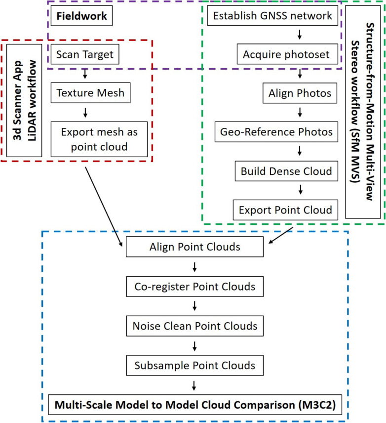
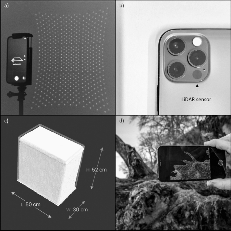
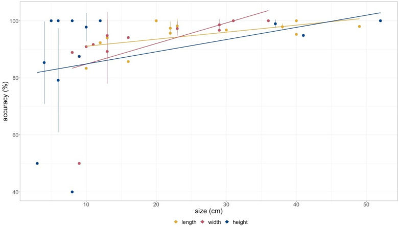
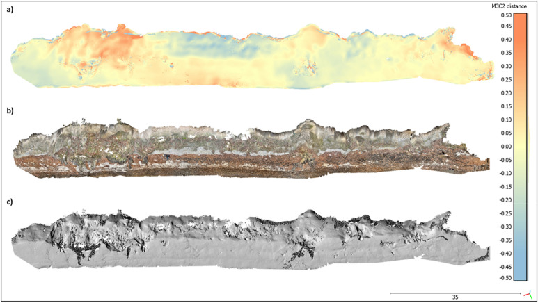
Traditionally, topographic surveying in earth sciences requires high financial investments, elaborate logistics, complicated training of staff and extensive data processing. Recently, off-the-shelf drones with optical sensors already reduced the costs for obtaining a high-resolution dataset of an Earth surface considerably. Nevertheless, costs and complexity associated with topographic surveying are still high. In 2020, Apple Inc. released the iPad Pro 2020 and the iPhone 12 Pro with novel build-in LiDAR sensors. Here we investigate the basic technical capabilities of the LiDAR sensors and we test the application at a coastal cliff in Denmark. The results are compared to state-of-the-art Structure from Motion Multi-View Stereo (SfM MVS) point clouds. The LiDAR sensors create accurate high-resolution models of small objects with a side length > 10 cm with an absolute accuracy of ± 1 cm. 3D models with the dimensions of up to 130 × 15 × 10 m of a coastal cliff with an absolute accuracy of ± 10 cm are compiled. Overall, the versatility in handling outweighs the range limitations, making the Apple LiDAR devices cost-effective alternatives to established techniques in remote sensing with possible fields of application for a wide range of geo-scientific areas and teaching.
© 2021. The Author(s).
Conflict of interest statement
The authors declare no competing interests.
Figures
References
-
- Jaboyedoff M, et al. Use of LIDAR in landslide investigations: A review. Nat. Hazards. 2010;61:5–28. doi: 10.1007/s11069-010-9634-2. - DOI
-
- Telling J, Lyda A, Hartzell P, Glennie C. Review of Earth science research using terrestrial laser scanning. Earth Sci. Rev. 2017;169:35–68. doi: 10.1016/j.earscirev.2017.04.007. - DOI
-
- Young AP, et al. Comparison of airborne and terrestrial lidar estimates of seacliff erosion in Southern California. Photogramm. Eng. Remote Sens. 2010;76:421–427. doi: 10.14358/Pers.76.4.421. - DOI
-
- Lohani B, Ghosh S. Airborne LiDAR technology: A review of data collection and processing systems. Proc. Natl. Acad. Sci. India A. 2017;87:567–579. doi: 10.1007/s40010-017-0435-9. - DOI
-
- Meigs A. Active tectonics and the LiDAR revolution. Lithosphere. 2013;5:226–229. doi: 10.1130/Rf.L004.1. - DOI
Publication types
Associated data
Grants and funding
LinkOut - more resources
Full Text Sources
