

The geography of sobriety checkpoints and alcohol-impaired driving
- PMID: 34859520
- PMCID: PMC9596227
- DOI: 10.1111/add.15766
The geography of sobriety checkpoints and alcohol-impaired driving
Abstract
Background and aims: Sobriety checkpoints are an effective strategy to reduce alcohol-impaired driving, motor vehicle crashes, injuries and fatalities. The aim of this study was to identify the geographic extent over which individual sobriety checkpoints affect alcohol-impaired driving.
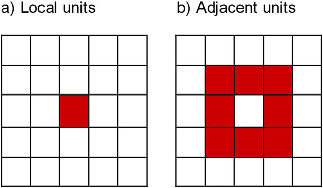
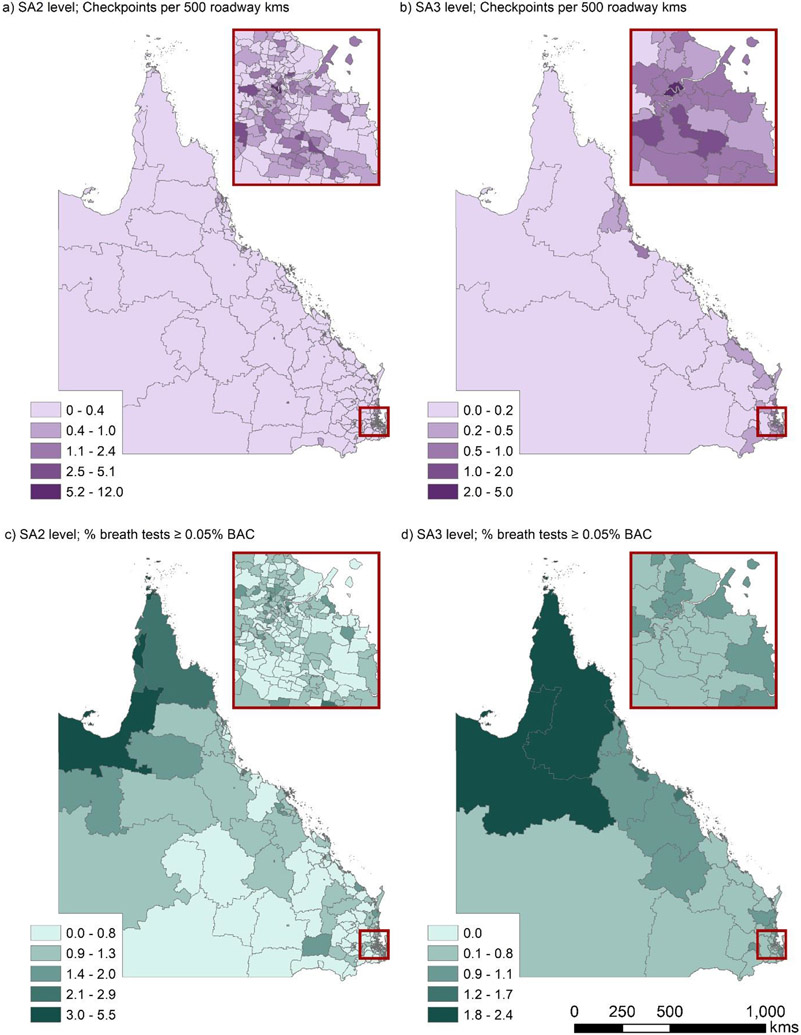
Design, setting, participants: Spatial ecological panel analysis using geolocated breath test data from the Queensland Police Service, Australia, for January 2012 to June 2018. Data were aggregated over 338 weeks within 528 Statistical Area level 2 (SA2) units (n = 178 464 SA2-weeks) and 84 Statistical Area level 3 (SA3) units (n = 28 392 SA3-weeks). SA2 units in Queensland contain a mean population of 8883.5 (SD = 55 018.3) and encompass 468.9 roadway kilometers (SD = 1490.0); SA3 units contain a mean population of 57 201.6 (SD = 29521.6) and encompass 2936.0 roadway kilometers (SD = 7025.0).
Measurements: Independent measures were the density of sobriety checkpoints conducted per 500 roadway kilometers within local and spatially adjacent space-time units. The dependent measure was the rate of tests that detected breath alcohol concentration (a proxy for blood alcohol concentration [BAC]) greater than the legal maximum value of 0.05% for fully licensed drivers in Queensland. Bayesian hierarchical spatial negative binomial models-related sobriety checkpoints to the rate of breath tests with BAC ≥ 0.05% within and between space-time units.
Findings: One additional sobriety checkpoint conducted per 500 roadway kilometers was associated with 2.5% reduction in the rate of breath tests with BAC ≥ 0.05% within local SA2 units (incidence rate ratio [IRR] = 0.975; 95% credibility interval (CrI): 0.973-0.978), and with 5.5% reduction in the rate of breath tests with BAC ≥ 0.05% within local SA3 units (IRR = 0.945; 95%CrI: 0.937-0.953). Associations were attenuated towards null in spatially adjacent units and in temporally lagged units (e.g. SA3-weeks; adjacent lagged 1 week: IRR = 0.969; 95%CrI: 0.937-1.003).
Conclusions: Individual sobriety checkpoints appear to be associated with reductions in nearby alcohol-impaired driving. Relationships decay after approximately 1 week and beyond local areas containing approximately 60 000 residents and 3000 kilometers of roadway.
Keywords: alcohol; checkpoint; crash; drunk driving; motor vehicle; sobriety.
© 2021 Society for the Study of Addiction.
Conflict of interest statement
Figures
References
-
- WHO. Global status report on road safety 2018. Licence: CC BY-NC-SA 3.0 IGO. Geneva; 2018.
-
- Global Burden of Disease Collaborators 2017. Global, regional, and national incidence, prevalence, and years lived with disability for 354 diseases and injuries for 195 countries and territories, 1990-2017: a systematic analysis for the Global Burden of Disease Study 2017. Lancet. 2018;392(10159):1789–858. - PMC - PubMed
-
- Chen S, Kuhn M, Prettner K, Bloom DE. The global macroeconomic burden of road injuries: estimates and projections for 166 countries. The Lancet Planetary Health. 2019;3(9):e390–e8. - PubMed
-
- GRSP. Drinking and Driving: a road safety manual for decision-makers and practitioners. Geneva; 2007.
-
- NHTSA. 2018 Fatal Motor Vehicle Crashes: Overview DOT HS 812 826. In: US Department of Transportation NHTSA, editor. Washington, DC: 2019.
Publication types
MeSH terms
Substances
Grants and funding
LinkOut - more resources
Full Text Sources
Medical
