

Deep learning-based landslide susceptibility mapping
- PMID: 34916586
- PMCID: PMC8677740
- DOI: 10.1038/s41598-021-03585-1
Deep learning-based landslide susceptibility mapping
Abstract
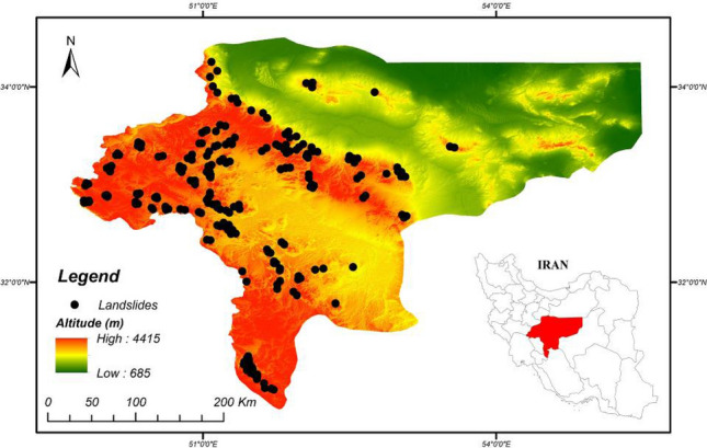
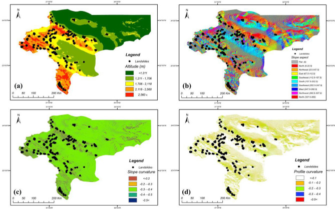
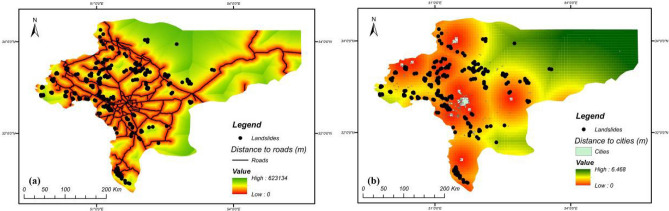
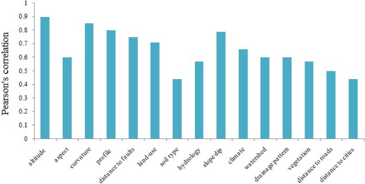
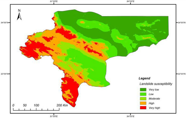
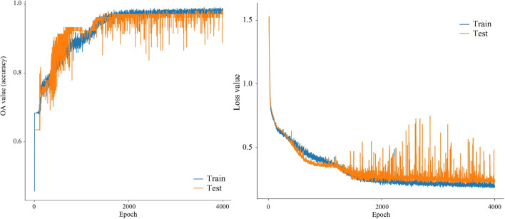
Landslides are considered as one of the most devastating natural hazards in Iran, causing extensive damage and loss of life. Landslide susceptibility maps for landslide prone areas can be used to plan for and mitigate the consequences of catastrophic landsliding events. Here, we developed a deep convolutional neural network (CNN-DNN) for mapping landslide susceptibility, and evaluated it on the Isfahan province, Iran, which has not previously been assessed on such a scale. The proposed model was trained and validated using training (80%) and testing (20%) datasets, each containing relevant data on historical landslides, field records and remote sensing images, and a range of geomorphological, geological, environmental and human activity factors as covariates. The CNN-DNN model prediction accuracy was tested using a wide range of statistics from the confusion matrix and error indices from the receiver operating characteristic (ROC) curve. The CNN-DNN model was evaluated comprehensively by comparing it to several state-of-the-art benchmark machine learning techniques including the support vector machine (SVM), logistic regression (LR), Gaussian naïve Bayes (GNB), multilayer perceptron (MLP), Bernoulli Naïve Bayes (BNB) and decision tree (DT) classifiers. The CNN-DNN model for landslide susceptibility mapping was found to predict more accurately than the benchmark algorithms, with an AUC = 90.9%, IRs = 84.8%, MSE = 0.17, RMSE = 0.40, and MAPE = 0.42. The map provided by the CNN-DNN clearly revealed a high-susceptibility area in the west and southwest, related to the main Zagros trend in the province. These findings can be of great utility for landslide risk management and land use planning in the Isfahan province.
© 2021. The Author(s).
Conflict of interest statement
The authors declare no competing interests.
Figures


References
-
- Colesanti C, Wasowski J. Investigating landslides with space-borne Synthetic Aperture Radar (SAR) interferometry. Eng. Geol. 2006;88:173–199. doi: 10.1016/j.enggeo.2006.09.013. - DOI
-
- Highland L, Bobrowsky PT. The Landslide Handbook: A Guide to Understanding Landslides. US Geological Survey Reston; 2008.
-
- Chen Z, et al. Landslide research in China. Q. J. Eng. Geol. Hydrogeol. 2016;49:279–285. doi: 10.1144/qjegh2016-100. - DOI
-
- Tang H, Wasowski J, Juang CH. Geohazards in the three Gorges Reservoir Area, China-Lessons learned from decades of research. Eng. Geol. 2019;261:105267. doi: 10.1016/j.enggeo.2019.105267. - DOI
-
- Wasowski J, et al. Recurrent rock avalanches progressively dismantle a mountain ridge in Beichuan County, Sichuan, most recently in the 2008 Wenchuan earthquake. Geomorphology. 2021;374:107492. doi: 10.1016/j.geomorph.2020.107492. - DOI
LinkOut - more resources
Full Text Sources
