

Drivers and extent of surface water occurrence in the Selenga River Delta, Russia
- PMID: 35529522
- PMCID: PMC9067400
- DOI: 10.1016/j.ejrh.2021.100945
Drivers and extent of surface water occurrence in the Selenga River Delta, Russia
Abstract
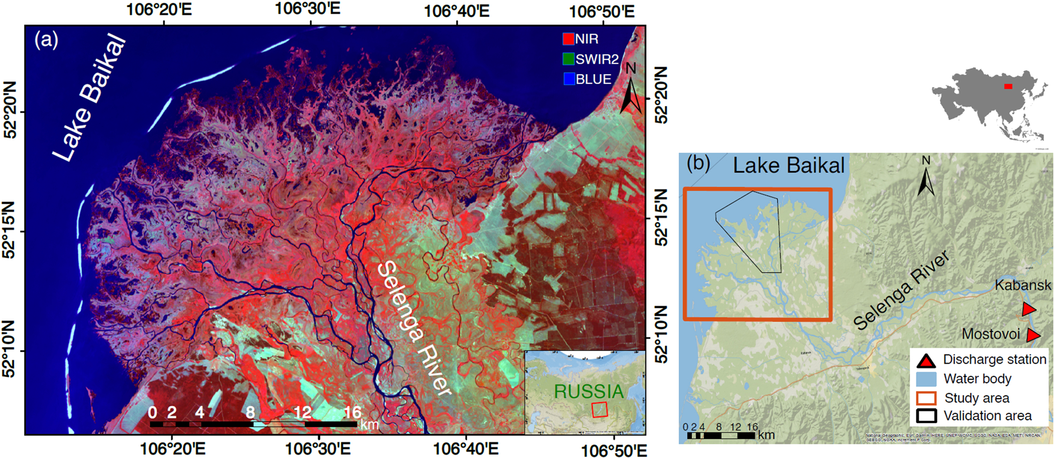
Study region: Selenga River Delta (SRD), Russia.
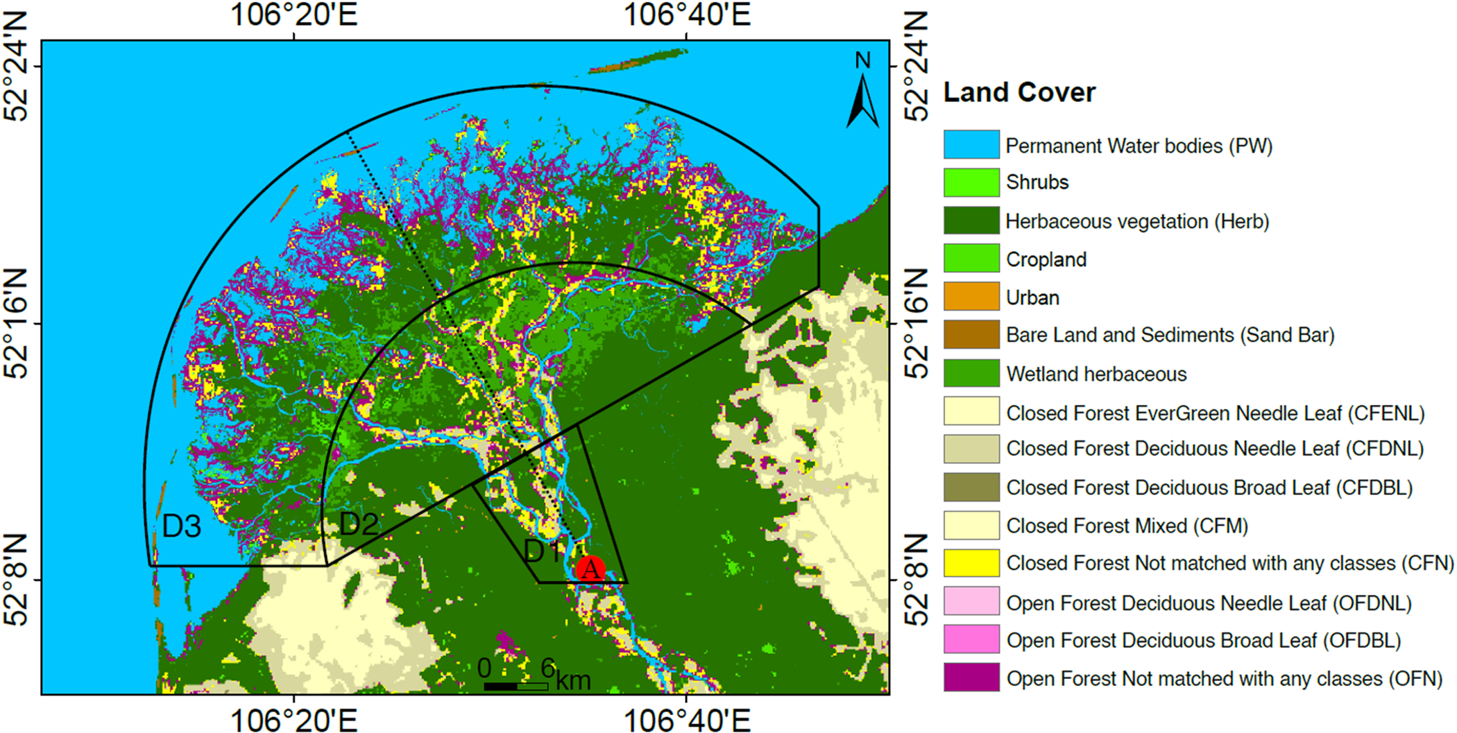
Study focus: How is water occurrence changing in the SRD, and what are the hydroclimatic drivers behind these changes? The presence of water on the surface in river deltas is governed by land use, geomorphology, and the flux of water to and from the Delta. We trained an accurate image classification of the Landsat satellite imagery during the last 33 years to quantify surface water occurrence and its changes in the SRD. After comparing our estimations with global-scale datasets, we determined the hydrological drivers of these changes.
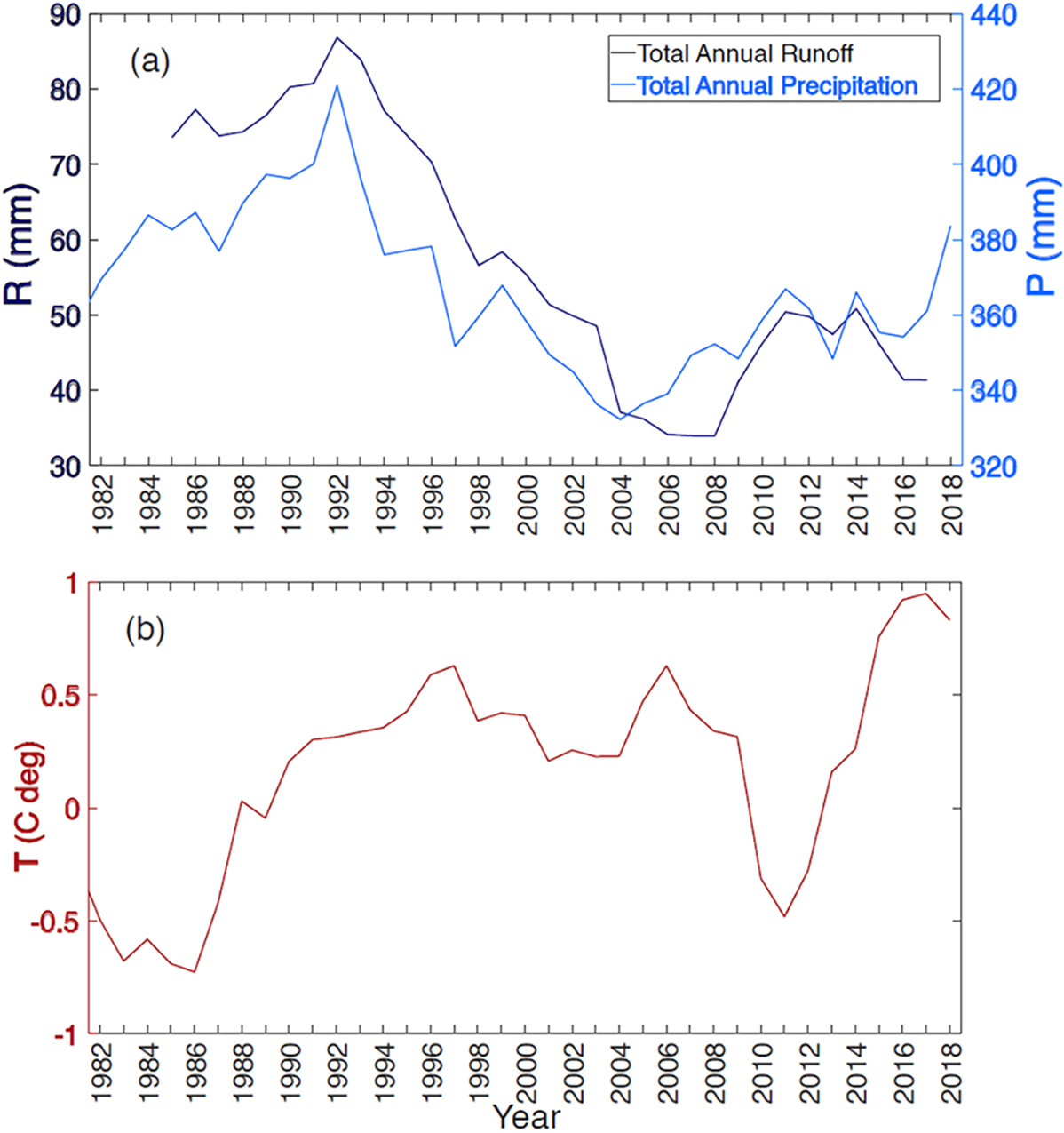
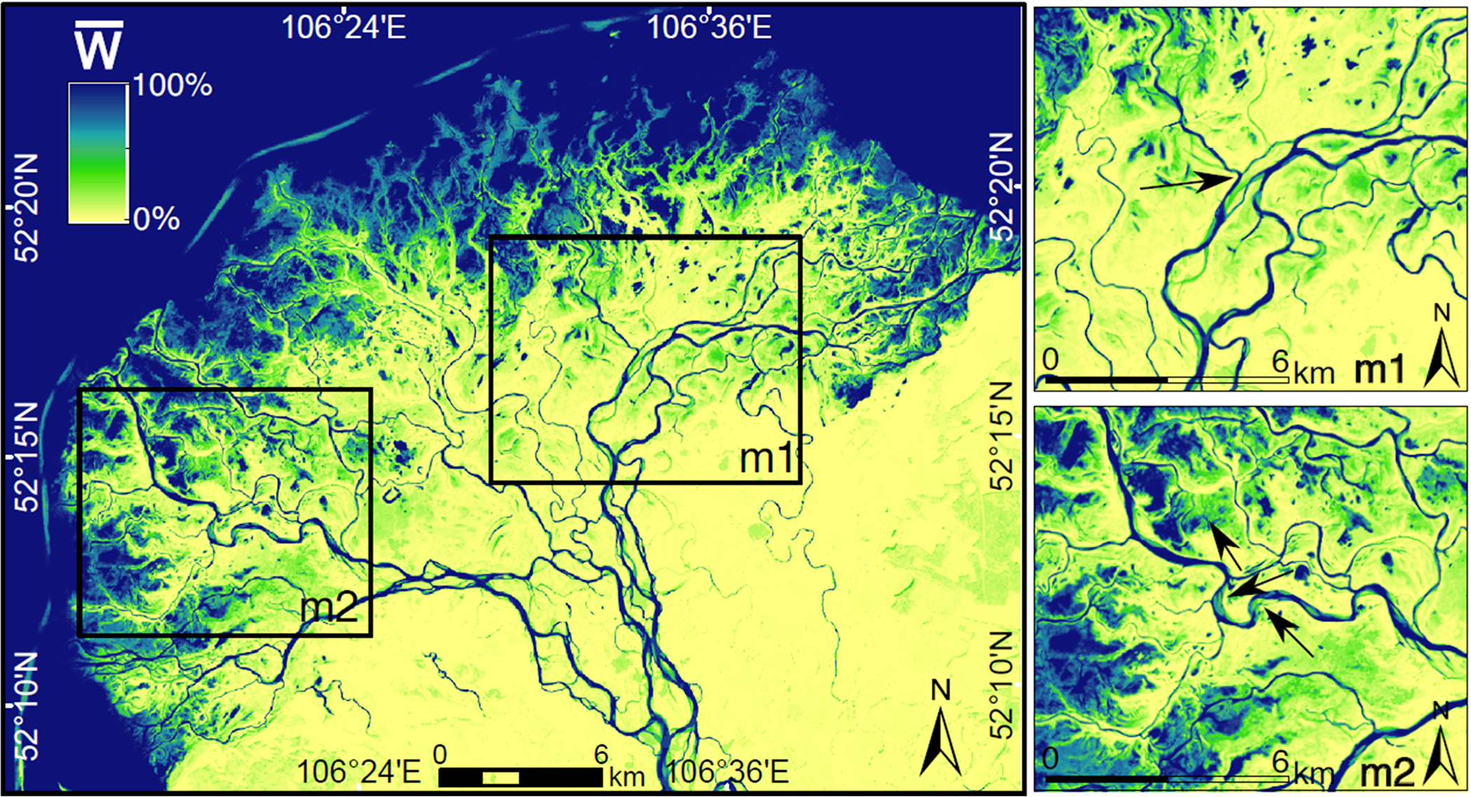
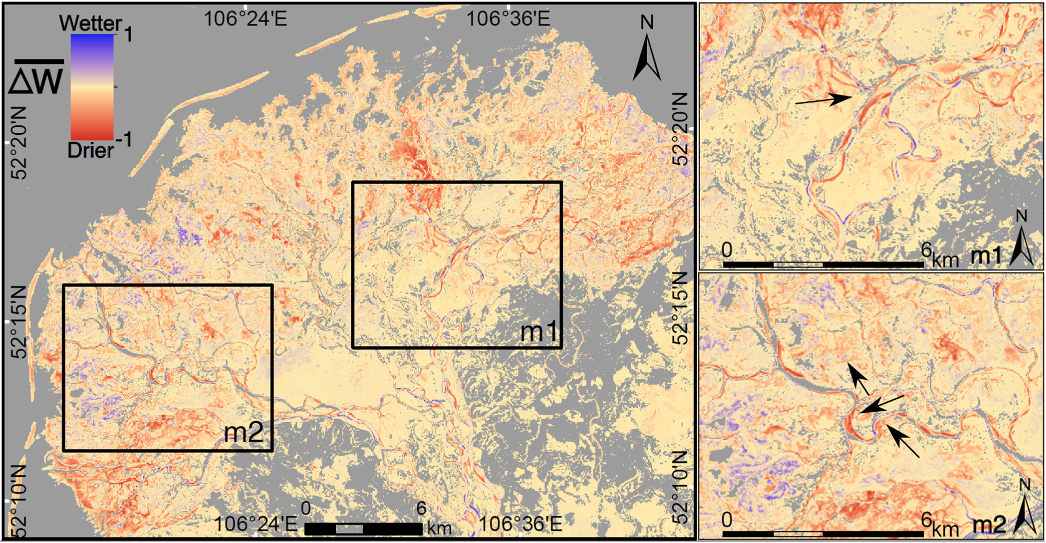
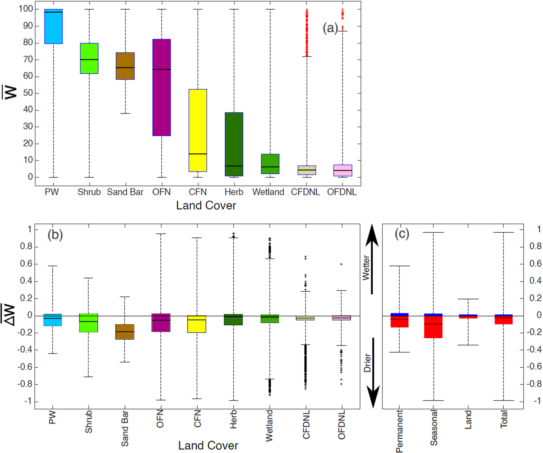
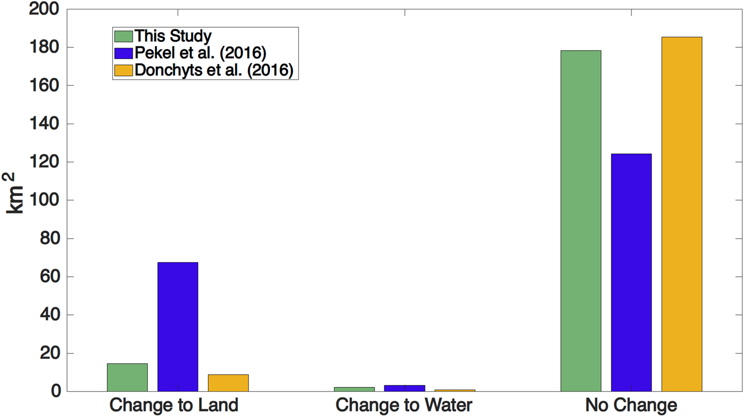
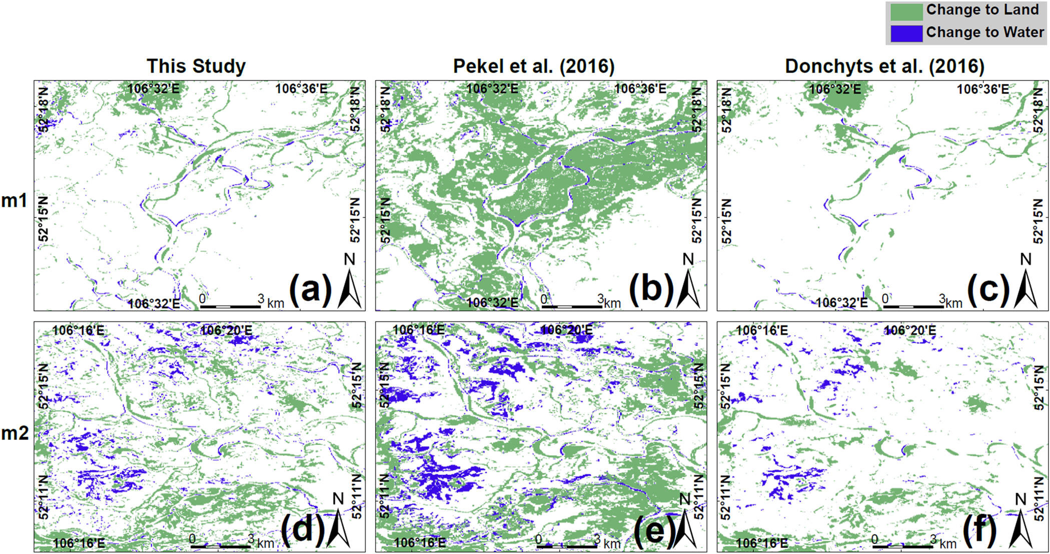
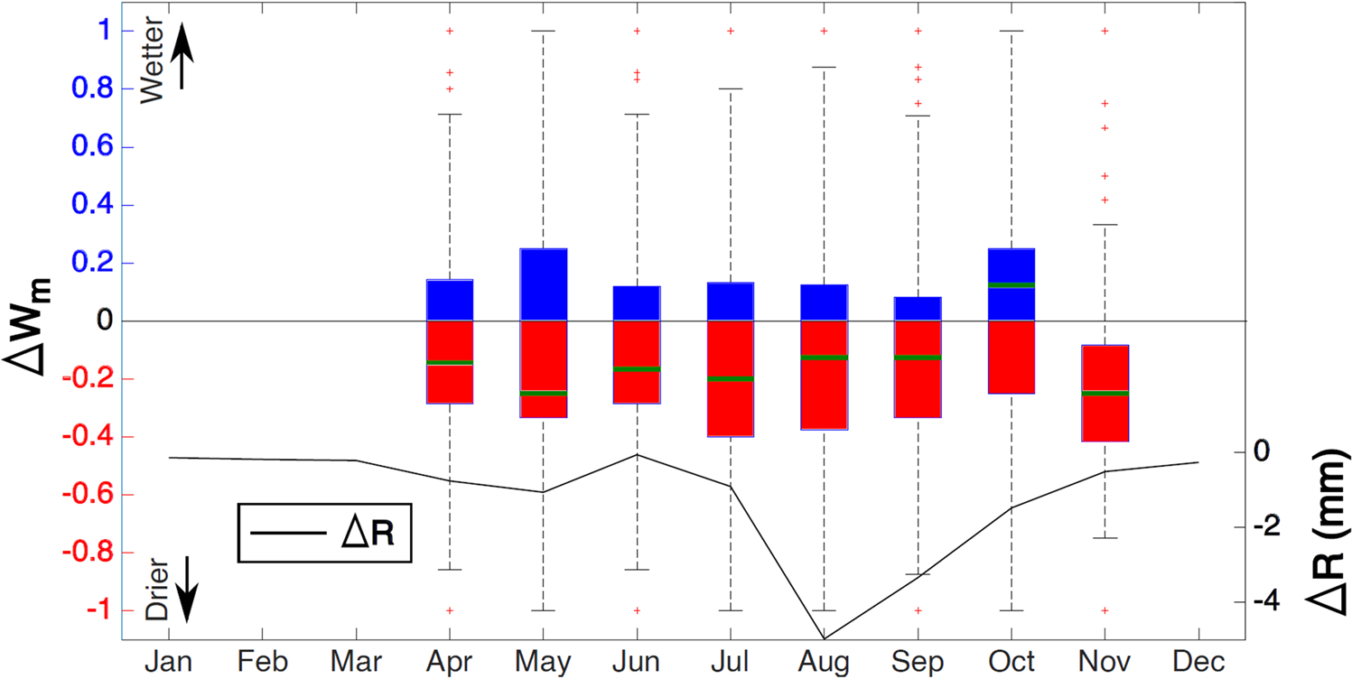
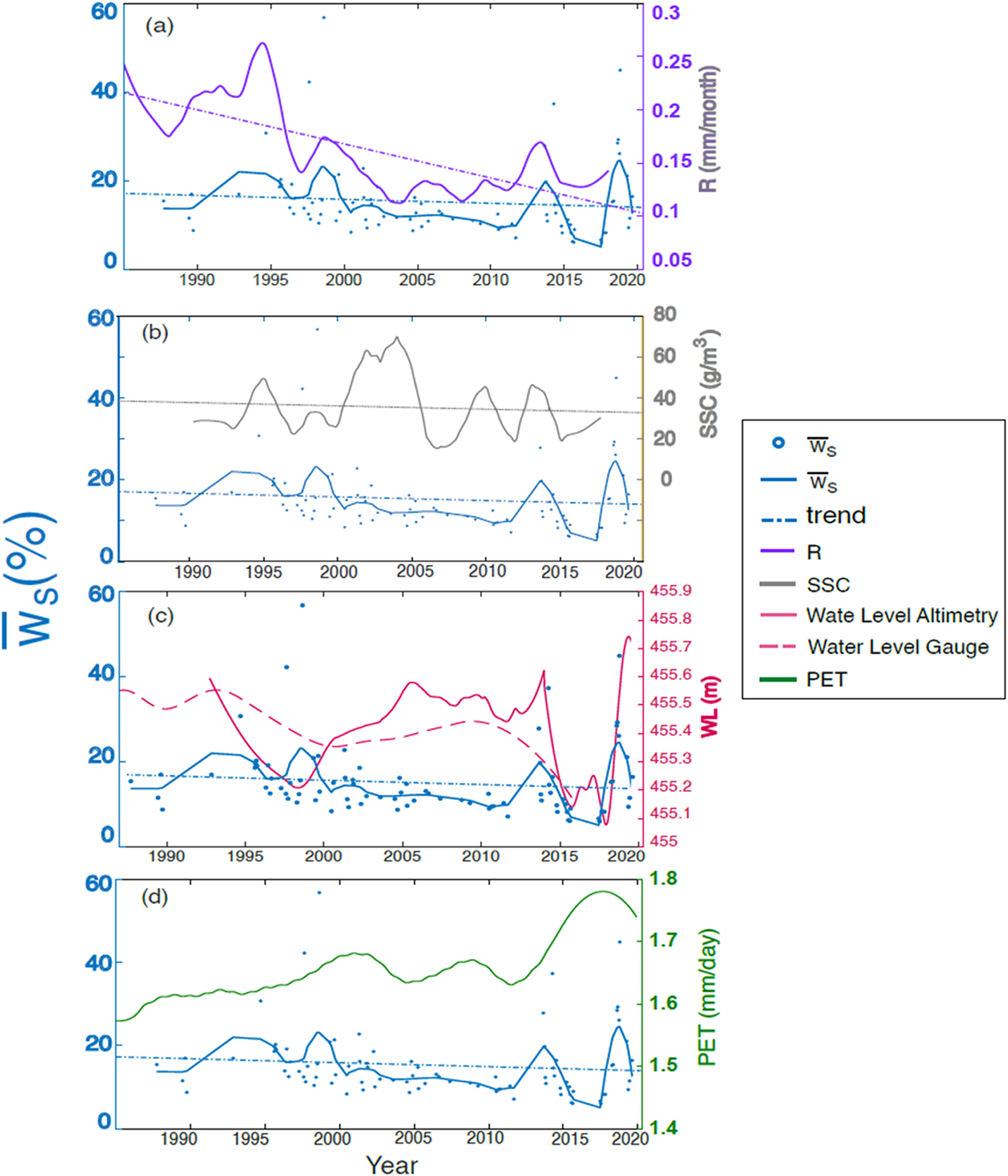
New hydrological insights for the region: We find mild decreases in water occurrence in 51% of the SRD's surface area from 1987-2002 to 2003-2020. Water occurrence in the most affected areas decreased by 20% and in the most water-gaining areas increased by 10%. We find a significant relationship between water occurrence and runoff (R2 = 0.56) that does not exist between water occurrence and suspended sediment concentration (SSC), Lake Baikal's water level, and potential evapotranspiration. The time series of water occurrence follows the peaks in the runoff but not its long-term trend. However, the extremes in SSC do not influence surface water occurrence (R2 < 0.1), although their long-term trends are similar. Contrary to expected, we find that the Delta has a relatively stable long-term water availability for the time being.
Keywords: Selenga River Delta; Supervised classification; Surface water occurrence.
Conflict of interest statement
Declaration of Competing Interest The authors declare that they have no known competing financial interests or personal relationships that could have appeared to influence the work reported in this paper.
Figures
Similar articles
-
Earthquake, floods and changing land use history: A 200-year overview of environmental changes in Selenga River basin as indicated by n-alkanes and related proxies in sediments from shallow lakes.Sci Total Environ. 2023 May 15;873:162245. doi: 10.1016/j.scitotenv.2023.162245. Epub 2023 Feb 18. Sci Total Environ. 2023. PMID: 36805057
-
Mercury loading within the Selenga River basin and Lake Baikal, Siberia.Environ Pollut. 2020 Apr;259:113814. doi: 10.1016/j.envpol.2019.113814. Epub 2019 Dec 16. Environ Pollut. 2020. PMID: 32023784
-
Inter-comparison of water balance components of river basins draining into selected delta districts of Eastern India.Sci Total Environ. 2019 Mar 1;654:1258-1269. doi: 10.1016/j.scitotenv.2018.11.162. Epub 2018 Nov 12. Sci Total Environ. 2019. PMID: 30841399
-
Sustained increase in suspended sediments near global river deltas over the past two decades.Nat Commun. 2024 Apr 18;15(1):3319. doi: 10.1038/s41467-024-47598-6. Nat Commun. 2024. PMID: 38637515 Free PMC article.
-
Large-scale monitoring and assessment of metal contamination in surface water of the Selenga River Basin (2007-2009).Environ Sci Pollut Res Int. 2015 Feb;22(4):2856-67. doi: 10.1007/s11356-014-3564-6. Epub 2014 Sep 14. Environ Sci Pollut Res Int. 2015. PMID: 25217283
References
-
- Antokhina OY, Latysheva IV, Mordvinov VI, 2019. A case study of Mongolian Cyclogenesis during the July 2018 blocking events. Geogr. Environ. Sustain. 12 (3), 66–78. 10.24057/2071-9388-2019-14. - DOI
-
- Bao Y, Ren J, 2011. Wetland landscape classification based on the BP neural network in DaLinor lake area. Procedia Environ. Sci. 10, 2360–2366. 10.1016/j.proenv.2011.09.368. - DOI
-
- Borisova TA, 2019. The evaluation of natural risks of floods in the Delta of the River Selenga and engineering protection against flooding. IOP Conf. Ser. Earth Environ. Sci. 272, 022232 10.1088/1755-1315/272/2/022232. - DOI
Grants and funding
LinkOut - more resources
Full Text Sources