

Mobility evaluation by GPS tracking in a rural, low-income population in Cambodia
- PMID: 35559983
- PMCID: PMC9106150
- DOI: 10.1371/journal.pone.0266460
Mobility evaluation by GPS tracking in a rural, low-income population in Cambodia
Abstract
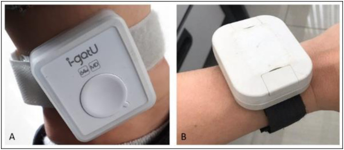
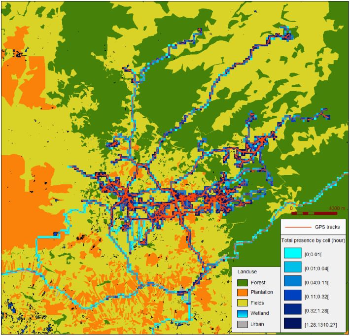
Global Positioning System (GPS) technology is an effective tool for quantifying individuals' mobility patterns and can be used to understand their influence on infectious disease transmission. In Cambodia, mobility measurements have been limited to questionnaires, which are of limited efficacy in rural environments. In this study, we used GPS tracking to measure the daily mobility of Cambodian forest goers, a population at high risk of malaria, and developed a workflow adapted to local constraints to produce an optimal dataset representative of the participants' mobility. We provide a detailed assessment of the GPS tracking and analysis of the data, and highlight the associated difficulties to facilitate the implementation of similar studies in the future.
Conflict of interest statement
The authors have declared that no competing interests exist.
Figures
References
-
- Paz-Soldan V.A.; Stoddard S.T.; Vazquez-Prokopec G.; Morrison A.C.; Elder J.P.; Kitron U.; et al. Assessing and Maximizing the Acceptability of Global Positioning System Device Use for Studying the Role of Human Movement in Dengue Virus Transmission in Iquitos, Peru. Am. J. Trop. Med. Hyg. 2010, 82, 723–730, doi: 10.4269/ajtmh.2010.09-0496 - DOI - PMC - PubMed
-
- Hast M.; Searle K.M.; Chaponda M.; Lupiya J.; Lubinda J.; Sikalima J.; et al. The Use of GPS Data Loggers to Describe the Impact of Spatio-Temporal Movement Patterns on Malaria Control in a High-Transmission Area of Northern Zambia. Int J Health Geogr 2019, 18, 19, doi: 10.1186/s12942-019-0183-y - DOI - PMC - PubMed
Publication types
MeSH terms
Associated data
Grants and funding
LinkOut - more resources
Full Text Sources
Medical
Molecular Biology Databases
