

Spatio-temporal Prediction of the Malaria Transmission Risk in Minab District (Hormozgan Province, Southern Iran)
- PMID: 35951221
- PMCID: PMC9705508
- DOI: 10.1007/s11686-022-00598-2
Spatio-temporal Prediction of the Malaria Transmission Risk in Minab District (Hormozgan Province, Southern Iran)
Abstract
Introduction: Malaria is the most important parasitic disease in tropical and subtropical regions, with more than 240 million cases reported annually. In Iran, indigenous cases occur in its south-eastern region. The aim of this study is to assess the environmental risk of malaria transmission in an endemic area of southern Iran.
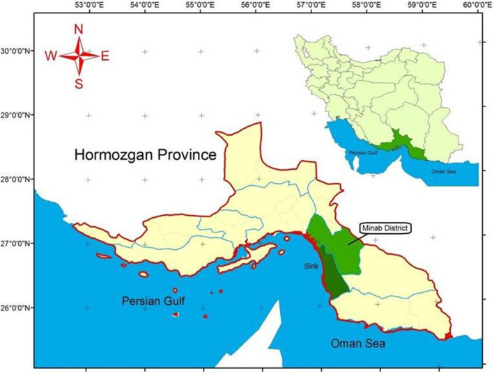
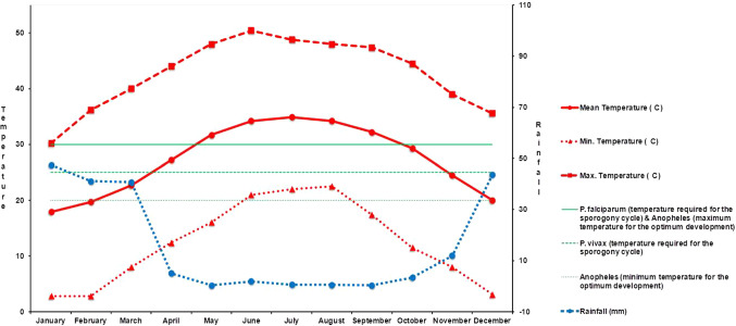
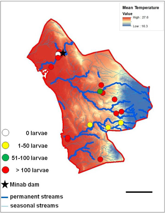
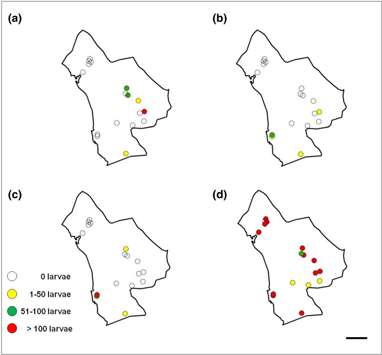
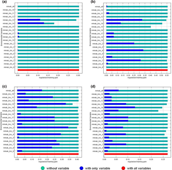
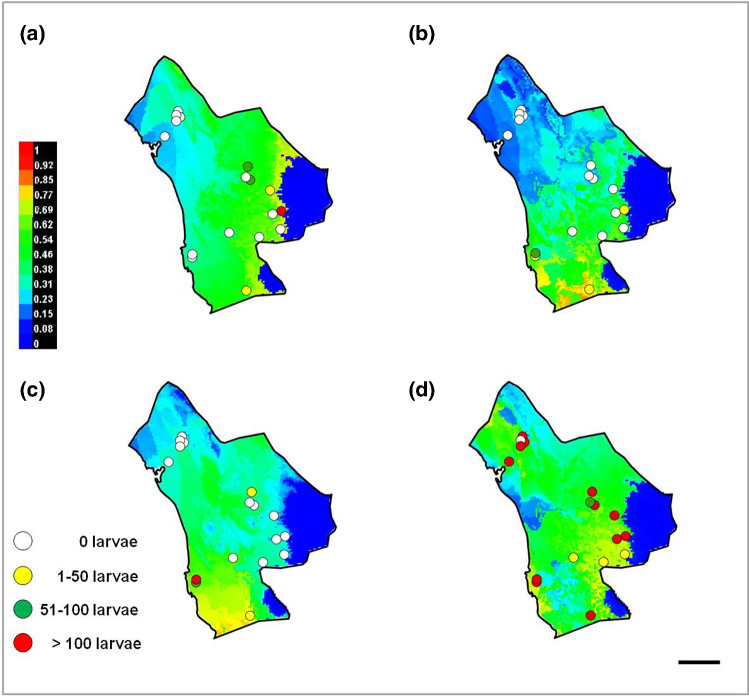
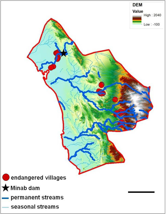
Methods: The study was carried out in Minab district (Hormozgan province, southern Iran), with the aim to assess the environmental risk of malaria, based on a spatio-temporal study, using Growing Degree Days (GDD)-based predictions, larval habitat ecology, MaxEnt spatial predictions and malaria transmission data.
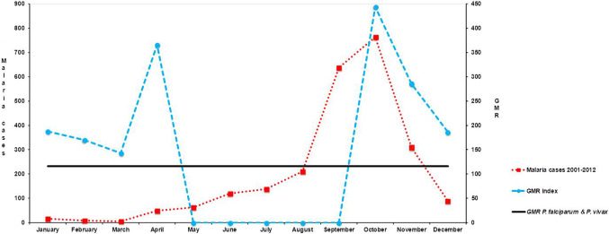
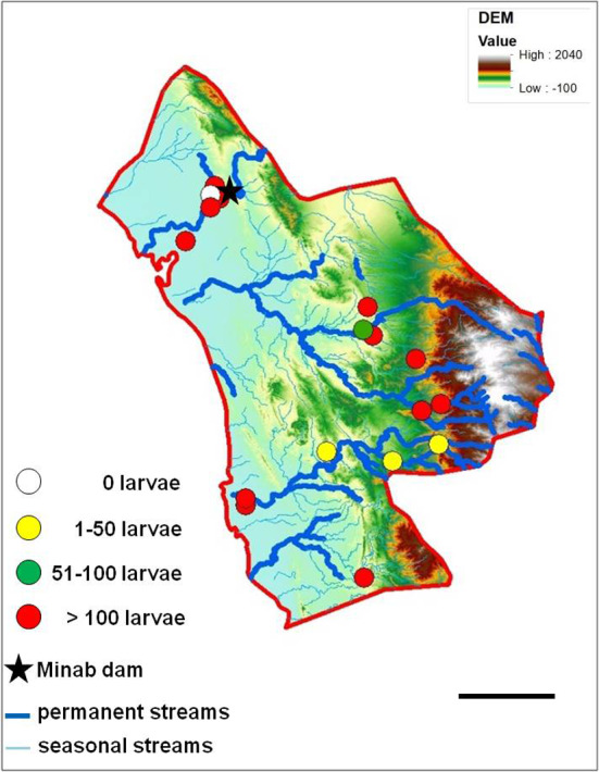
Results: The Gradient Model Risk index showed the highest malaria transmission risk period to be during January-April and October-December. The ecological conditions of water bodies of larval habitats of the four vector species (Anopheles culicifacies, A. dthali, A. fluviatilis and A. stephensi) were assessed, with A. stephensi being the most prevalent and the most widely distributed species.
Conclusion: These findings, together with the MaxEnt Anopheles predictive distribution models, allowed identifying villages in danger of malaria transmission in Minab district. This spatio-temporal prediction of malaria transmission risk should be incorporated in the design of malaria control initiatives towards a local malaria early warning system. Moreover, the proposed transmission risk model can be extrapolated, at local scale, to other malaria endemic areas of tropical and subtropical regions.
Keywords: Anopheline larvae; Environmental risk; GIS; Hormozgan province; Iran; Malaria.
© 2022. The Author(s).
Conflict of interest statement
On behalf of all authors, the corresponding author states that there is no conflict of interest.
Figures

References
-
- WHO (2021). World Malaria Report 2021. https://www.who.int/teams/global-malaria-programme/reports/world-malaria...
-
- Holakouei K, Nadim A, Moradi G, Teimori S, Rashidian H, Kandi Kaleh M. Malaria epidemiology in Iran from 1941 to 2006. J Sch Public Health Inst Public Health Res. 2012;10:77–90.
-
- Salahi-Moghadam A, Khoshdel AR, Barati M, Sedaghat MM. An overview and mapping of malaria and its vectors in Iran. Hormozgan Med J. 2014;18:473–485.
MeSH terms
Grants and funding
LinkOut - more resources
Full Text Sources
Medical
Miscellaneous
