

Two multi-temporal datasets to track debris flow after the 2008 Wenchuan earthquake
- PMID: 36030254
- PMCID: PMC9420130
- DOI: 10.1038/s41597-022-01658-y
Two multi-temporal datasets to track debris flow after the 2008 Wenchuan earthquake
Abstract
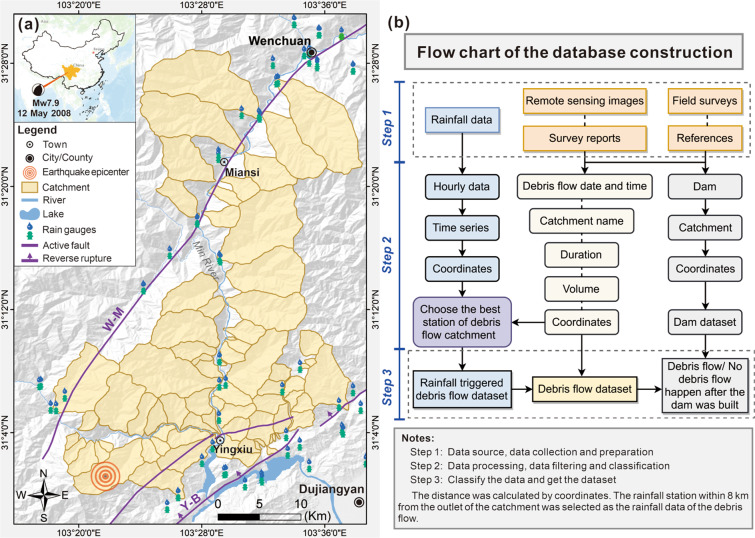
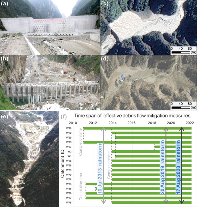
We provide two datasets for tracking the debris flow induced by the 2008 Wenchuan Mw 7.9 earthquake on a section of the Longmen mountains on the eastern side of the Tibetan plateau (Sichuan, China). The database was obtained through a literature review and field survey reports in the epicenter area, combined with high-resolution remote sensing image and extensive data collection and processing. The first dataset covers an area of 892 km2, including debris flows from 2008 to 2020 (an updated version). 186 debris flows affecting 79 watersheds were identified. 89 rainfall stations were collected to determine the rainfall events for the post-earthquake debris flow outbreak. The second database is a list of mitigation measures for post-earthquake debris flows, including catchment name, check dam number, coordinates, construction time, and successful mitigation date. The datasets can aid different applications, including the early warning and engineering prevention of post-earthquake debris flow, as well as provide valuable data support for research in related disciplines.
© 2022. The Author(s).
Conflict of interest statement
The authors declare no competing interests.
Figures


References
-
- Keefer DK. The importance of earthquake-induced landslides to long-term slope erosion and slope-failure hazards in seismically active regions. Geomorphology. 1994;10:265–284. doi: 10.1016/0169-555X(94)90021-3. - DOI
-
- Keefer DK. Investigating landslides caused by earthquakes - a historical review. Surv Geophys. 2002;23:473–510. doi: 10.1023/A:1021274710840. - DOI
-
- Dadson SJ, et al. Earthquake-triggered increase in sediment delivery from an active mountain belt. Geology. 2004;32:733–736. doi: 10.1130/G20639.1. - DOI
-
- Lin CW, et al. Impact of chi-chi earthquake on the occurrence of landslides and debris flows: Example from the chenyulan river watershed, nantou, taiwan. Eng Geol. 2004;71:49–61. doi: 10.1016/S0013-7952(03)00125-X. - DOI
-
- Parker RN, et al. Mass wasting triggered by the 2008 wenchuan earthquake is greater than orogenic growth. Nat Geosci. 2011;4:449–452. doi: 10.1038/ngeo1154. - DOI
Publication types
Grants and funding
LinkOut - more resources
Full Text Sources
