

Prediction of mining-induced subsidence at Barapukuria longwall coal mine, Bangladesh
- PMID: 36042276
- PMCID: PMC9427737
- DOI: 10.1038/s41598-022-19160-1
Prediction of mining-induced subsidence at Barapukuria longwall coal mine, Bangladesh
Abstract
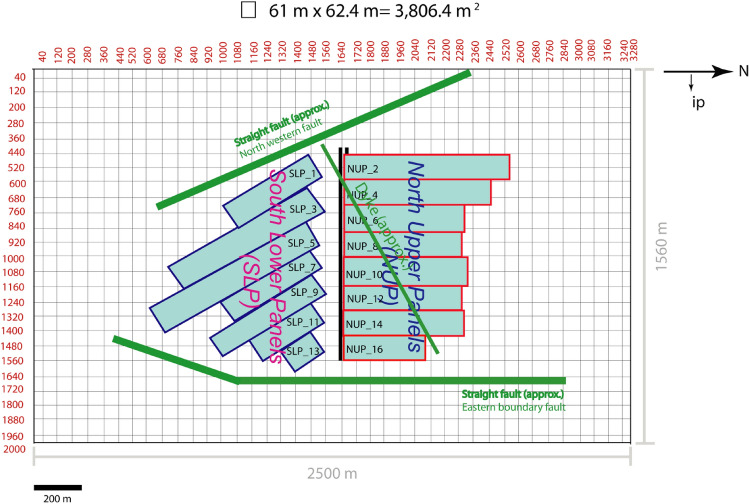
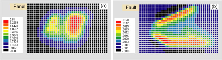
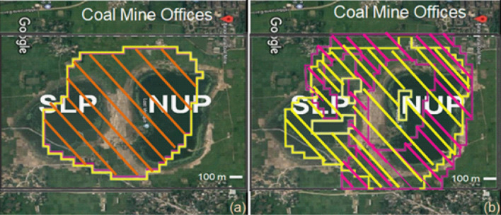
It is essential to predict the mining-induced subsidence for sustainable mine management. The maximum observed subsidence having a noticeable areal extent due to Northern Upper Panels (NUP) and Southern Lower Panels (SLP) at the Barapukuria longwall coal mine is 5.8 m and 4.2 m, respectively, after the extraction of a 10 m thick coal seam. The mining-induced subsidence was simulated by the Displacement Discontinuity Method. The numerical model considered the effects of the ground surface, mining panels, faults, and the dyke. The predicted and the observed subsidence due to the mining of NUP and SLP were compared by varying Young's modulus, and the 0.10 GPa Young's modulus was found to be the best match in the geo-environmental condition. The effects of the faults and the dyke in the calculation were negligible. Future subsidence was predicted by considering 30 m extraction of the thick coal seam as 15.7-17.5 m in NUP and 8.7-10.5 m in SLP. The vulnerable areas demarcated considering the tilt angle and extensile strain might extend up to the coal mine office area and some villages.
© 2022. The Author(s).
Conflict of interest statement
The authors declare no competing interests.
Figures


References
-
- NSW, D. o. P. Impacts of underground coal mining on natural features in the Southern Coalfield: Strategic review. (New South Wales Government, Sydney, 2008).
-
- Merad M, Verdel T, Roy B, Kouniali S. Use of multi-criteria decision-aids for risk zoning and management of large area subjected to mining-induced hazards. Tunn. Undergr. Space Technol. 2004;19:125–138. doi: 10.1016/S0886-7798(03)00106-8. - DOI
-
- Star, D. Fresh cracks in many houses. (Daily star , Dhaka, 2016). Preprint at https://www.thedailystar.net/country/fresh-cracks-many-houses-1322431
-
- BDNEWS24, 2016. Barapukuria coal mine: Cracks in houses in surrounding sreas, lakes dring up, Dhaka: BDNEWS24.COM.
-
- Board, N. C. Subsidence Engineering Handbook. (London, National coal board: Mining Department, 1975).
Publication types
MeSH terms
Substances
LinkOut - more resources
Full Text Sources
