

Predicting walking-to-work using street-level imagery and deep learning in seven Canadian cities
- PMID: 36319661
- PMCID: PMC9626470
- DOI: 10.1038/s41598-022-22630-1
Predicting walking-to-work using street-level imagery and deep learning in seven Canadian cities
Abstract
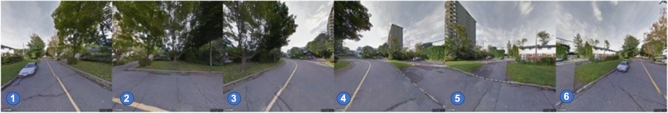
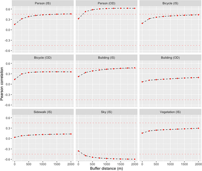
New 'big data' streams such as street-level imagery are offering unprecedented possibilities for developing health-relevant data on the urban environment. Urban environmental features derived from street-level imagery have been used to assess pedestrian-friendly neighbourhood design and to predict active commuting, but few such studies have been conducted in Canada. Using 1.15 million Google Street View (GSV) images in seven Canadian cities, we applied image segmentation and object detection computer vision methods to extract data on persons, bicycles, buildings, sidewalks, open sky (without trees or buildings), and vegetation at postal codes. The associations between urban features and walk-to-work rates obtained from the Canadian Census were assessed. We also assessed how GSV-derived urban features perform in predicting walk-to-work rates relative to more widely used walkability measures. Results showed that features derived from street-level images are better able to predict the percent of people walking to work as their primary mode of transportation compared to data derived from traditional walkability metrics. Given the increasing coverage of street-level imagery around the world, there is considerable potential for machine learning and computer vision to help researchers study patterns of active transportation and other health-related behaviours and exposures.
© 2022. The Author(s).
Conflict of interest statement
The authors declare no competing interests.
Figures

References
-
- Yin L, Cheng Q, Wang Z, Shao Z. ‘Big data’ for pedestrian volume: Exploring the use of google street view images for pedestrian counts. Appl. Geogr. 2015;63:337–345. doi: 10.1016/j.apgeog.2015.07.010. - DOI
MeSH terms
LinkOut - more resources
Full Text Sources
