A Review of Spatial Analysis Application in Childhood Malnutrition Studies
- PMID: 36474532
- PMCID: PMC9680994
- DOI: 10.21315/mjms2022.29.5.4
A Review of Spatial Analysis Application in Childhood Malnutrition Studies
Abstract
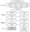
Approximately 230 million children under 5 years old of age suffer from malnutrition and over half of the children below 5 years old deaths are due to malnutrition nowadays. To gain a better understanding of this problem, the application of spatial analysis has risen exponentially in recent years. In this review, the present state of information on the use of spatial analysis in childhood malnutrition studies was evaluated using four databases of digital scientific journals: ScienceDirect, Scopus, PubMed and CINAHL. We chose 2,278 articles from the search results and a total of 27 articles met our criteria for review. The following information was extracted from each article: objective of study, study area, types of malnutrition, subject, data sources, computer software packages, spatial analysis and factors associated with childhood malnutrition. A total of 10 spatial analysis methods were reported in the reviewed articles and the Bayesian geoadditive regression model was the most common method applied in childhood malnutrition studies. This review highlights the importance of the application of spatial analysis in determining the geographic distribution of malnutrition cases, hotspot areas and risk factors correlated with childhood malnutrition. It also provides implications for strategic initiatives to eradicate all forms of malnutrition.
Keywords: Geographic Information System (GIS); childhood malnutrition; mapping; spatial analysis.
© Penerbit Universiti Sains Malaysia, 2022.
Conflict of interest statement
Conflict of Interest None.
Figures
References
-
- World Health Organization (WHO) Geneva: WHO; 2019. More than one in three low- and middle-income countries face both extremes of nutrition. [Retrieved 2020 Aug 31]. Available from: https://www.who.int/news-room/detail/16-12-2019-more-than-one-in-three-l....
-
- World Health Organization (WHO) Malnutrition. Geneva: WHO; 2020. [Retrieved 2020 Aug 31]. Available from: https://www.who.int/news-room/fact-sheets/detail/malnutrition#.
-
- UNICEF. Malnutrition. Geneva: UNICEF; 2020. [Retrieved 2020 Sep 7]. Available from: https://data.unicef.org/topic/nutrition/malnutrition/#:~:text=While%20th....
-
- Almasi A, Zangeneh A, Saeidi S, Nader SR, Choobtashani M, Saeidi F, et al. Study of the spatial pattern of malnutrition (stunting, wasting and overweight) in countries in the world using geographic information system. Int J Pediatr. 2019;7(10):10269–10281.
Publication types
LinkOut - more resources
Full Text Sources
Miscellaneous

