

Improvement of a coastal vulnerability index and its application along the Calabria Coastline, Italy
- PMID: 36535998
- PMCID: PMC9763354
- DOI: 10.1038/s41598-022-26374-w
Improvement of a coastal vulnerability index and its application along the Calabria Coastline, Italy
Abstract
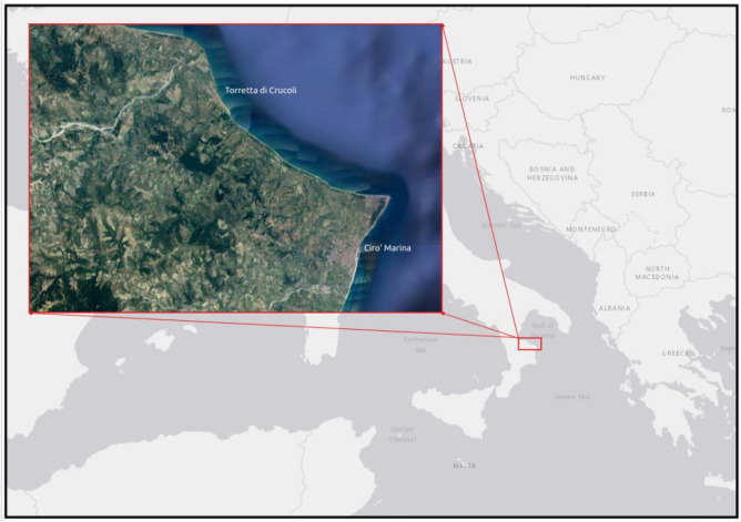
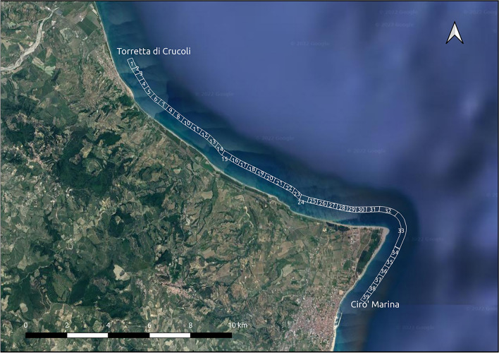
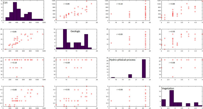
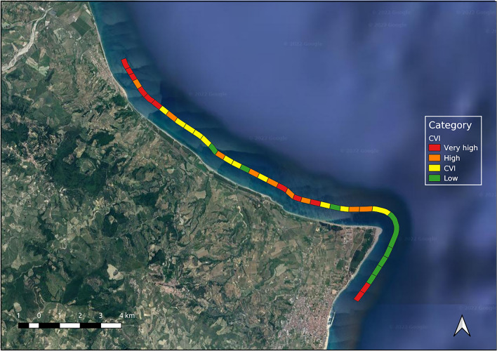
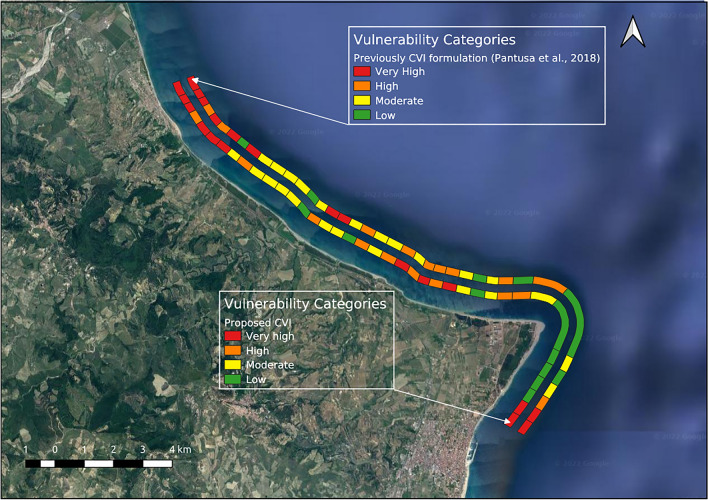
The present paper further develops a coastal vulnerability index formulation (CVI) previously proposed by the authors by integrating a new variable and redefining three variables to improve the suitability of the index for low-lying coasts. Eleven variables are divided into three typological groups: geological, hydro-physical process and vegetation. The geological variables are: geomorphology, shoreline erosion/accretion rates, coastal slope, emerged beach width, and dune. The hydro-physical process group includes: river discharge, sea-level change, mean significant wave height and mean tide range. The vegetation variables are: vegetation behind the back-beach and coverage of Posidonia oceanica. The index was applied to a stretch of the Ionian coast in the province of Crotone in the Calabria region (Southern Italy), and a vulnerability map was produced. A geography information system (GIS) platform was used to better process the data. For the case study area, the most influential variables are shoreline erosion/accretion rates, coastal slope, emerged beach width, dune, vegetation behind the back-beach, and coverage of Posidonia oceanica. The most vulnerable transects are those near urban areas characterized by the absence of dunes and vegetation. Statistical and sensitivity analyses were performed, and the proposed CVI was compared with the previous formulation proposed by the authors and with two other CVI methods present in the literature.
© 2022. The Author(s).
Conflict of interest statement
The authors declare no competing interests.
Figures


References
-
- Ozyurt G, Ergin A. Improving coastal vulnerability assessment to sea-level rise: A new indicator-based methodology for decision makers. J. Coast. Res. 2010;26(2):265–273. doi: 10.2112/08-1055.1. - DOI
-
- Gornitz V, White TW, Cushman RM. Vulnerability of the East coast, USA to future sea level rise. J. Coast. Res. 1990;9:201–237.
-
- Gornitz V. Global coastal hazards from future sea level rise. Glob. Planet. Chang. 1991;89:379–398. doi: 10.1016/0921-8181(91)90118-G. - DOI
-
- Thieler, E. R. & Hammar-Klose, E. National Assessment of Coastal Vulnerability to Sea-level Rise: Preliminary Results for US Atlantic Coast; Open-File Report 99–593; US Geological Survey: Reston, VA, USA, 1999; 1 Sheet. Available online: https://pubs.usgs.gov/of/1999/of99-593.
-
- Pendleton, E. A., Thieler E. R. & Williams S. J. Coastal Vulnerability Assessment of National Park of American Samoa to Sea-level Rise. US Geological Survey Open-File Report 2005–1055. 10.3133/ofr20051055 (2005).
