. 2023 Feb 23;23(5):2470.
doi: 10.3390/s23052470.

Wide-Field-of-View Multispectral Camera Design for Continuous Turfgrass Monitoring

Affiliations

Wide-Field-of-View Multispectral Camera Design for Continuous Turfgrass Monitoring

Lien Smeesters et al. Sensors (Basel). .

Abstract

Sustainably using resources, while reducing the use of chemicals, is of major importance in agriculture, including turfgrass monitoring. Today, crop monitoring often uses camera-based drone sensing, offering an accurate evaluation but typically requiring a technical operator. To enable autonomous and continuous monitoring, we propose a novel five-channel multispectral camera design suitable for integrating it inside lighting fixtures and enabling the sensing of a multitude of vegetation indices by covering visible, near-infrared and thermal wavelength bands. To limit the number of cameras, and in contrast to the drone-sensing systems that show a small field of view, a novel wide-field-of-view imaging design is proposed, featuring a field of view exceeding 164°. This paper presents the development of the five-channel wide-field-of-view imaging design, starting from the optimization of the design parameters and moving toward a demonstrator setup and optical characterization. All imaging channels show an excellent image quality, indicated by an MTF exceeding 0.5 at a spatial frequency of 72 lp/mm for the visible and near-infrared imaging designs and 27 lp/mm for the thermal channel. Consequently, we believe our novel five-channel imaging design paves the way toward autonomous crop monitoring while optimizing resource usage.

Keywords: camera design; demonstrator setup; modulation transfer function; multispectral camera; thermal imaging; turfgrass monitoring; vegetation indices; wide field of view.


Conflict of interest statement

The authors declare no conflict of interest.

Figures

Figure 1
Figure 1
Targeted novel camera design, using fixed camera positioning while observing the whole field thanks to the wide field of view. The multichannel camera design enables the calculation of the vegetational indices, providing input to a decision-support system (DSS).
Figure 2
Figure 2
Required number of pixels as function of the resolution, for different FOV and working distances: (a) a full FOV from 120° up to 179°; (b) a closeup of (a) focusing on the small resolution values between 0 cm and 140 cm, for full FOV of 120°, 150° and 168°. A steep increase of the number of pixels can be observed with improved resolution.
Figure 3
Figure 3
Lens focal length as function of the number of pixels, when using a working distance of 30 m: (a) a full FOV from 120° up to 179° and a pixel pitch of 2.2 µm and 12 µm; (b) a closeup of (a) but at up to 5292 pixels. In general, a linear scaling of the design can be observed.
Figure 4
Figure 4
Layout of the 5-channel camera design: (a) 3D view, (b) front view indicating the position of the thermal camera in the center surrounded by the visible and NIR imaging channels, (c) side view indicating the mounting of the imaging sensors, (d) top view.
Figure 5
Figure 5
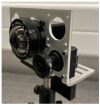
Laboratory test setup featuring the thermal channel and one of the visible and NIR imaging channels.
Figure 6
Figure 6
Cemented optical filters on the wide FOV lens: (a) technical drawing indicating the cementing of the filters, with the optical bandpass filter indicated in orange; (b) channel 1 featuring the MidOpt BP695 filter, (c) channel 2 featuring the MidOpt BN595 filter, (d) channel 3 featuring the MidOpt DB660/850 filter, (e) channel 4 featuring the MidOpt BP550 filter.
Figure 7
Figure 7
Transmittance spectrum for the different visible and NIR imaging channels, after the cementing of their respective optical filters.
Figure 8
Figure 8
Image of the slanted edge evaluating the image quality of the visible and NIR camera channels: (a) on-axis positioning, (b) off-axis positioning (at 179°), indicating the presence of barrel distortion.
Figure 9
Figure 9
MTF measurement of the visible and NIR camera channels, showing on-axis and off-axis (at 179°) positioning of the object, indicating good image quality.
Figure 10
Figure 10
Thermal image of a mounted LED, heating up a metal plate: (a) on-axis positioning, (b) off-axis (at 164°) positioning.
Figure 11
Figure 11
Grayscale thermal image of a mounted LED, heating up a metal plate after background correction: (a) on-axis positioning, (b) off-axis positioning (at 164°). These images were used as inputs for the MTF calculation.
Figure 12
Figure 12
Measured MTF for the thermal camera channel, for the on-axis and off-axis (at 164°) configurations, surpassing the current state of the art.
Figure 13
Figure 13
Sustainable and efficient turfgrass monitoring by integration of the multichannel camera within a fully robotized system, in combination with deep-learning processing and a decision-support system, a weather station, a mobile-sensing platform and an agriculture robot.

References

    1. European Court of Auditors . Sustainable Water Use in Agriculture. European Court of Auditors; Luxembourg: 2021.
    1. European Commission Sustainable Use of Pesticides. [(accessed on 24 June 2022)]. Available online: https://ec.europa.eu/food/plants/pesticides/sustainable-use-pesticides_en.
    1. Deng L., Mao Z., Li X., Hu Z., Duan F., Yan Y. UAV-Based Multispectral Remote Sensing for Precision Agriculture: A Comparison between Different Cameras. ISPRS J. Photogramm. Remote Sens. 2018;146:124–136. doi: 10.1016/j.isprsjprs.2018.09.008. - DOI
    1. Hong M., Bremer D.J., van der Merwe D. Thermal Imaging Detects Early Drought Stress in Turfgrass Utilizing Small Unmanned Aircraft Systems. Agrosyst. Geosci. Environ. 2019;2:1–9. doi: 10.2134/age2019.04.0028. - DOI
    1. Nebiker S., Annen A., Scherrer M., Oesch D. A Light-Weight Multispectral Sensor for Micro UAV–Opportunities for Very High Resolution Airborne Remote Sensing. Int. Arch. Photogramm. Remote Sens. Spat. Inf. Sci. 2008;XXXVI:1193–1200.

LinkOut - more resources