

Impact of sea level rise on the Mediterranean Lithophyllum byssoides rims
- PMID: 37386002
- PMCID: PMC10310750
- DOI: 10.1038/s41598-023-37110-3
Impact of sea level rise on the Mediterranean Lithophyllum byssoides rims
Abstract
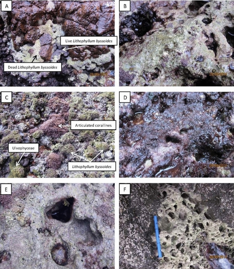
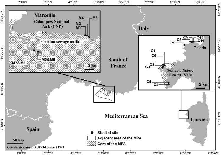
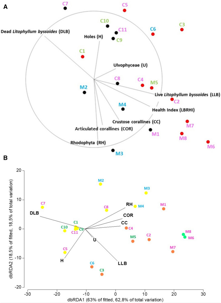
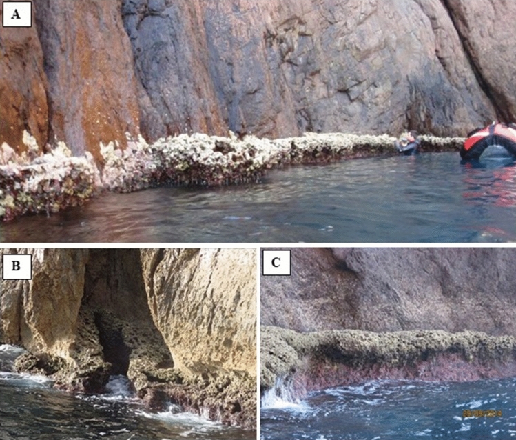
The calcified red macroalga Lithophyllum byssoides, a very common midlittoral species in the western Mediterranean Sea, is a significant ecosystem engineer capable, under exposed and dim light conditions, of building wide and solid endemic bioconstructions near the mean sea level: the L. byssoides rims or 'trottoirs à L. byssoides'. Although the growth of the species is relatively rapid for a calcified alga, the construction of a large rim requires several centuries of near stable or slowly rising sea level. As the time scale of their formation is measured in centuries, L. byssoides bioconstructions constitute valuable and sensitive sea level markers. The health status of L. byssoides rims has been studied at two sites located far apart from each other (Marseille and Corsica), both in areas heavily impacted by humans and in areas with little impact (MPAs and unprotected areas). A health index is proposed: Lithophylum byssoides Rims Health Index. The main and inevitable threat is the rise in the sea level. This ecosystem would be the first case worldwide of marine ecosystem collapse resulting, indirectly, from man-induced global change.
© 2023. The Author(s).
Conflict of interest statement
The authors declare no competing interests.
Figures


References
-
- Picone F, Sottile G, Fazio C, Chemello R. The neglected status of the vermetid reefs in the Mediterranean Sea: A systematic map. Ecol. Indic. 2022;143:109358. doi: 10.1016/j.ecolind.2022.109358. - DOI
-
- Laborel J, Delibrias G, Boudouresque CF. Evidence of recent changes of sea-level at Port-Cros Is (Western Mediterranean) from the study of an intertidal algal construction (Variations récentes du niveau marin à Port-Cros (Var, France), mises en évidence par l'étude de la corniche à Lithophyllum lichenoides) C. R. Hebd. Séances Acad. Sci. 1983;297:157–160.
-
- Laborel J, et al. Biological evidence of sea-level rise during the last 4500 years on the rocky coast of continental southwestern France and Corsica. Mar. Geol. 1994;120:203–223. doi: 10.1016/0025-3227(94)90059-0. - DOI
-
- Faivre S, Bakran-Petricioli T, Horvatinčić N, Sironić A. Distinct phases of relative sea level changes in the central Adriatic during the last 1500 years—influence of climatic variations? Palaeogeography Palaeoclimat. Palaeoecol. 2013;369:163–174. doi: 10.1016/j.palaeo.2012.10.016. - DOI
-
- Sechi D, Andreucci S, Stevens T, Pascucci V. Age and significance of late Pleistocene Lithophyllum byssoides intertidal algal ridge, NW Sardinia. Italy. Sed. Geol. 2020;400:105618. doi: 10.1016/j.sedgeo.2020.105618. - DOI
MeSH terms
LinkOut - more resources
Full Text Sources
Research Materials
