

State-of-the-Art Deep Learning Methods for Objects Detection in Remote Sensing Satellite Images
- PMID: 37447699
- PMCID: PMC10347255
- DOI: 10.3390/s23135849
State-of-the-Art Deep Learning Methods for Objects Detection in Remote Sensing Satellite Images
Abstract
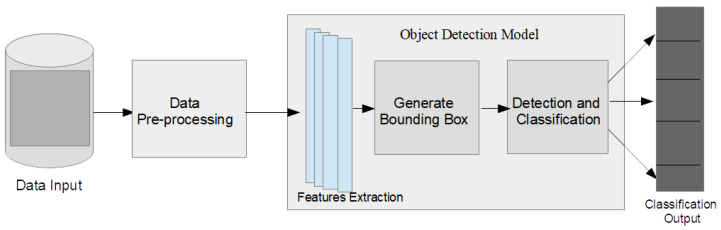
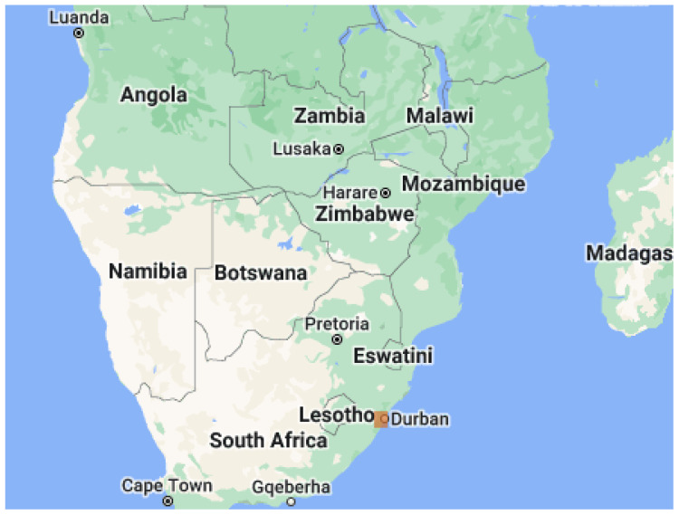
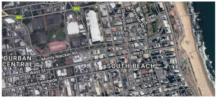
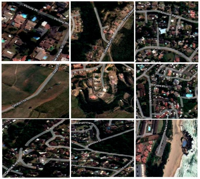
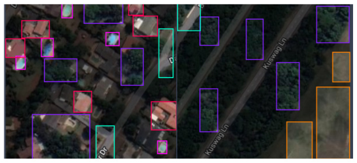
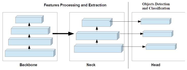
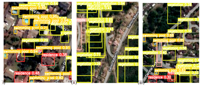
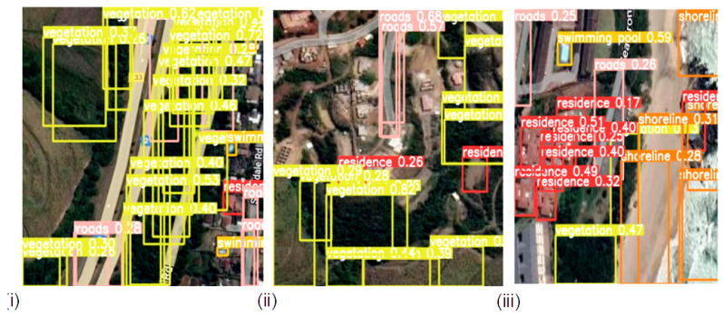
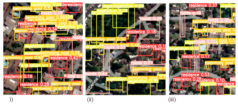
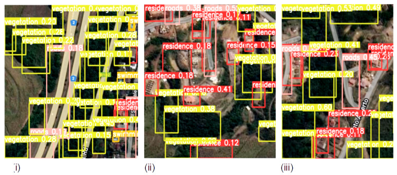
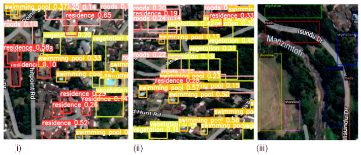
Introduction: Object detection in remotely sensed satellite images is critical to socio-economic, bio-physical, and environmental monitoring, necessary for the prevention of natural disasters such as flooding and fires, socio-economic service delivery, and general urban and rural planning and management. Whereas deep learning approaches have recently gained popularity in remotely sensed image analysis, they have been unable to efficiently detect image objects due to complex landscape heterogeneity, high inter-class similarity and intra-class diversity, and difficulty in acquiring suitable training data that represents the complexities, among others. Methods: To address these challenges, this study employed multi-object detection deep learning algorithms with a transfer learning approach on remotely sensed satellite imagery captured on a heterogeneous landscape. In the study, a new dataset of diverse features with five object classes collected from Google Earth Engine in various locations in southern KwaZulu-Natal province in South Africa was used to evaluate the models. The dataset images were characterized with objects that have varying sizes and resolutions. Five (5) object detection methods based on R-CNN and YOLO architectures were investigated via experiments on our newly created dataset. Conclusions: This paper provides a comprehensive performance evaluation and analysis of the recent deep learning-based object detection methods for detecting objects in high-resolution remote sensing satellite images. The models were also evaluated on two publicly available datasets: Visdron and PASCAL VOC2007. Results showed that the highest detection accuracy of the vegetation and swimming pool instances was more than 90%, and the fastest detection speed 0.2 ms was observed in YOLOv8.
Keywords: R-CNN; YOLO; object detection; remote sensing; satellite images.
Conflict of interest statement
The authors declare that there is no conflict of interest.
Figures

References
-
- Simelane S.P., Hansen C., Munghemezulu C. The use of remote sensing and GIS for land use and land cover mapping in Eswatini: A Review. S. Afr. J. Geomat. 2022;10:181–206. doi: 10.4314/sajg.v10i2.13. - DOI
-
- Bhuyan K., Van Westen C., Wang J., Meena S.R. Mapping and characterising buildings for flood exposure analysis using open-source data and artificial intelligence. Nat. Hazards. 2022:1–31. doi: 10.1007/s11069-022-05612-4. - DOI
-
- Qi W. Object detection in high resolution optical image based on deep learning technique. Nat. Hazards Res. 2022;2:384–392. doi: 10.1016/j.nhres.2022.10.002. - DOI
-
- Vemuri R.K., Reddy P.C.S., Kumar B.S.P., Ravi J., Sharma S., Ponnusamy S. Deep learning based remote sensing technique for environmental parameter retrieval and data fusion from physical models. Arab. J. Geosci. 2021;14:1230. doi: 10.1007/s12517-021-07577-3. - DOI
-
- Li K., Wan G., Cheng G., Meng L., Han J. Object detection in optical remote sensing images: A survey and a new benchmark. ISPRS J. Photogramm. Remote Sens. 2020;159:296–307. doi: 10.1016/j.isprsjprs.2019.11.023. - DOI
MeSH terms
LinkOut - more resources
Full Text Sources
Other Literature Sources
