SkyPole-A method for locating the north celestial pole from skylight polarization patterns
- PMID: 37459542
- PMCID: PMC10374162
- DOI: 10.1073/pnas.2304847120
SkyPole-A method for locating the north celestial pole from skylight polarization patterns
Abstract
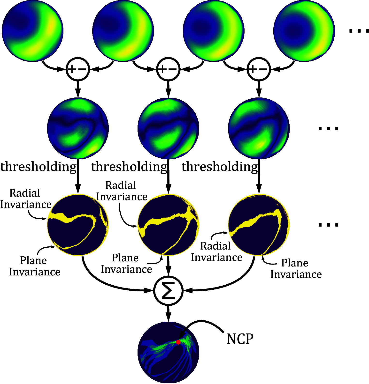
True north can be determined on Earth by three means: magnetic compasses, stars, and via the global navigation satellite systems (GNSS), each of which has its own drawbacks. GNSS are sensitive to jamming and spoofing, magnetic compasses are vulnerable to magnetic interferences, and the stars can be used only at night with a clear sky. As an alternative to these methods, nature-inspired navigational cues are of particular interest. Celestial polarization, which is used by insects such as Cataglyphis ants, can provide useful directional cues. Migrating birds calibrate their magnetic compasses by observing the celestial rotation at night. By combining these cues, we have developed a bioinspired optical method for finding the celestial pole during the daytime. This method, which we have named SkyPole, is based on the rotation of the skylight polarization pattern. A polarimetric camera was used to measure the degree of skylight polarization rotating with the Sun. Image difference processes were then applied to the time-varying measurements in order to determine the north celestial pole's position and thus the observer's latitude and bearing with respect to the true north.
Keywords: GPS-denied environment; celestial compass; celestial navigation; geolocation; polarized vision.
Conflict of interest statement
The authors declare no competing interest.
Figures


References
-
- Renfro B., Stein M., Reed E., Morales J., Villalba E., An Analysis of Global Positioning System (GPS) Standard Positioning Service Performance for 2019 (University of Texas, Austin, 2020), pp. 1–111.
-
- T. Kos, I. Markezic, J. Pokrajcic, “Effects of multipath reception on GPS positioning performance” in Proceedings ELMAR-2010 (2010), pp. 399–402.
-
- Alkendi Y., Seneviratne L., Zweiri Y., State of the art in vision-based localization techniques for autonomous navigation systems. IEEE Access 9, 76847–76874 (2021).
-
- Wehner R., Desert Navigator: The Journey of an Ant (Harvard University Press, 2020).
-
- Emlen S., The ontogenetic development of orientation capabilities. NASA Spec. Publ. 262, 191 (1972).
LinkOut - more resources
Full Text Sources
Research Materials

