

A review on landslide susceptibility mapping research in Bangladesh
- PMID: 37519718
- PMCID: PMC10372248
- DOI: 10.1016/j.heliyon.2023.e17972
A review on landslide susceptibility mapping research in Bangladesh
Abstract
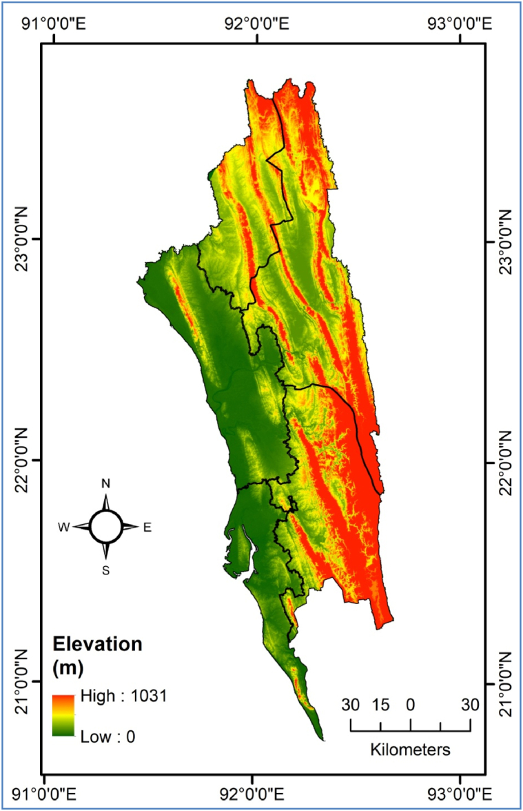
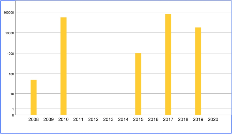
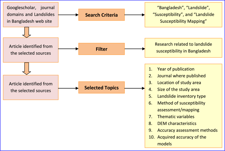
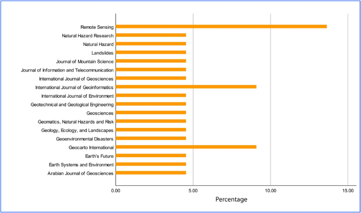
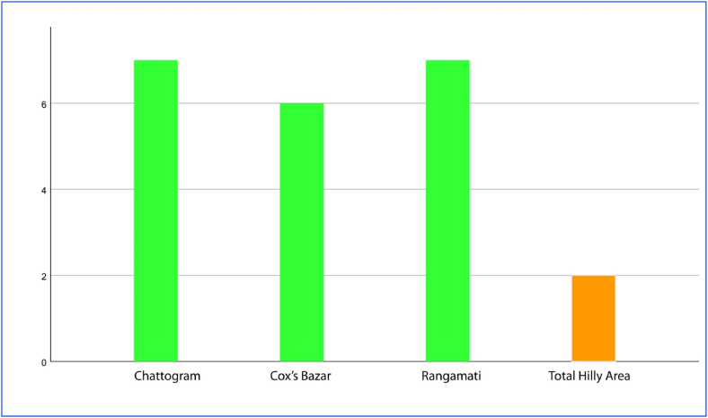
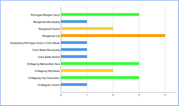
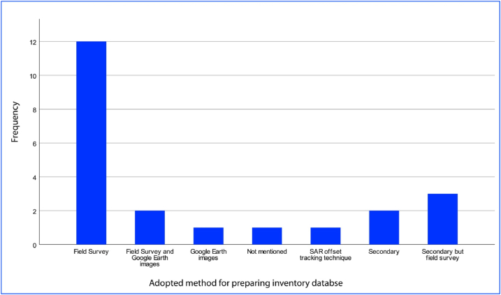
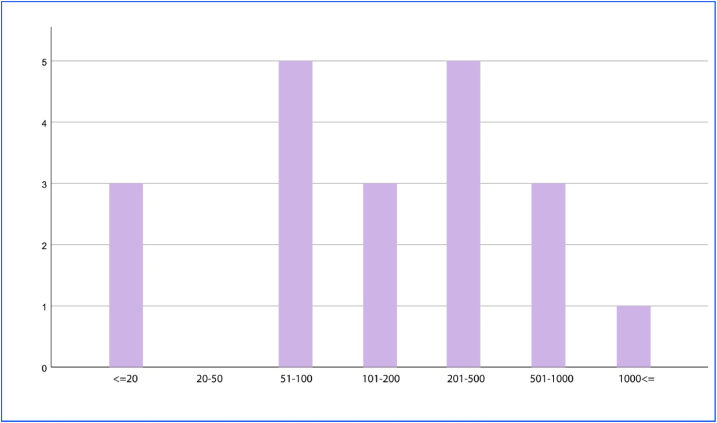
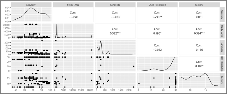
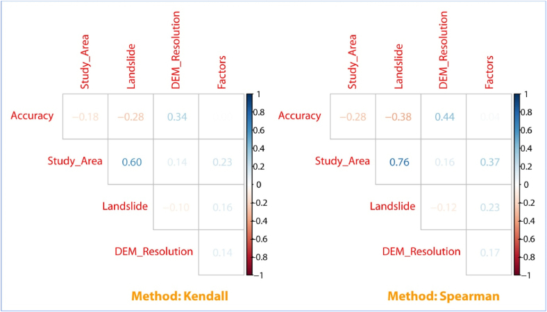
Landslide susceptibility mapping is a common practice for landslide susceptibility assessment across the world. Like many other mountainous areas of the world, Bangladesh is facing frequent catastrophic landslides causing severe damage to the economy and society. As a result, several types of research have been conducted on landslides in Bangladesh. In the current research, a systematic review is conducted on the existing literature related to landslide susceptibility mapping to assess its contemporary trend with global research. The publications analyzed in this research were extracted from a website comprising landslide research of Bangladesh and by manual search. The aspects of the literature considered are year of publication, the journal where published, location/size of the study area, landslide inventory data type, susceptibility assessment/mapping method, thematic variables used, DEM characteristics, accuracy assessment methods and acquired accuracy of the models. The Chi-square test was conducted and correlation was measured to assess relation between selected features and map accuracy but no significant relationship was found. The studies are concentrated into three administrative districts of Chattogram, Rangamati and Cox's Bazar mainly covering the city centre. The publication rate is increasing but not following the global trend. Though various types of models are used and compared, the application of machine and deep learning algorithms are very limited and no evidence of Physically-based methods is found. Most of the cases, landslide inventory is prepared by conducting field survey, but the size is small. The research will help future practitioner in landslide susceptibility mapping research in the area.
Keywords: Accuracy assessment; Bangladesh; Chi-square; Correlation; Landslide; Landslide susceptibility mapping.
© 2023 The Author.
Conflict of interest statement
The author declares that he has no known competing financial interests or personal relationships that could have appeared to influence the work reported in this paper.
Figures


References
-
- Alam E., Ray-Bennett N.S. Disaster risk governance for district-level landslide risk management in Bangladesh. Int. J. Disaster Risk Reduc. 2021;59 doi: 10.1016/j.ijdrr.2021.102220. - DOI
-
- Zaman T., Tahsin K.T., Rousseau Rozario S., Kamal A.B., Khan M.R., Huq S., Bodrud-Doza M. An overview of disaster risk reduction and anticipatory action in Bangladesh. Front Clim. 2022;4 doi: 10.3389/fclim.2022.944736. - DOI
-
- Ahmed B. The root causes of landslide vulnerability in Bangladesh. Landslides. 2021;18(5):1707–1720. doi: 10.1007/s10346-020-01606-0. - DOI
-
- Sultana N., Tan S. Landslide mitigation strategies in southeast Bangladesh: lessons learned from the institutional responses. Int. J. Disaster Risk Reduc. 2021;62 doi: 10.1016/j.ijdrr.2021.102402. - DOI
-
- Alam E. Landslide hazard knowledge, risk perception and preparedness in Southeast Bangladesh. Sustainability. 2020;12(16):6305. doi: 10.3390/su12166305. - DOI
Publication types
LinkOut - more resources
Full Text Sources
Research Materials
