

Exploring the urban gradient in population health: insights from satellite-derived urbanicity classes across multiple countries and years in sub-Saharan Africa
- PMID: 37865402
- PMCID: PMC10603412
- DOI: 10.1136/bmjgh-2023-013471
Exploring the urban gradient in population health: insights from satellite-derived urbanicity classes across multiple countries and years in sub-Saharan Africa
Abstract
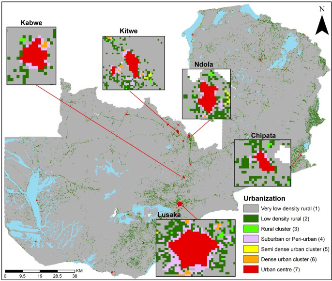
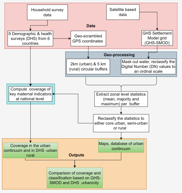
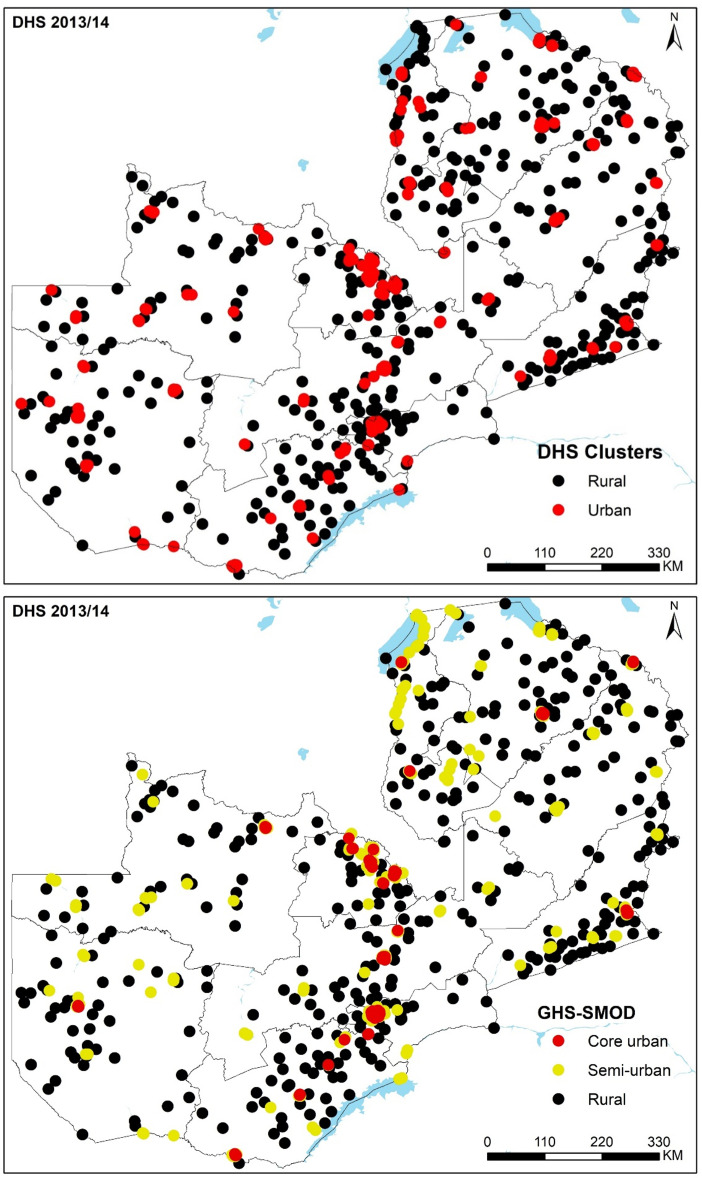
The demographic, ecological and socioeconomic changes associated with urbanisation are linked to changes in disease incidence, health service provision and mortality. These effects are heterogeneous between and within urban areas, yet without a clear definition of what constitutes an 'urban' area, their measurement and comparison are constrained. The definitions used vary between countries and over time hindering analyses of the relationship between urbanisation and health outcomes, evaluation of policy actions and results in uncertainties in estimated differences. While a binary urban-rural designation fails to capture the complexities of the urban-rural continuum, satellite data augmented with models of population density and built-up areas offer an opportunity to develop an objective, comparable and continuous measure which captures urbanisation gradient at high spatial resolution. We examine the urban gradient within the context of population health. We compare the categorisation of urban and rural areas (defined by national statistical offices) used in household surveys in sub-Saharan Africa (SSA) to an urban-rural gradient derived from augmented satellite data within a geospatial framework. Using nine Demographic and Health Surveys (DHS) conducted between 2005 and 2019 in six SSA countries, we then assess the extent of misalignment between urbanicity based on DHS categorisation compared with a satellite-derived measure, while discussing the implications on the coverage of key maternal health indicators. The proposed indicator provides a useful supplement to country-specific urbanicity definitions and reveals new health dynamics along the rural-urban gradient. Satellite-derived urbanicity measures will need frequent updates to align with years when household surveys are conducted.
Keywords: epidemiology; geographic information systems; indices of health and disease and standardisation of rates; maternal health; public health.
© Author(s) (or their employer(s)) 2023. Re-use permitted under CC BY. Published by BMJ.
Conflict of interest statement
Competing interests: None declared.
Figures
References
-
- United Nations, Department of Economic and Social Affairs Population Division . World urbanization prospects the 2018 revision (ST/ESA/SER.A/420), New York. 2019. Available: https://population.un.org/wup/publications/Files/WUP2018-Report.pdf
-
- Montgomery MR, Stren R, Cohen B, et al. . Cities transformed: demographic change and its implications in the developing world. 2013. 10.4324/9781315065700 - DOI
-
- Vernon H, Vivian L, Cong P, et al. . Demographic and health outcomes by degree of Urbanisation: perspectives from a new classification of urban areas. 2019. Available: https://ec.europa.eu/regional_policy/sources/studies/demogr_health_urban...
Publication types
MeSH terms
LinkOut - more resources
Full Text Sources
Research Materials