

Framework for assessing bridges construction impact on work zone traffic using BrIM
- PMID: 38167437
- PMCID: PMC10761946
- DOI: 10.1038/s41598-023-50404-w
Framework for assessing bridges construction impact on work zone traffic using BrIM
Abstract
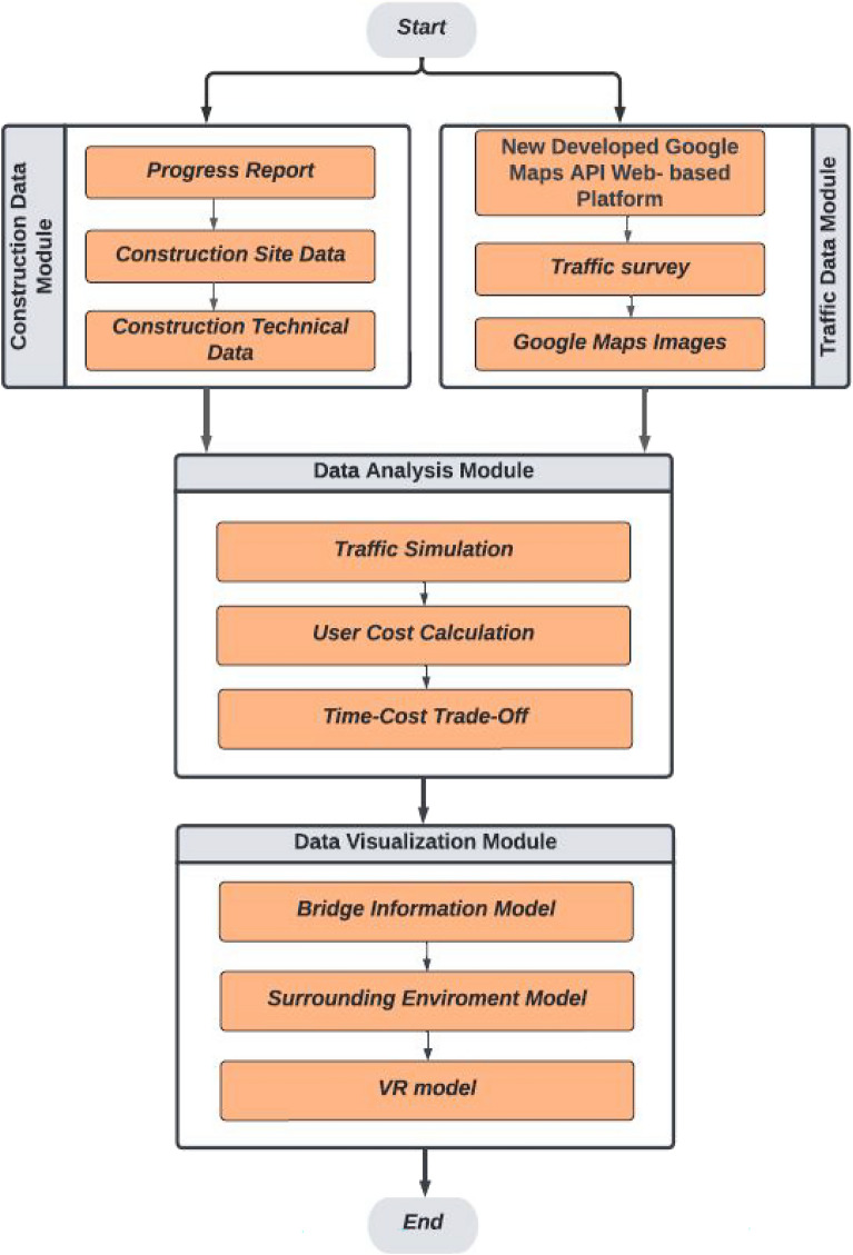
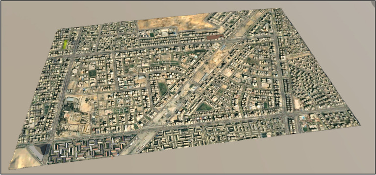
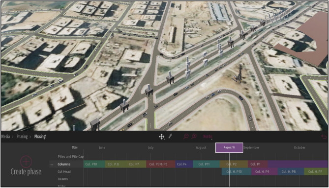
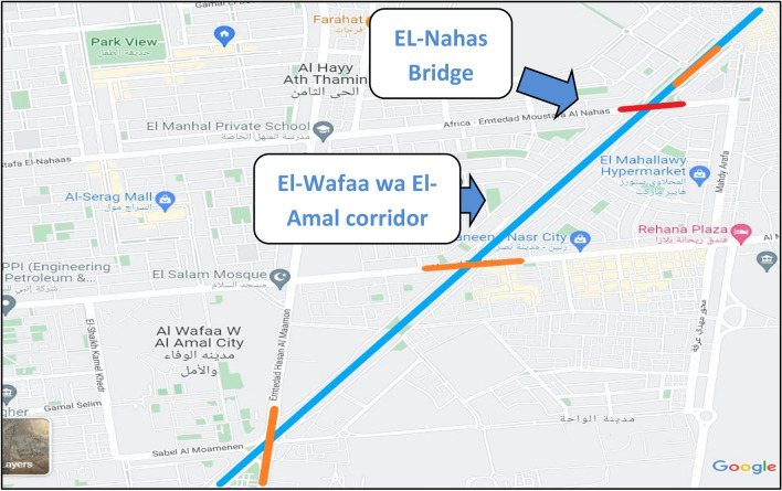
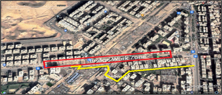
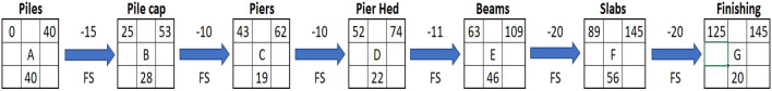
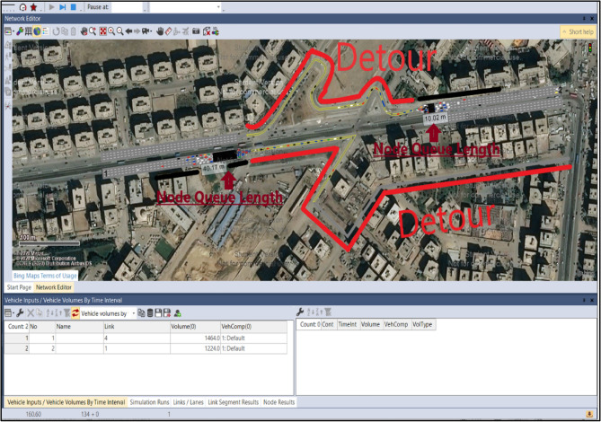
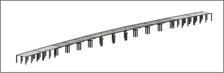
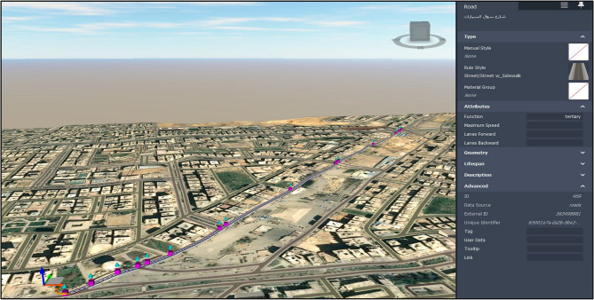
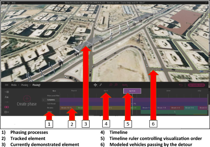
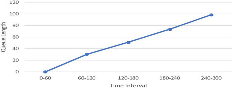
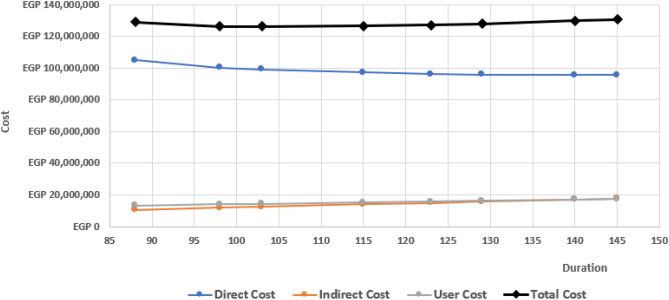
This research presents a framework for visualizing bridge construction impact on work zone traffic using Bridge Information Modelling (BrIM) and Google Maps API. The framework consists of four modules. The first module contains the construction data of the bridge by reporting the construction's daily progress. The second module is designated to model traffic data of the work zone using Google Maps API, traffic Survey counting, and Google Earth Images. The third module performs a traffic simulation for the work zone, and calculating the user cost of different stages. The fourth module visualizes the bridge's construction using Bridge Information Modelling (BrIM) and virtual reality in the Twinmotion engine to demonstrate the construction stages and the corresponding traffic states. An actual case study of El-Nahas Bridge in Cairo city-Egypt is presented to demonstrate the main features of the developed framework and its practical aspects. The case study results reveal that the impact of the construction stages varies on work zone traffic throughout the project period. The impact greatly influences the traffic status at the beginning of the project associated with high user costs. Then, the impact declines in later stages depending on the type of construction activities in each stage.
© 2024. The Author(s).
Conflict of interest statement
The authors declare no competing interests.
Figures

References
-
- Harb R, Radwan E, Yan X, Pande A, Abdel-Aty M. Freeway work-zone crash analysis and risk identification using multiple and conditional logistic regression. J. Transp. Eng. 2008;134(5):203–214. doi: 10.1061/(ASCE)0733-947X(2008)134:5(203). - DOI
-
- Systematics, C. Traffic congestion and reliability: Linking solutions to problems (No. FHWA-HOP-05-004). United States. Federal Highway Administration (2004).
-
- Raju N, Arkatkar S, Joshi G. Effect of construction work zone on traffic stream parameters using vehicular trajectory data under mixed traffic conditions. J. Transp. Eng. Part A Syst. 2020;146(6):05020002. doi: 10.1061/JTEPBS.0000353. - DOI
-
- Saha T, Sisiopiku VP. Assessing work zone traffic control options for 3-to-1 lane closures. J. Transp. Technol. 2020;10(1):50. doi: 10.4236/jtts.2020.101004. - DOI
-
- Transportation Pooled Fund program. U.S. Department of Transportation/Federal Highway Administration. February 22. Retrieved July 24, 2022, from https://www.fhwa.dot.gov/publications/research/general/21031/index.cfm (2021).
LinkOut - more resources
Full Text Sources
