

SiaN-VO: Siamese Network for Visual Odometry
- PMID: 38339690
- PMCID: PMC10856906
- DOI: 10.3390/s24030973
SiaN-VO: Siamese Network for Visual Odometry
Abstract
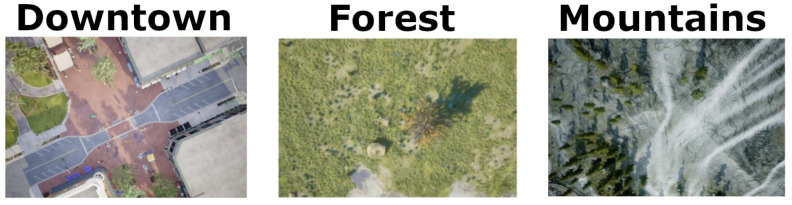
Despite the significant advancements in drone sensory device reliability, data integrity from these devices remains critical in securing successful flight plans. A notable issue is the vulnerability of GNSS to jamming attacks or signal loss from satellites, potentially leading to incomplete drone flight plans. To address this, we introduce SiaN-VO, a Siamese neural network designed for visual odometry prediction in such challenging scenarios. Our preliminary studies have shown promising results, particularly for flights under static conditions (constant speed and altitude); while these findings are encouraging, they do not fully represent the complexities of real-world flight conditions. Therefore, in this paper, we have furthered our research to enhance SiaN-VO, improving data integration from multiple sensors and enabling more accurate displacement predictions in dynamic flight conditions, thereby marking a significant step forward in drone navigation technology.
Keywords: autonomous flight; drone; visual odometry.
Conflict of interest statement
The authors declare no conflicts of interest.
Figures


References
-
- Oruc A. Potential cyber threats, vulnerabilities, and protections of unmanned vehicles. Drone Syst. Appl. 2022;10:51–58. doi: 10.1139/juvs-2021-0022. - DOI
-
- Moore A.B., Johnson M. Drones and Geographical Information Technologies in Agroecology and Organic Farming Contributions to Technological Sovereignty. CRC Press; Boca Raton, FL, USA: 2022. Geospatial Support for Agroecological Transition through Geodesign; pp. 174–203.
-
- Mohsan S.A.H., Khan M.A., Noor F., Ullah I., Alsharif M.H. Towards the Unmanned Aerial Vehicles (UAVs): A Comprehensive Review. Drones. 2022;6:147. doi: 10.3390/drones6060147. - DOI
-
- Braga J.R.G., Velho H.F.C., Conte G., Doherty P., Shiguemori É.H. An image matching system for autonomous UAV navigation based on neural network; Proceedings of the 2016 14th International Conference on Control, Automation, Robotics and Vision (ICARCV); Phuket, Thailand. 13–15 November 2016; pp. 1–6. - DOI
-
- da Penha Neto G., de Campos Velho H.F., Shiguemori E.H. UAV Autonomous Navigation by Image Processing with Uncertainty Trajectory Estimation. In: De Cursi J.E.S., editor. Proceedings of the 5th International Symposium on Uncertainty Quantification and Stochastic Modelling; Rouen, France. 29 June–3 July 2021; Cham, Switzerland: Springer; 2021. pp. 211–221.
Grants and funding
LinkOut - more resources
Full Text Sources
