

Infrared thermography reveals weathering hotspots at the Požáry field laboratory
- PMID: 38918559
- PMCID: PMC11199624
- DOI: 10.1038/s41598-024-65527-x
Infrared thermography reveals weathering hotspots at the Požáry field laboratory
Abstract
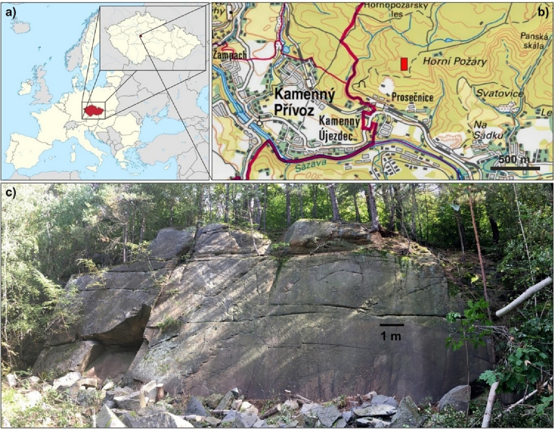
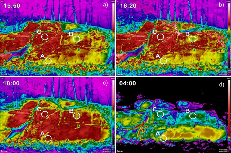
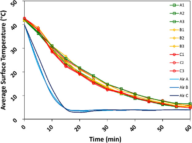
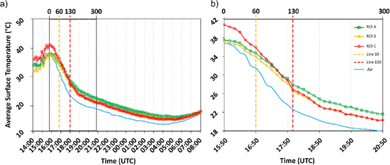
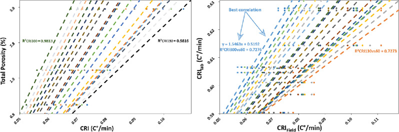
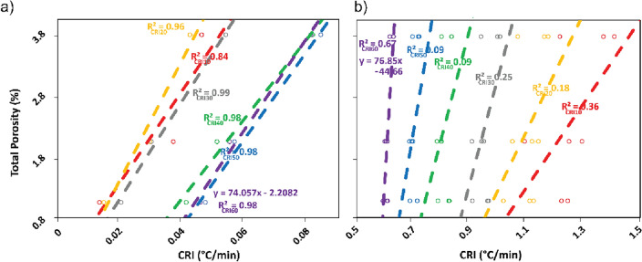
Evaluating physical properties and mechanical parameters of rock slopes and their spatial variability is challenging, particularly at locations inaccessible for fieldwork. This obstacle can be bypassed by acquiring spatially-distributed field data indirectly. InfraRed Thermography (IRT) has emerged as a promising technology to statistically infer rock properties and inform slope stability models. Here, we explore the use of Cooling Rate Indices (CRIs) to quantify the thermal response of a granodiorite rock wall within the recently established Požáry Test Site in Czechia. We observe distinct cooling patterns across different segments of the wall, compatible with the different degrees of weathering evaluated in the laboratory and suggested by IRT observations of cored samples. Our findings support previous examinations of the efficacy of this method and unveil correlations between cooling phases in the field and in the laboratory. We discuss the scale-dependency of the Informative Time Window (ITW) of the CRIs, noting that it may serve as a reference for conducting systematic IRT field surveys. We contend that our approach not only represents a viable and scientifically robust strategy for characterising rock slopes but also holds the potential for identifying unstable areas.
Keywords: Cooling rate index; Informative time window; Infrared thermography; Porosity; Rock mass; Slope stability.
© 2024. The Author(s).
Conflict of interest statement
The authors declare no competing interests.
Figures


References
-
- Bieniawski ZT. Classification of rock masses for engineering: The RMR system and future trends. In: Bieniawski ZT, editor. Rock Testing and Site Characterization. Elsevier; 1993. pp. 553–573.
-
- Volkwein A, et al. Rockfall characterisation and structural protection—A review. Nat. Hazard. 2011;11:2617–2651. doi: 10.5194/nhess-11-2617-2011. - DOI
-
- Casagli, N., Intrieri, E., Tofani, V., Gigli, G. & Raspini, F. Landslide detection, monitoring and prediction with remote-sensing techniques. Nat. Rev. Earth Environ. 4, 51–64 (2023).
-
- Vivaldi V, et al. Airborne combined photogrammetry—infrared thermography applied to landslide remote monitoring. Landslides. 2022;20:297–313. doi: 10.1007/s10346-022-01970-z. - DOI
-
- Massi A, Ortolani M, Vitulano D, Bruni V, Mazzanti P. Enhancing the thermal images of the upper scarp of the Poggio Baldi Landslide (Italy) by physical modeling and image analysis. Remote Sens. (Basel) 2023;15:907. doi: 10.3390/rs15040907. - DOI
Grants and funding
LinkOut - more resources
Full Text Sources
