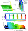
Hyperspectral imaging and its applications: A review
- PMID: 39021975
- PMCID: PMC11253060
- DOI: 10.1016/j.heliyon.2024.e33208
Hyperspectral imaging and its applications: A review
Abstract
Hyperspectral imaging has emerged as an effective powerful tool in plentiful military, environmental, and civil applications over the last three decades. The modern remote sensing approaches are adequate for covering huge earth surfaces with phenomenal temporal, spectral, and spatial resolutions. These features make HSI more effective in various applications of remote sensing depending upon the physical estimation of identical material identification and manifold composite surfaces having accomplished spectral resolutions. Recently, HSI has attained immense significance in the research on safety and quality assessment of food, medical analysis, and agriculture applications. This review focuses on HSI fundamentals and its applications like safety and quality assessment of food, medical analysis, agriculture, water resources, plant stress identification, weed & crop discrimination, and flood management. Various investigators have promising solutions for automatic systems depending upon HSI. Future research may use this review as a baseline and future advancement analysis.
Keywords: Hyperspectral; Imaging; Sensors; Spatial; Spectral; Temporal.
© 2024 The Author(s).
Conflict of interest statement
The authors declare that they have no known competing financial interests or personal relationships that could have appeared to influence the work reported in this paper.
Figures


References
-
- Kuswidiyanto L.W., Noh H.-H., Han X. Plant disease diagnosis using deep learning based on aerial hyperspectral images: a review. Rem. Sens. 2022;14:6031. doi: 10.3390/rs14236031. - DOI
-
- Goetz A.F.H., Vane G., Solomon J.E., Rock B.N. Imaging spectrometry for earth remote sensing. Science. 1985;228(4704):1147–1153. - PubMed
-
- Transon J., d'Andrimont R., Maugnard A., Defourny P. Survey of hyperspectral earth observation applications from space in the sentinel-2 context. Rem. Sens. 2018;10(2)
-
- Transon J., d'Andrimont R., Maugnard A., Defourny P. 2017 9th International Workshop on the Analysis of Multitemporal Remote Sensing Images (MultiTemp) 2017. Survey of current hyperspectral earth observation applications from space and synergies with sentinel-2; pp. 1–8.
Publication types
LinkOut - more resources
Full Text Sources

