Evaluating Geospatial Sampling Frames with a Novel Field Census for a Malaria Household Survey in Artibonite, Haiti
- PMID: 39137752
- PMCID: PMC11448545
- DOI: 10.4269/ajtmh.23-0891
Evaluating Geospatial Sampling Frames with a Novel Field Census for a Malaria Household Survey in Artibonite, Haiti
Abstract
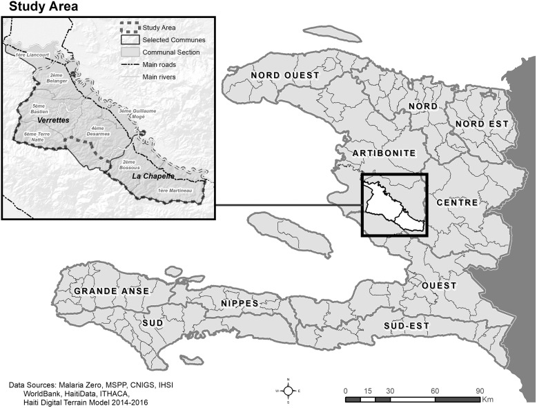
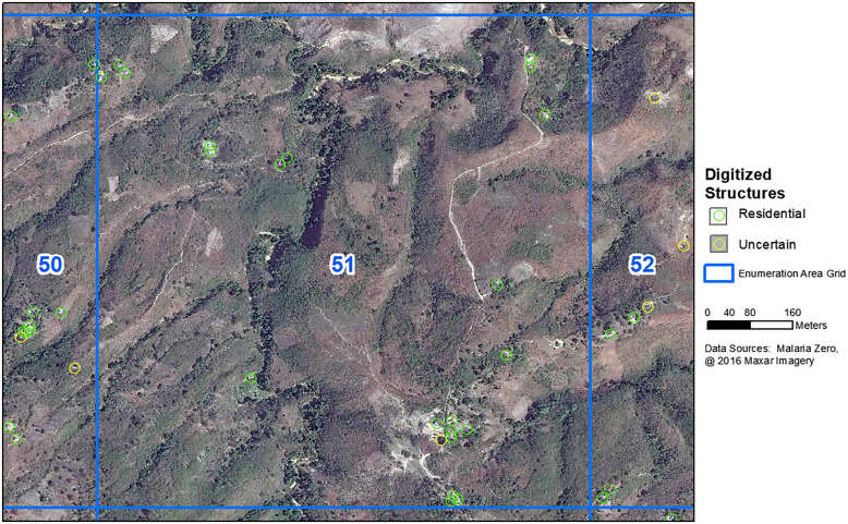
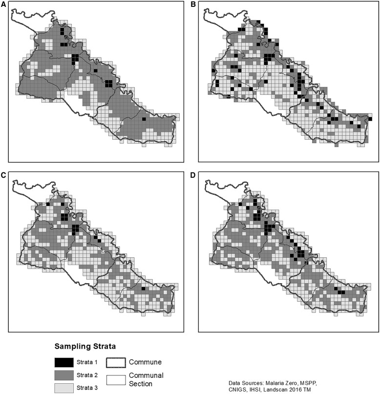
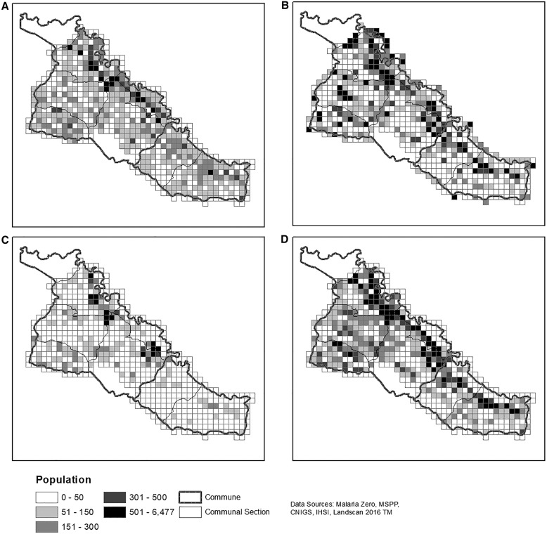
The Ministry of Public Health and Population in Haiti is committed to malaria elimination. In 2017, we used novel methods to conduct a census, monitor progress, and return to sampled households (HH) before a cross-sectional survey in La Chapelle and Verrettes communes in Artibonite department ("the 2017 Artibonite HH census"). Geospatial PDFs with digitized structures and basemaps were loaded onto tablets. Enumerators captured GPS coordinates and details of each HH and points of interest. The census used 1 km2 enumeration areas (EAs) to draw a representative sample. Three remote sampling frames were compared with the 2017 Artibonite HH census. First, 2003 census EAs with 2012 population estimates from the Haitian Institute of Statistics and Informatics were standardized to the study EAs. The second sampling frame used the 2016 LandScanTM population estimates and study EAs. The third sampling frame used structures ≥3 m2 manually digitized using Maxar satellite images. In each study EA, 70% of structures were estimated to be inhabited with 4.5 persons/HH. The census identified 33,060 inhabited HHs with an estimated population of 121,593 and 6,126 points of interest. Using daily coverage maps and including digitized structures were novel methods that improved the census quality. Manual digitization was closest to the census sampling frame results with 30,514 digitized structures in the study area. The LandScanTM method performed better in urban areas; however, it produced the highest number of HHs to sample. If a census is not possible, when feasible, remotely digitizing structures and estimating occupancy may provide a close estimate.
Conflict of interest statement
Disclosures: The findings and conclusions presented are those of the authors and do not necessarily reflect the official position of the U.S. Centers for Diseases Control and Prevention.
Figures
References
-
- World Health Organization , 2018. World Health Organization Vaccination Coverage Cluster Surveys: Reference Manual. Geneva, Switzerland: WHO.
-
- ICF International , 2012. Demographic and Health Survey Sampling and Household Listing Manual. Calverton, MD: ICF International.
-
- ICF International , 2016. Malaria Indicator Survey Household Listing Manual. Rockville, MD: ICF International.
-
- The DHS Program , 2016. Guidelines for Sampling for the Malaria Indicator Survey. Rockville, MD: The DHS Program.
-
- Institut Haïtien de Statistique et d’Informatique , 2009. Population Totale, Population de 18 ans et plus menages et densites estimes en 2009. Port-au-Prince, Haiti: Sociales Direction des Statistiques Démographiques et Sociales (DSDS).
MeSH terms
LinkOut - more resources
Full Text Sources
Medical