

Can continental transboundary compacts hold water?
- PMID: 39154090
- PMCID: PMC11330536
- DOI: 10.1038/s41467-024-51456-w
Can continental transboundary compacts hold water?
Abstract
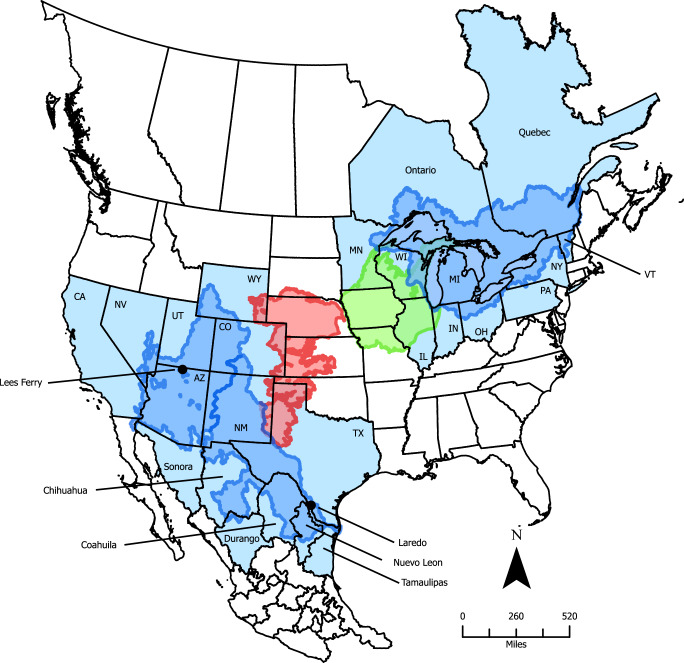
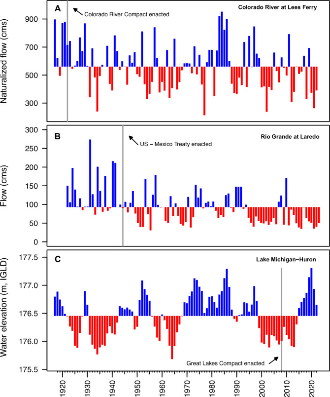
The growing number of threats facing continental-scale transboundary water treaties warrants contemporary evaluation of not only the political and climatological conditions under which they were constructed, but also of how different management strategies for accommodating changes in those conditions can lead to treaty success or failure. We assess these threats by highlighting key attributes and vulnerabilities of water treaties across North America that frame a diverse set of future water management priorities. While these threats are ubiquitous globally, they are particularly pronounced in North America where water-abundant basins along the border between the United States (US) and Canada contrast with arid basins along the border between the US and Mexico. We propose addressing these needs through a three-step call to action for management agencies, politicians, and the public at large to embrace a holistic perspective on transboundary water agreements.
Conflict of interest statement
The authors declare no competing interests.
Figures
References
-
- Bernauer, T. & Böhmelt, T. International conflict and cooperation over freshwater resources. Nat. Sustain.3, 350–356 (2020). 10.1038/s41893-020-0479-8 - DOI
-
- Udall, B. & Overpeck, J. The twenty-first century Colorado River hot drought and implications for the future. Water Resour. Res.53, 2404–2418 (2017). 10.1002/2016WR019638 - DOI
-
- Carter, E. & Steinschneider, S. Hydroclimatological drivers of extreme floods on Lake Ontario. Water Resour. Res.54, 4461–4478 (2018). 10.1029/2018WR022908 - DOI
-
- Pfahl, S., O’Gorman, P. A. & Fischer, E. M. Understanding the regional pattern of projected future changes in extreme precipitation. Nat. Clim. Change7, 423–427 (2017). 10.1038/nclimate3287 - DOI
Grants and funding
LinkOut - more resources
Full Text Sources
Miscellaneous
