

Historical datasets (1950-2022) of monthly water balance components for the Laurentian Great Lakes
- PMID: 39557909
- PMCID: PMC11574198
- DOI: 10.1038/s41597-024-03994-7
Historical datasets (1950-2022) of monthly water balance components for the Laurentian Great Lakes
Abstract
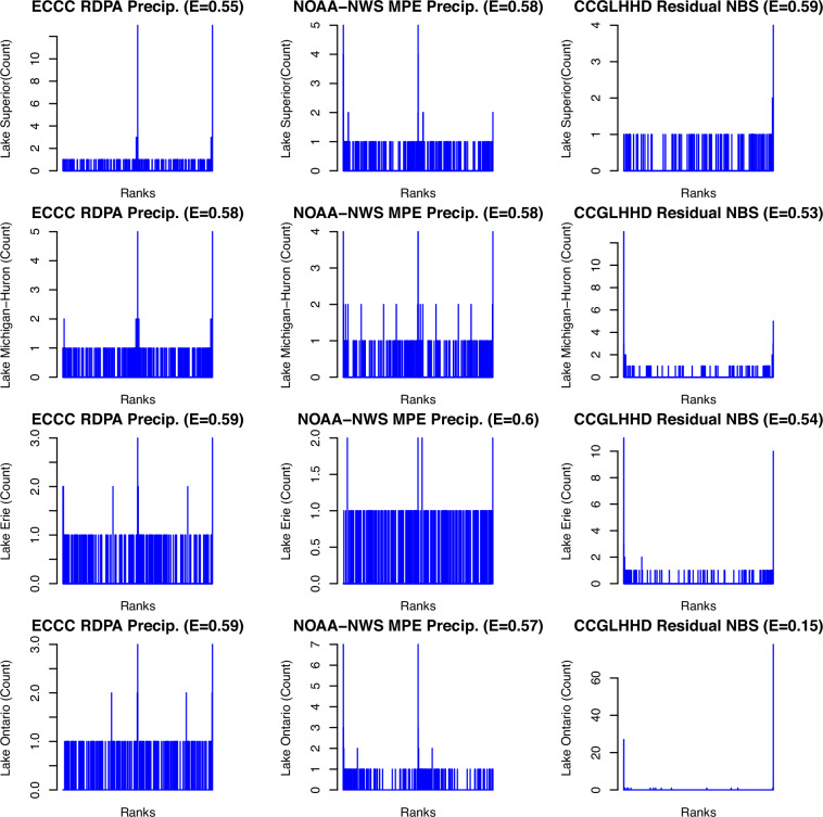
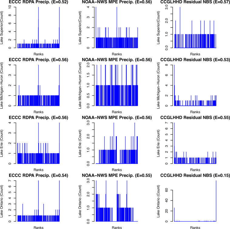
This study develops a 73-year dataset of water balance components from 1950 to 2022 for the Laurentian Great Lakes Basins. This is carried out using the Large Lakes Statistical Water Balance Model (L2SWBM), which provides a Bayesian statistical framework that assimilates binational input datasets sourced from the United States and Canada. The L2SWBM infers feasible water balance component estimates through this Bayesian framework by constraining the output with a standard water balance equation. The result is value-added time series, including expressions of uncertainty, that ultimately close the water balance across the interconnected Great Lakes system. Therefore, the L2SWBM facilitates the understanding of discrepancies in datasets and hydroclimate parameters. This enhanced reliability stemming from coordinated data, with an understanding and quantification of uncertainty, could significantly boost confidence in decision support tools for water resources practitioners and policymakers. This joint effort advances scientific understanding and strengthens strategies and policies designed to bolster resilience in Great Lakes communities and its ecosystem in the face of a shifting climate.
© 2024. The Author(s).
Conflict of interest statement
Figures


References
-
- Fergen, J. T. et al. Updated census in the Laurentian Great Lakes Watershed: A framework for determining the relationship between the population and this aquatic resource. Journal of Great Lakes Research48, 1337-1344 10.1016/j.jglr.2022.03.004 Top of Form (2022).
-
- Anderson, O., Harrison, A., Heumann, B., Godwin, C. & Uzarski, D. The influence of extreme water levels on coastal wetland extent across the Laurentian Great Lakes. Science of The Total Environment885, 163755, 10.1016/j.scitotenv.2023.163755 (2023). - PubMed
-
- Seglenieks, F. & Temgoua, A. Future water levels of the Great Lakes under 1.5 °C to 3 °C warmer climates. Journal of Great Lakes Research48, 865–875, 10.1016/j.jglr.2022.05.012 (2022).
-
- Gronewold, A. D. & Rood, R. B. Recent water level changes across Earth’s largest lake system and implications for future variability. Journal of Great Lakes Research45, 1–3, 10.1016/j.jglr.2018.10.012 (2019).
-
- Shrestha, N. K., Seglenieks, F., Temgoua, A. G. T. & Dehghan, A. The Impacts of Climate Change on Land Hydroclimatology of the Laurentian Great Lakes Basin. Frontiers in Water4 (2022).
LinkOut - more resources
Full Text Sources
